Georeferencing Scanned Paper Maps & Imagery: 5 Steps to Match Real-World Coordinates

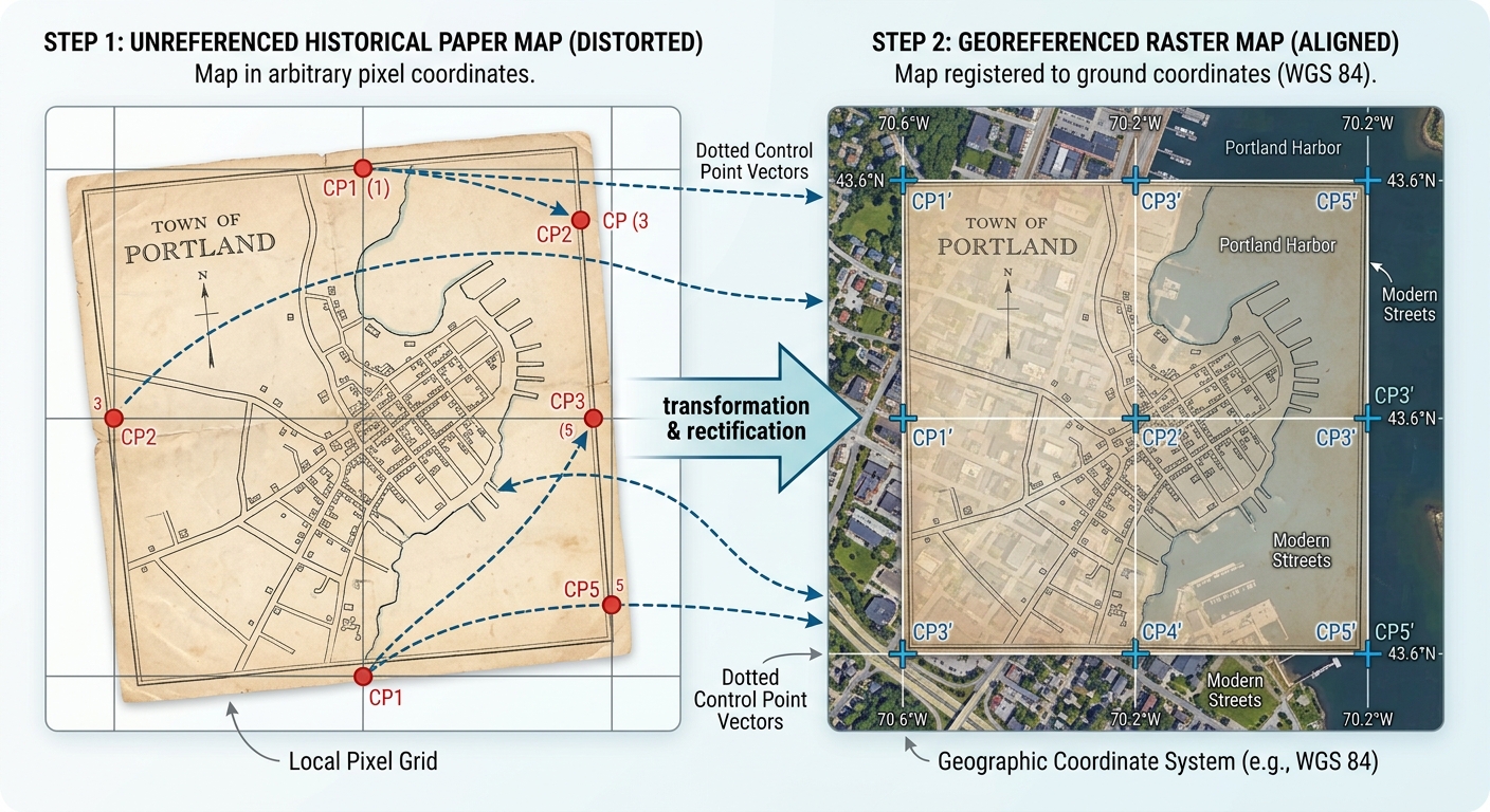
Georeferencing Scanned Paper Maps & Imagery: 5 Steps to Match Real-World Coordinates   1. Introduction: What Is Georeferencing?   When mastering Georeferencing Scanned Maps QGIS ArcGIS Pro workflows, Imagine you find a scanned paper map showing roads, settlements, rivers, and administrative boundaries from 1960. The map is clear, but when you load the image into … Read more
Geographically Weighted Regression (GWR) vs. Multiscale GWR (MGWR): A Practical GIS Guide

Geographically Weighted Regression (GWR) vs. Multiscale GWR (MGWR): A Practical GIS Guide   1. Introduction: Why Spatial Relationships Change Across Geography When exploring spatial modeling techniques like GWR vs MGWR GIS, Imagine you are studying housing prices across a city. You want to understand how distance to the city centre, household income, and access to … Read more

Catchment Area Analysis Using Isochrones (Travel Time Maps) in QGIS

Isochrones Travel Time Maps QGIS catchment area

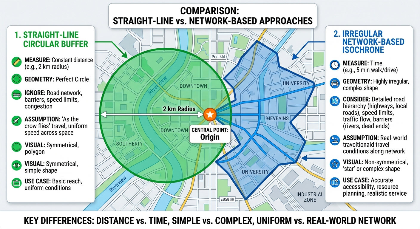
Catchment Area Analysis Using Isochrones (Travel Time Maps) in QGIS 1. Introduction: Why Use Isochrones Instead of Buffers? When conducting Isochrones Travel Time Maps QGIS catchment area analysis In urban transportation planning, knowing how far a person can travel is just as important as knowing how close a facility appears on a map. A school … Read more

Random Forest Classification for Land Cover Mapping Using Python & GeoPandas

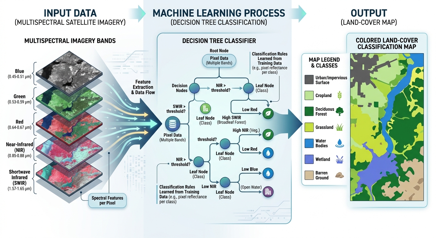
Random Forest Classification Python GIS land cover

Random Forest Classification for Land Cover Mapping Using Python & GeoPandas   1. Introduction: Moving from Desktop GIS to Machine Learning When exploring Random Forest Classification Python GIS land cover mapping is a fundamental application of remote sensing. It involves identifying surface categories such as forests, cropland, built-up areas, water bodies, and bare soil from … Read more

5 Layout Design Rules for Professional GIS Maps (ArcGIS Pro & QGIS)

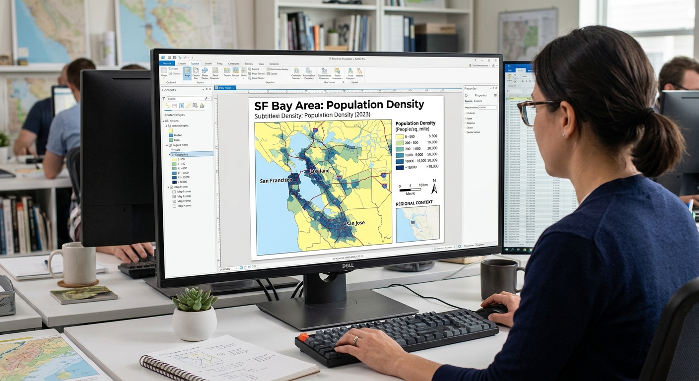
5 Layout Design Rules for Professional GIS Maps (ArcGIS Pro & QGIS)   Introduction: Why Professional Map Design Matters When applying Layout Design Rules GIS Maps, remember that any GIS map can contain accurate data and sophisticated spatial analysis yet still communicate poorly if its layout is cluttered, its labels overlap, or its colours confuse … Read more

Understanding Coordinate Reference Systems (CRS): Datum Transformations & EPSG Codes Explained

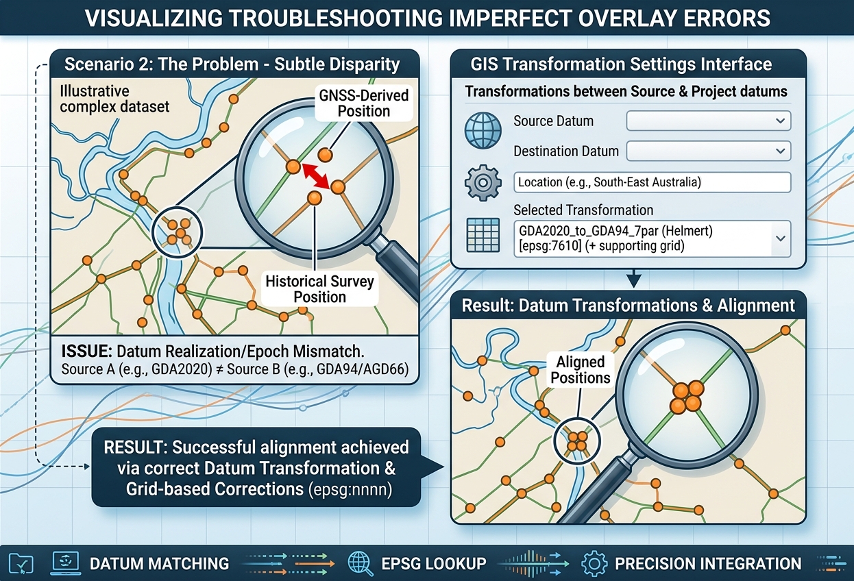
`Coordinate Reference Systems Datum Transformations EPSG`

Understanding Coordinate Reference Systems (CRS): Datum Transformations & EPSG Codes Explained 1. Introduction: Why Coordinate Reference Systems Matter in GIS Imagine you are creating a GIS map of a river catchment. You import a river network, a digital elevation model (DEM), administrative boundaries, and satellite imagery. Each dataset appears in a different location, and the … Read more

Shapefile vs. GeoPackage vs. File Geodatabase: Which Format Should You Use?

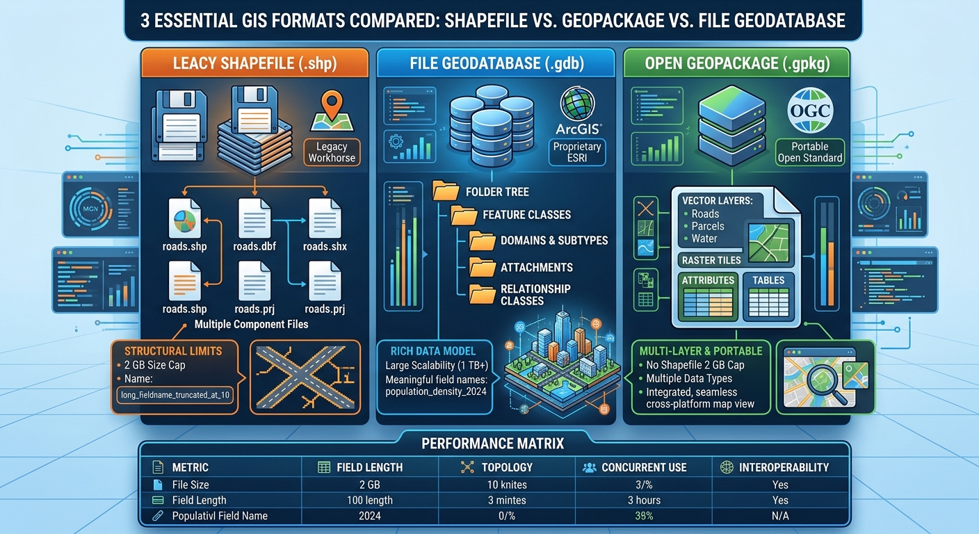
Shapefile vs GeoPackage vs File Geodatabase GIS

Shapefile vs. GeoPackage vs. File Geodatabase: Which Format Should You Use?   1. Introduction: The Evolution of GIS Data Storage Understanding Shapefile vs GeoPackage vs File Geodatabase GIS criteria is essential because choosing the right spatial data format is a fundamental decision in any GIS project. Choosing the right spatial data format is an important … Read more

PostGIS Starter Guide: 5 Spatial SQL Queries Every GIS Student Should Know

PostGIS Starter Guide spatial SQL queries

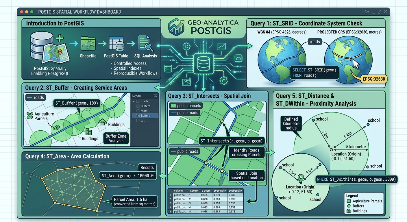
PostGIS Starter Guide: 5 Spatial SQL Queries Every GIS Student Should Know   1. Introduction: Why GIS Students Should Learn PostGIS Welcome to this comprehensive PostGIS Starter Guide spatial SQL queries overview, designed to help GIS students master database management. Traditional GIS workflows often rely on individual files such as Shapefiles, GeoJSON, and GeoPackage datasets. … Read more

How to Calculate Leaf Area Index (LAI) from Satellite Imagery for Precision Agriculture

Calculate Leaf Area Index LAI satellite imagery GIS

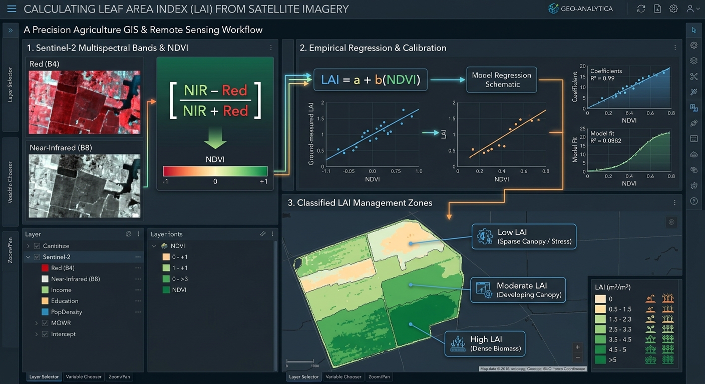
How to Calculate Leaf Area Index (LAI) from Satellite Imagery for Precision Agriculture   1. Introduction: Understanding Leaf Area Index in Precision Agriculture Modern agriculture increasingly relies on satellite remote sensing to monitor crop growth, identify stressed areas, estimate biomass, and improve the efficiency of farm inputs. One important vegetation canopy metric is the Leaf … Read more