Analyzing Spatial Networks in Python with OSMnx and NetworkX

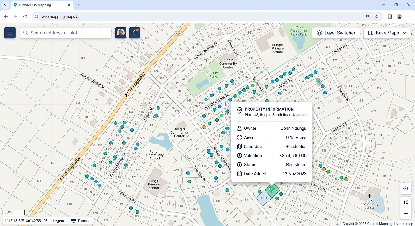
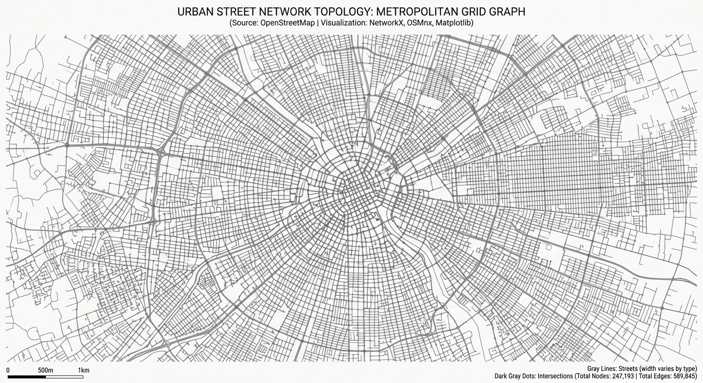
workflow diagram for OSMnx NetworkX Python spatial network analysis

Analyzing Spatial Networks in Python with OSMnx and NetworkX Introduction Urban street networks shape how people move through cities and access essential services. The arrangement of intersections, road segments, and pedestrian pathways influences travel distance, route choice, and accessibility to schools, hospitals, public transport, and employment. For urban planners and geospatial analysts, understanding these relationships … Read more

Processing LiDAR Point Clouds: Extracting Canopy Height Models (CHM) in QGIS & CloudCompare

Processing LiDAR Point Clouds: Extracting Canopy Height Models (CHM) in QGIS & CloudCompare 1. Processing LiDAR Point Clouds: Extracting Canopy Height Models (CHM) in QGIS & CloudCompare: Introduction Light Detection and Ranging (LiDAR) is a remote sensing technology that uses laser pulses to measure distances between a sensor and objects on the Earth’s surface. Airborne … Read more

Automating PDF Map Books and Atlases in ArcGIS Pro and QGIS

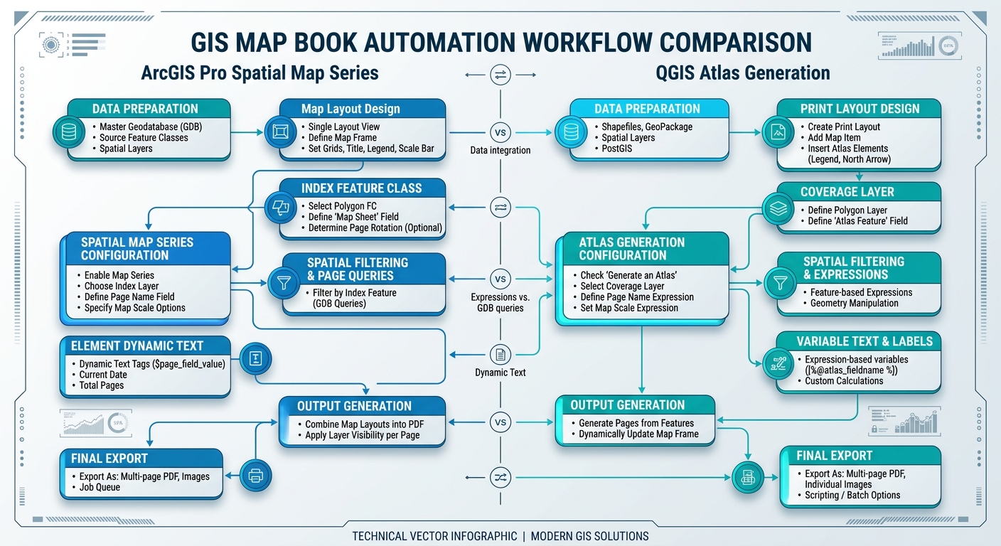
Automating PDF Map Books and Atlases in ArcGIS Pro and QGIS workflow comparison diagram

Automating PDF Map Books and Atlases in ArcGIS Pro and QGIS Introduction to Automating PDF Map Books and Atlases in ArcGIS Pro and QGIS Manually producing multi-page map series for extensive linear infrastructure (such as highways, pipelines, transmission corridors, and rivers) or multi-district administrative reporting is an inefficient and error-prone process. Creating individual layouts for … Read more

Geographically Weighted Summary Statistics (GWSS) in GIS: Beyond Global Means

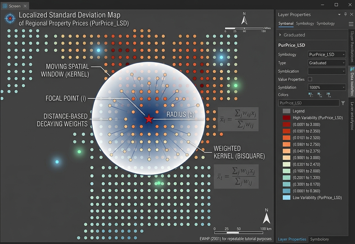
GIS map output demonstrating Geographically Weighted Summary Statistics and local standard deviation patterns.

Geographically Weighted Summary Statistics (GWSS) in GIS: Beyond Global Means   1. Introduction: Why Global Summary Statistics Are Not Enough Imagine analyzing household income across an entire city. You calculate an average monthly income of KSh 35,000 and a standard deviation of KSh 15,000. These figures summarize the dataset, but do they tell you which … Read more

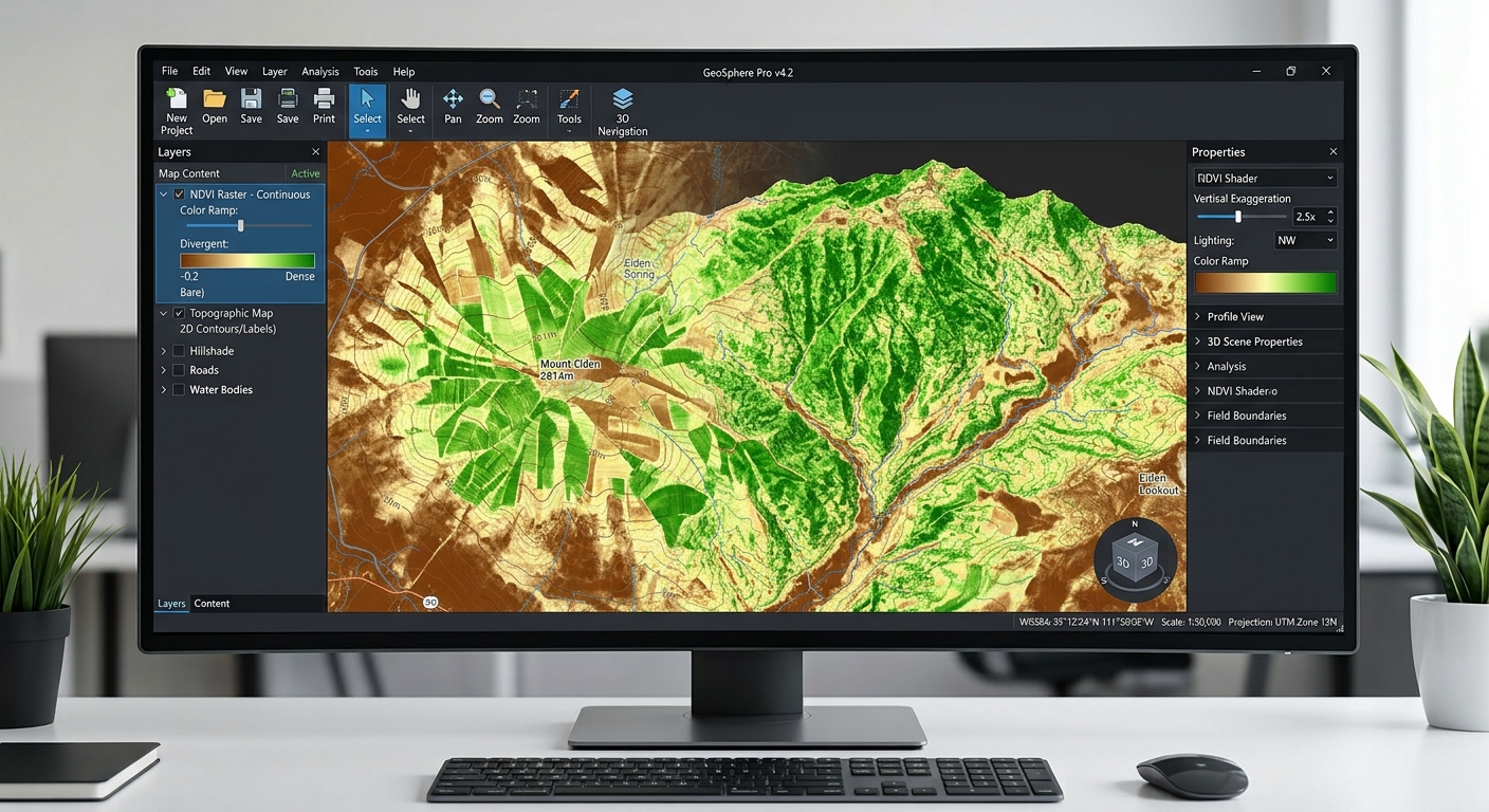
Calculating NDVI and Vegetation Health in ArcGIS Pro: A Complete Walkthrough

Calculating NDVI and Vegetation Health in ArcGIS Pro showing the resulting raster layer and spatial vegetation variation.

Calculating NDVI and Vegetation Health in ArcGIS Pro: A Complete Walkthrough Introduction: What Is NDVI? The Normalized Difference Vegetation Index (NDVI) is a remote sensing indicator used to assess vegetation greenness and relative vigor using multispectral satellite imagery. It is widely applied in agricultural monitoring, forestry, environmental management, drought assessment, and land-cover analysis. NDVI works … Read more

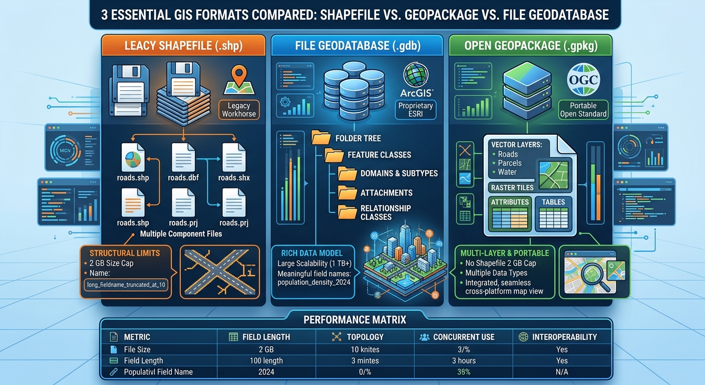
Shapefile vs. GeoPackage vs. File Geodatabase: Which Format Should You Use?

Shapefile vs GeoPackage vs File Geodatabase GIS

Shapefile vs. GeoPackage vs. File Geodatabase: Which Format Should You Use?   1. Introduction: The Evolution of GIS Data Storage Understanding Shapefile vs GeoPackage vs File Geodatabase GIS criteria is essential because choosing the right spatial data format is a fundamental decision in any GIS project. Choosing the right spatial data format is an important … Read more

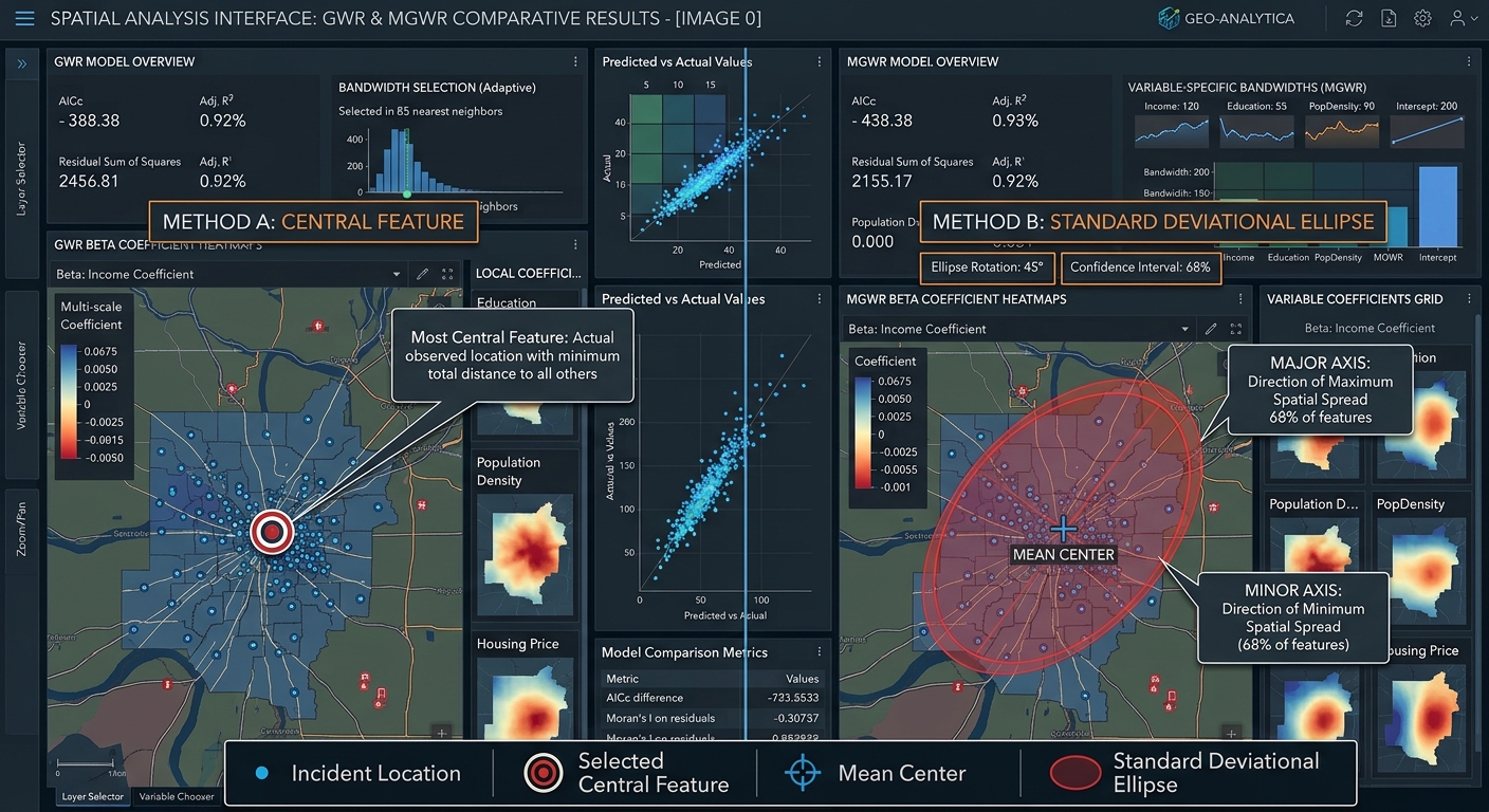
Directional Distribution vs. Central Feature in GIS: Measuring Point Patterns

Directional Distribution vs Central Feature GIS

Directional Distribution vs. Central Feature in GIS: Measuring Point Patterns   1. Introduction: Why Measure Geographic Point Patterns? Imagine you are analyzing thousands of emergency incident locations across a city. When analyzing spatial point patterns using Directional Distribution vs Central Feature GIS techniques, analysts can summarize, but it does not immediately tell you where the … Read more

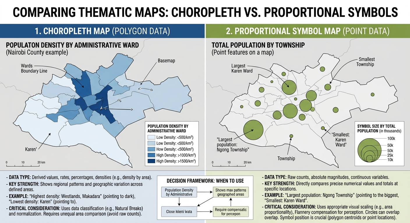
Choropleth vs. Proportional Symbol Maps: When to Use Which

Choropleth vs Proportional Symbol Maps GIS

Choropleth vs. Proportional Symbol Maps: When to Use Which 1. Introduction: Choosing the Right Thematic Map When designing thematic maps for your project, mastering Choropleth vs Proportional Symbol Maps GIS ensures you choose the correct method for your data. A thematic map communicates the geographic distribution of a particular variable, such as population density, income, … Read more

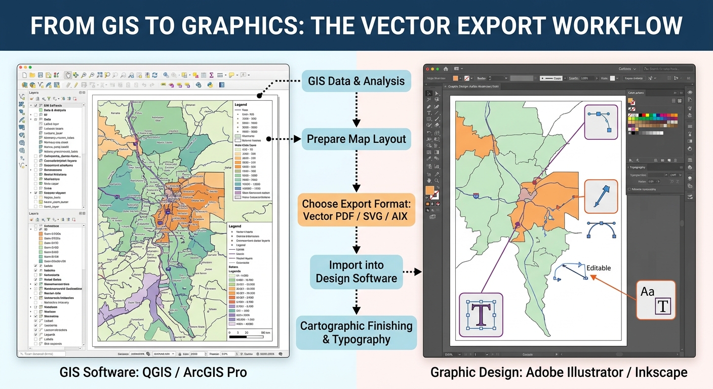
How to Export High-Resolution Vector PDFs and SVGs from GIS for Adobe Illustrator

Export Vector PDF SVG GIS Adobe Illustrator

How to Export High-Resolution Vector PDFs and SVGs from GIS for Adobe Illustrator 1. Introduction: Why Export GIS Maps to Graphic Design Software? When preparing professional cartographic deliverables, learning how to Export Vector PDF SVG GIS Adobe Illustrator correctly is essential for maintaining clean vector layers and sharp typography. GIS software is built for spatial … Read more