How to Build a GIS Portfolio on GitHub/Web to Land Your First Job

GIS Portfolio GitHub web job workflow visualization showing QGIS, GitHub, and portfolio website on screens

How to Build a GIS Portfolio on GitHub/Web to Land Your First Job 1. Introduction: Why Your GIS Portfolio Matters To successfully build a GIS Portfolio GitHub web job application, candidates must showcase practical, well-documented projects that demonstrate their technical abilities. Imagine two applicants applying for the same junior GIS analyst position.Both have similar qualifications … Read more

5 Key Differences Between IDW vs Kriging GIS Methods

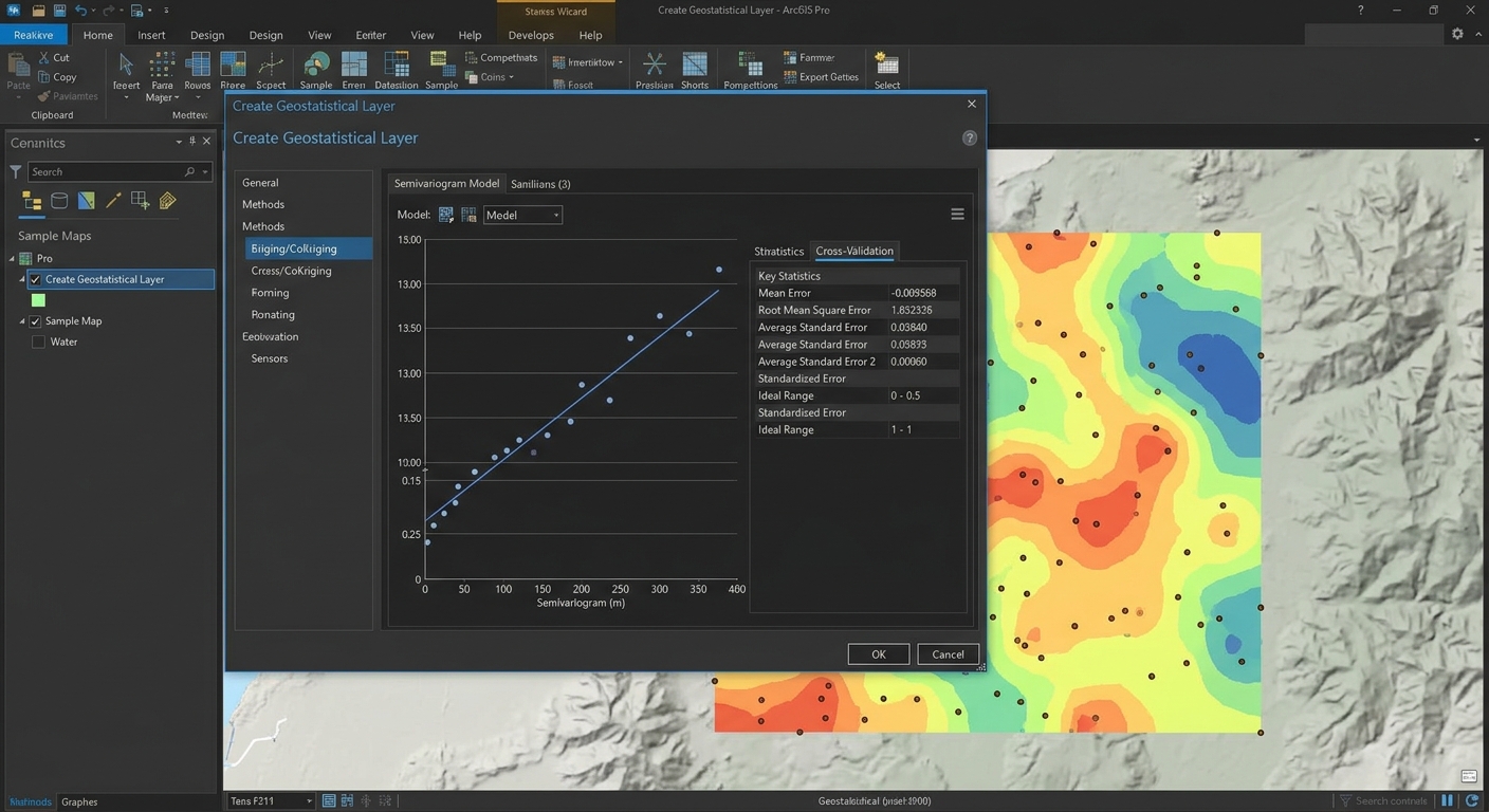
IDW vs Kriging GIS

5 Key Differences Between IDW vs Kriging GIS Methods   When working with GIS lab assignments, you may have a dataset containing sample points for rainfall, temperature, air quality, soil properties, or groundwater levels. The challenge is turning those discrete observations into a continuous surface that can be mapped and analyzed. Understanding IDW vs Kriging … Read more

Top 5 Common Map Projections Every GIS Student Needs to Know

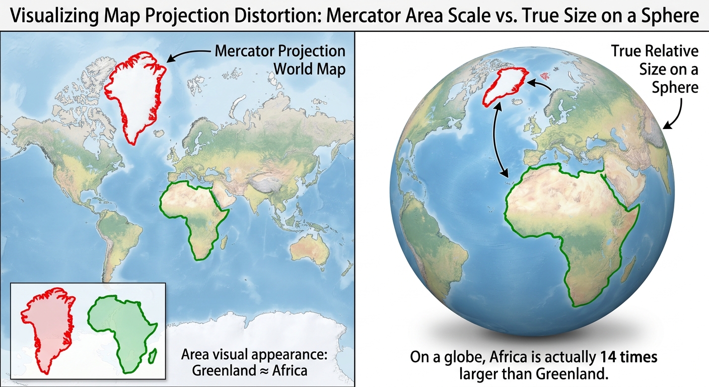
A visual comparison showing how the Mercator projection GIS uses distorts the true area of landmasses like Greenland and Africa.

Top 5 Common Map Projections Every GIS Student Needs to Know (Plus the Distortion Trade-Offs That Decide Your Grade) Introduction: Why You Can’t Flatten a Sphere Without Breaking Something Whether you are preparing for a lab practical or writing a research paper, mastering common map projections GIS professionals rely on is essential for preventing costly … Read more

Intersect vs Union vs Erase in GIS: Step-by-Step Guide

Intersect vs Union vs Erase in GIS: A Visual Step-by-Step Guide to Vector Overlay Analysis Spatial overlay analysis is one of the core techniques in vector GIS because it allows you to combine or compare geographic features based on their location. Understanding intersect vs union vs erase in GIS is especially important when completing university … Read more

Map Layout Design in ArcGIS Pro: 10 Ultimate Steps for Best Maps

Introduction: Map Layout Design in ArcGIS Pro Learning map layout design arcgis pro techniques is essential for arranging geographic data, titles, legends, scale information, and text into a publication-ready map. Map layout design in ArcGIS Pro is the process of arranging geographic data, titles, legends, scale information, text, and other cartographic elements into a clear … Read more

Spatial Data vs Non Spatial Data: 5 Essential Key Differences

Spatial Data vs Non Spatial Data: 5 Key Differences Every GIS Student Should Know When comparing spatial data vs non spatial data, spatial data describes where something is located .Spatial data and non-spatial data are two fundamental geographic data types used in Geographic Information Systems (GIS). Spatial data describes where something is located and its … Read more

Vector vs Raster GIS: 7 Best Differences for Students

Vector vs. Raster Data: The Ultimate Cheatsheet for GIS Students   Vector vs Raster GIS: Why This Difference Matters When studying Vector vs Raster GIS, one of the first decisions that can feel confusing is whether your data should be represented as points, lines, and polygons or as a grid made up of pixels. Why … Read more

Spatial Join and Buffer Analysis in GIS: 5 Best Steps

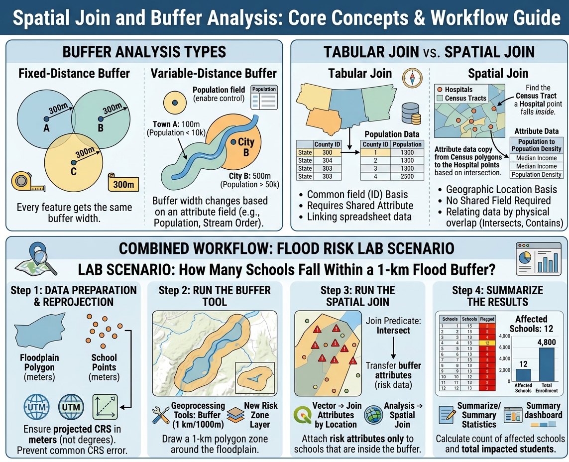
Spatial Join and Buffer Analysis workflow showing buffer types, spatial vs tabular join, and flood risk lab scenario

Demystifying Spatial Join & Buffer Analysis in GIS: A Beginner’s Guide Introduction Every GIS lab assignment eventually boils down to one of two questions: “What is near this?” and “What overlaps or falls inside this?” Answering the first question is the job of buffer analysis. Answering the second is the job of spatial joins. Together, … Read more

Geographic vs Projected CRS: 5 Best Differences for Students

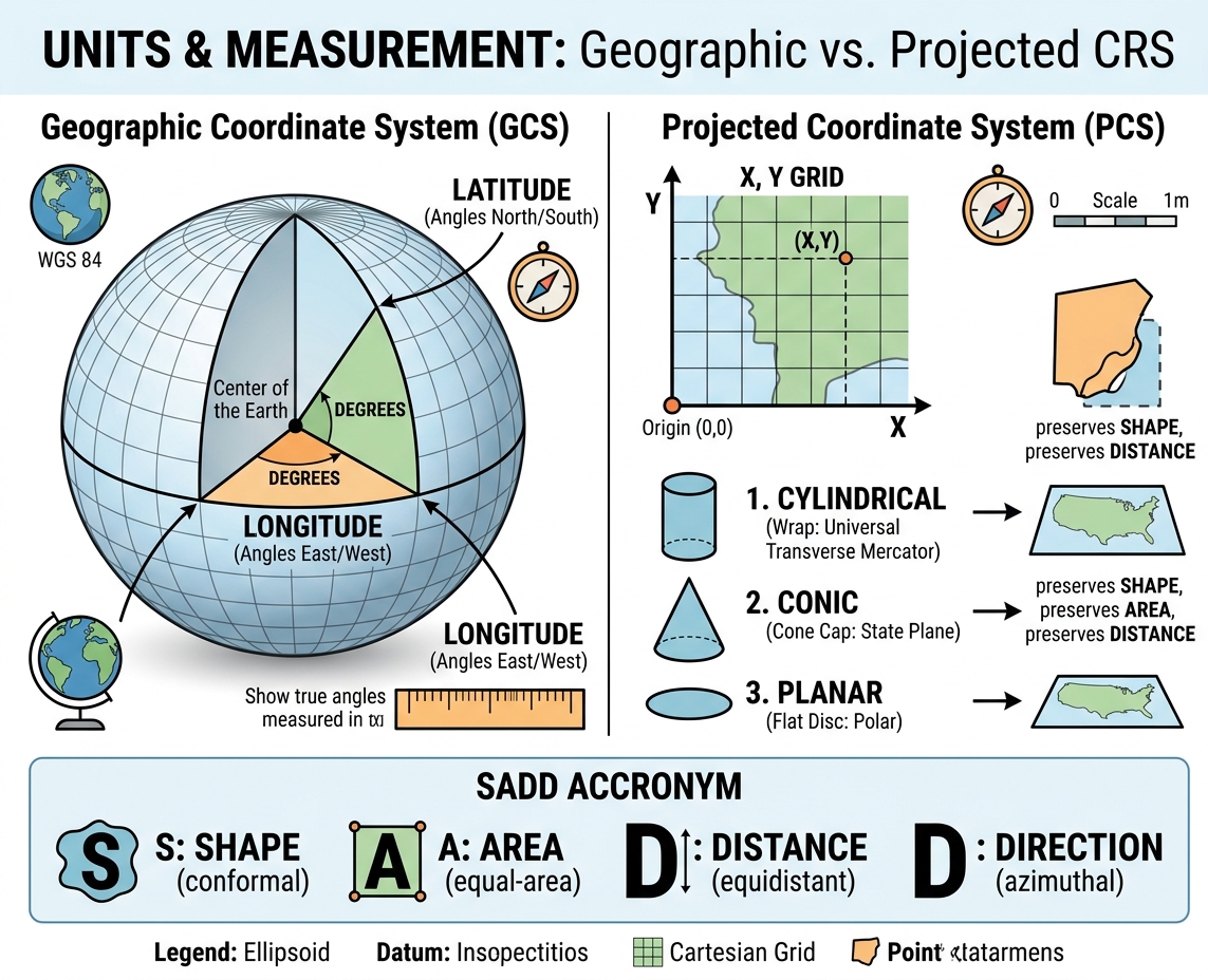
GIS infographic comparing Geographic (3D angles) vs. Projected (2D linear) CRS, showing map projection developable surfaces and SADD distortion trade-offs.

Geographic vs. Projected Coordinate Reference Systems (CRS) Explained Simply Introduction: The Orange Peel Dilemma When studying Geographic vs Projected CRS, imagine peeling an orange in one continuous piece and trying to lay that curved peel completely flat on a table without stretching or tearing it—it is physically impossible. This classic orange peel analogy illustrates the … Read more

GIS in Urban Planning: 5 Best Applications for Students

GIS in Urban Planning & Smart Cities: Coursework, Applications & Project Ideas Introduction When applying GIS in Urban Planning, modern cities must be analyzed as complex spatial systems where housing, roads, public transport, and utilities compete for limited land. For urban planners and civil engineers, understanding where something happens is just as important as understanding … Read more