Vector Tiles vs Traditional Raster Tiles: GIS Performance

Vector Tiles vs Traditional Raster Tiles: GIS Performance Introduction: The Evolution of Web Mapping Tiles Web mapping systems must deliver geographic information quickly while supporting smooth navigation, readable labels, and interactive spatial features. From national-scale basemaps to urban infrastructure dashboards, the tile architecture used to deliver map data has a direct impact on bandwidth consumption, … Read more
Time Series Analysis of Satellite Imagery Using the Google Earth Engine Python API

Time Series Analysis of Satellite Imagery Using the Google Earth Engine Python API Introduction: Cloud-Native Remote Sensing for Multi-Year Analysis Monitoring vegetation dynamics, agricultural productivity, deforestation, drought, and land-cover change often requires satellite observations collected over multiple years. Processing this data locally can quickly become computationally expensive, particularly when an analysis involves thousands of satellite … Read more

Object Based Image Analysis (OBIA) vs Pixel Based Classification

Object Based Image Analysis (OBIA) vs Pixel Based Classification Introduction: From Individual Pixels to Geographic Objects Remote sensing classification transforms satellite or aerial imagery into meaningful geographic information, such as buildings, forests, agricultural fields, roads, wetlands, and urban land-cover classes. The analytical approach used to classify an image determines how spatial patterns are represented, how … Read more

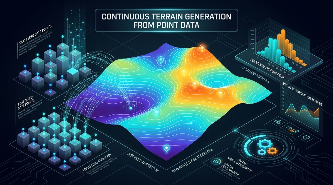
Spatial Interpolation in Python: Kriging and IDW using PyKrige and SciPy

Spatial Interpolation in Python transforming scatter points into continuous prediction surfaces.

Spatial Interpolation in Python: Kriging and IDW using PyKrige and SciPy Introduction Spatial interpolation transforms scattered point observations into a continuous surface by estimating values at locations where measurements are unavailable. It is widely used to map rainfall, groundwater levels, soil properties, air pollution, temperature, and other environmental variables. Performing Spatial Interpolation in Python using … Read more

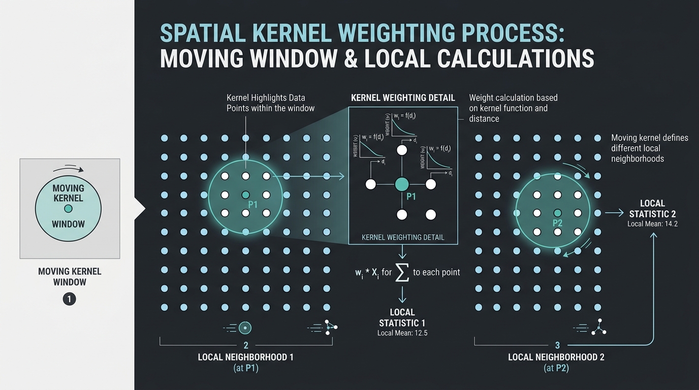
Geographically Weighted Principal Component Analysis (GWPCA) in GIS

Geographically Weighted Principal Component Analysis showing local spatial bandwidth windows and coordinate weights.

Geographically Weighted Principal Component Analysis (GWPCA) in GIS Introduction: Why Spatial Data Needs Local Multivariate Analysis Principal Component Analysis (PCA) is a multivariate statistical technique used to reduce a large set of correlated variables into a smaller number of components that summarize the dominant patterns of variation in the data. It is widely used in … Read more

Top 5 Freelance GIS Platforms & How to Win Your First Mapping Contract

Top 5 Freelance GIS Platforms & How to Win Your First Mapping Contract

Top 5 Freelance GIS Platforms & How to Win Your First Mapping Contract Top 5 Freelance GIS Platforms & How to Win Your First Mapping Contract is essential when transitioning from a GIS student or recent graduate into a paid professional.. However, geospatial expertise is in high demand globally. Businesses, researchers, real estate developers, and … Read more

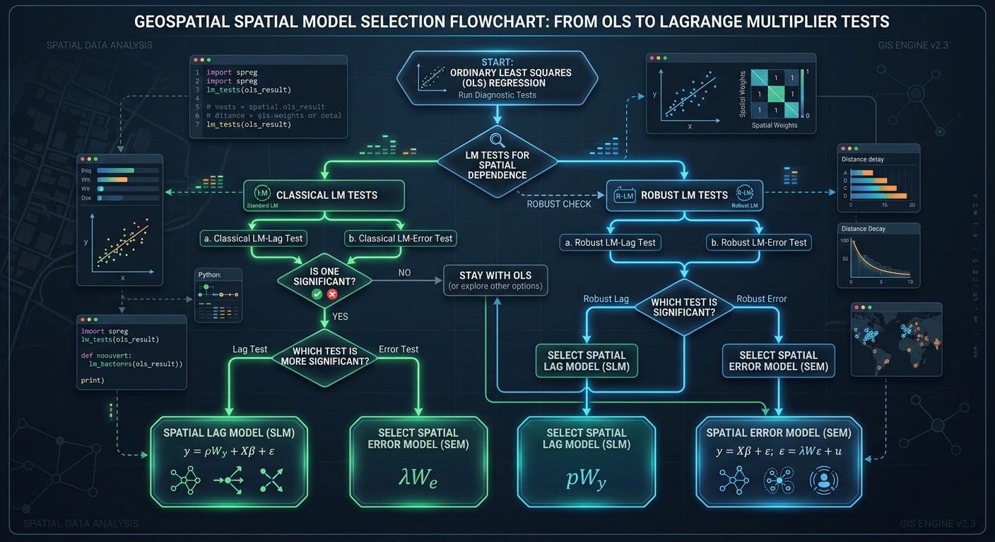
Spatial Lag vs. Spatial Error Models: Choosing the Right Spatial Econometric Model

Lagrange Multiplier test workflow and decision guidelines for choosing between Spatial Lag vs Spatial Error Models.

Spatial Lag vs. Spatial Error Models: Choosing the Right Spatial Econometric Model   1. Introduction: Why Standard OLS Regression Can Fail in Spatial Analysis Imagine a researcher studying why property prices differ across neighborhoods. The researcher collects data on house prices, household income, distance to the city center, and access to public transportation. Using Ordinary … Read more

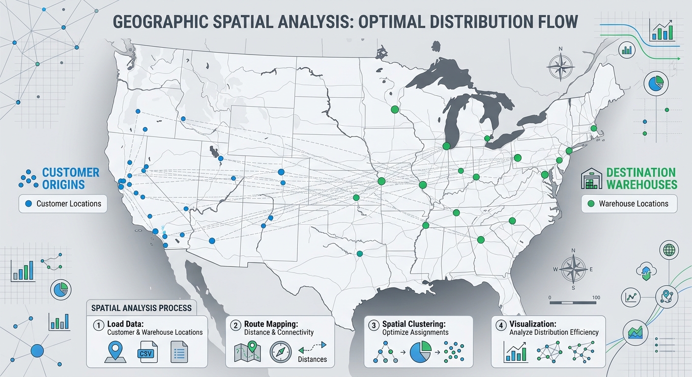
How to Calculate Spatial Distance Matrices with Python SciPy and Shapely

Workflow diagram illustrating how to calculate spatial distance matrices between customer origins and facility destinations using Python SciPy and Shapely.

How to Calculate Spatial Distance Matrices with Python SciPy and Shapely How to Calculate Spatial Distance Matrices with Python SciPy and Shapely is essential for mastering spatial distance calculations in GIS workflows. Whether you are determining which hospital is closest to a patient, matching warehouses to customers, or analyzing the nearest neighboring features, calculating distances between … Read more

Mapping Groundwater Potential Zones Using Analytical Hierarchy Process (AHP) in GIS GIS Research Guide · Hydrogeology · Multi-Criteria Decision Analysis · QGIS & ArcGIS Pro Introduction Groundwater is a critical source of freshwater for domestic consumption, agriculture, and industrial development. However, identifying productive groundwater zones is challenging because groundwater occurrence depends on several interacting factors, … Read more

Visibility Analysis & Viewshed Modeling: Determining Line-of-Sight in GIS

Visibility Analysis & Viewshed Modeling: Determining Line-of-Sight in GIS GIS Tutorial · Spatial Analysis · Environmental Planning · QGIS & ArcGIS Pro Introduction Viewshed analysis is a GIS technique used to determine which locations on a landscape are visible from one or more observation points. It evaluates the terrain between an observer and surrounding locations … Read more