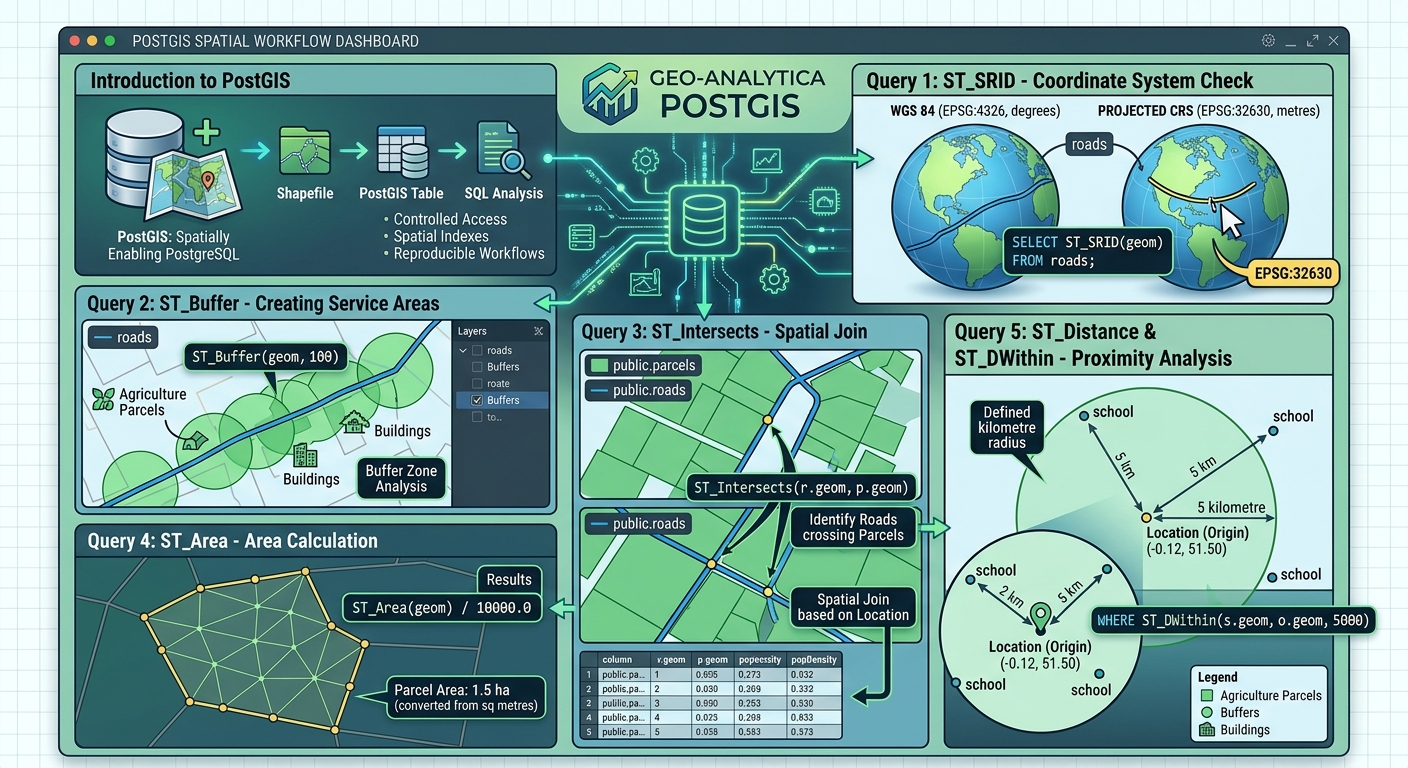
PostGIS Starter Guide: 5 Spatial SQL Queries Every GIS Student Should Know

PostGIS Starter Guide spatial SQL queries

PostGIS Starter Guide: 5 Spatial SQL Queries Every GIS Student Should Know   1. Introduction: Why GIS Students Should Learn PostGIS Welcome to this comprehensive PostGIS Starter Guide spatial SQL queries overview, designed to help GIS students master database management. Traditional GIS workflows often rely on individual files such as Shapefiles, GeoJSON, and GeoPackage datasets. … Read more
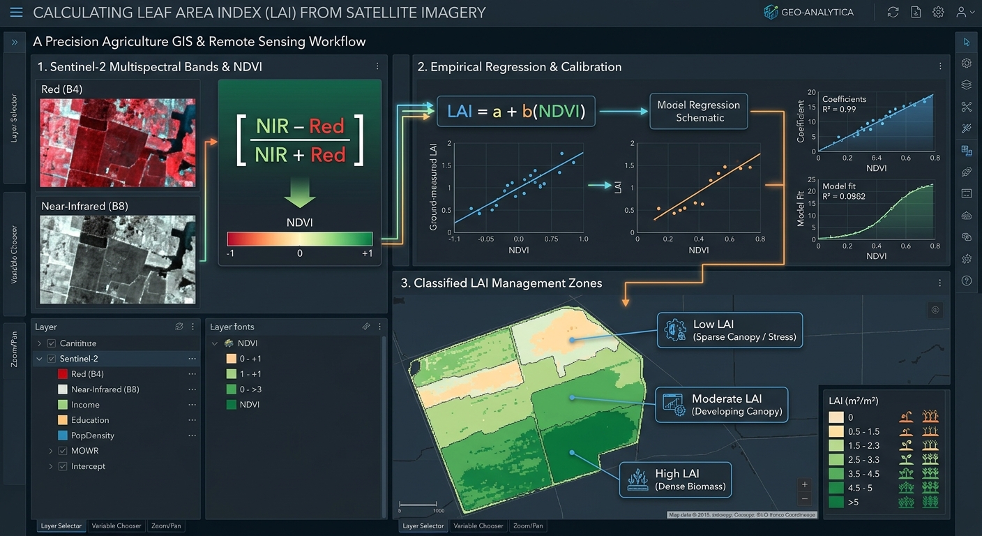
How to Calculate Leaf Area Index (LAI) from Satellite Imagery for Precision Agriculture

Calculate Leaf Area Index LAI satellite imagery GIS

How to Calculate Leaf Area Index (LAI) from Satellite Imagery for Precision Agriculture   1. Introduction: Understanding Leaf Area Index in Precision Agriculture Modern agriculture increasingly relies on satellite remote sensing to monitor crop growth, identify stressed areas, estimate biomass, and improve the efficiency of farm inputs. One important vegetation canopy metric is the Leaf … Read more

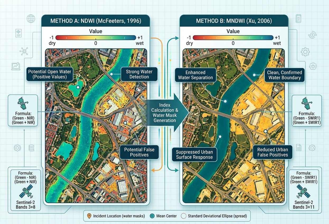
Normalized Difference Water Index NDWI vs MNDWI QGIS: A Practical Water Mapping Guide

NDWI vs MNDWI water mapping GIS

Normalized Difference Water Index NDWI vs MNDWI QGIS: A Practical Water Mapping Guide   1. Introduction: Why Map Water Bodies Using Satellite Imagery? To effectively NDWI vs MNDWI water mapping GIS workflows, it is important to understand. Accurately identifying water bodies from satellite imagery is an important task in hydrology, environmental management, disaster response, and … Read more

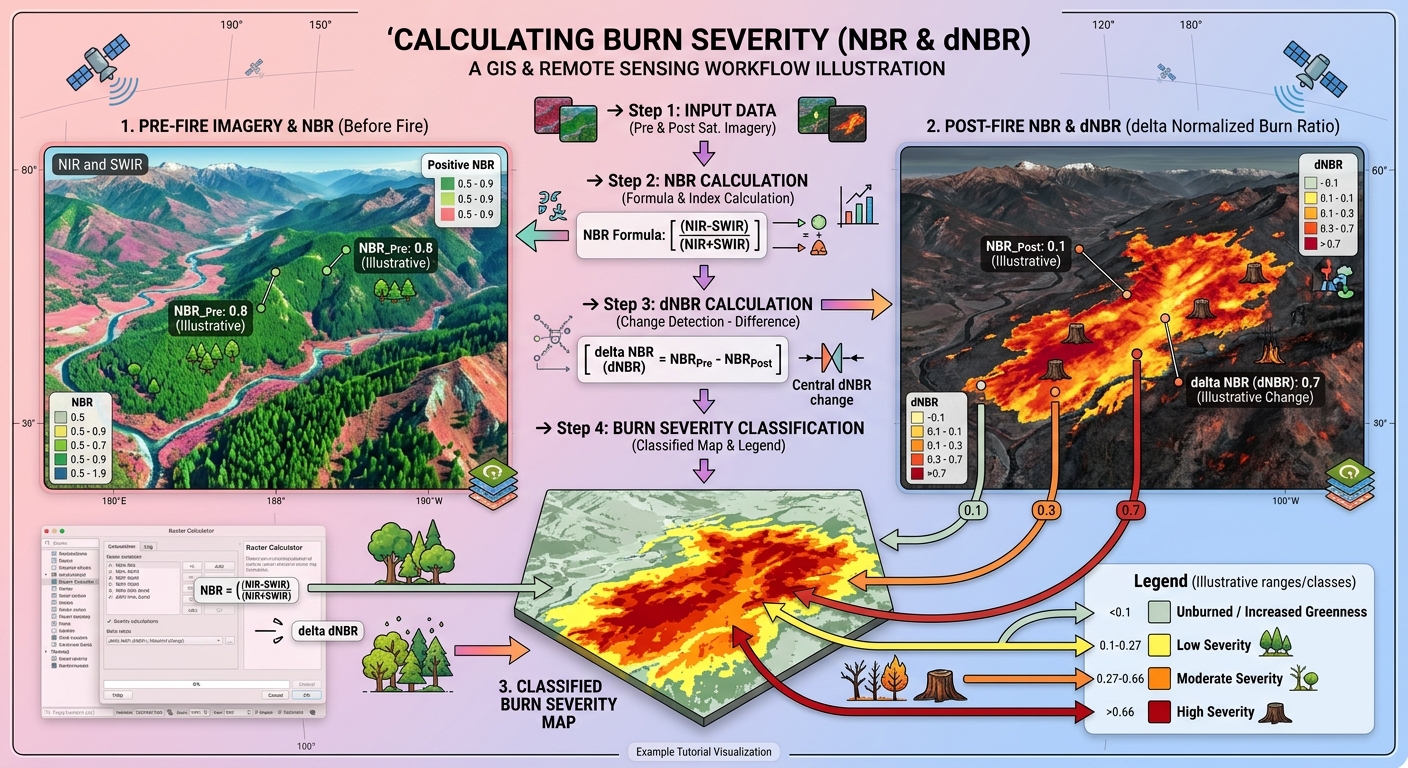
Calculating Burn Severity with Normalized Burn Ratio (NBR) in QGIS: A Step-by-Step Tutorial

Calculate Burn Severity NBR QGIS

Calculating Burn Severity with Normalized Burn Ratio (NBR) in QGIS: A Step-by-Step Tutorial   1. Introduction: Understanding Burn Severity with Satellite Remote Sensing To successfully Calculate Burn Severity NBR QGIS workflows, environmental scientists must understand how wildfires transform vegetation and soil. Wildfires can transform vegetation, expose bare soil, alter soil moisture, and affect ecosystem recovery. … Read more

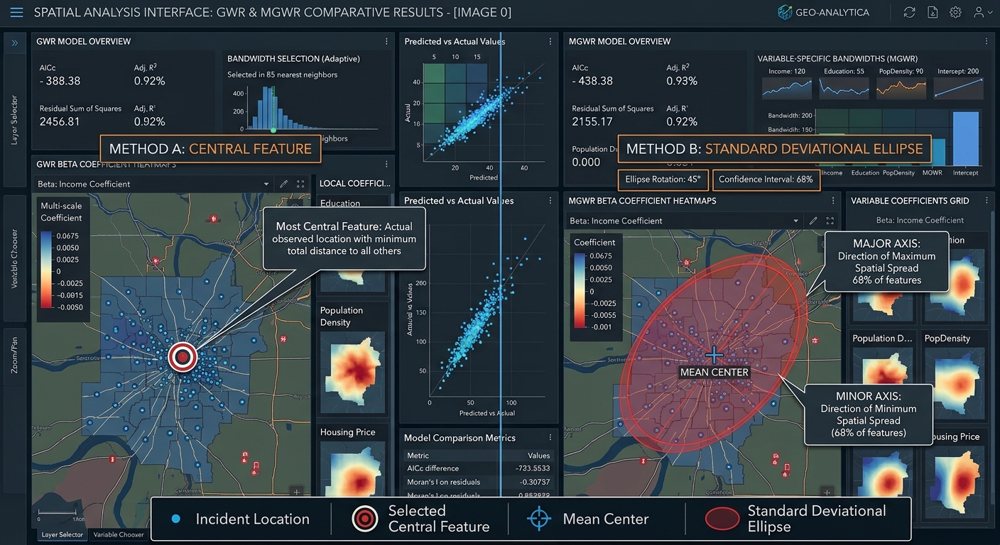
Directional Distribution vs. Central Feature in GIS: Measuring Point Patterns

Directional Distribution vs Central Feature GIS

Directional Distribution vs. Central Feature in GIS: Measuring Point Patterns   1. Introduction: Why Measure Geographic Point Patterns? Imagine you are analyzing thousands of emergency incident locations across a city. When analyzing spatial point patterns using Directional Distribution vs Central Feature GIS techniques, analysts can summarize, but it does not immediately tell you where the … Read more

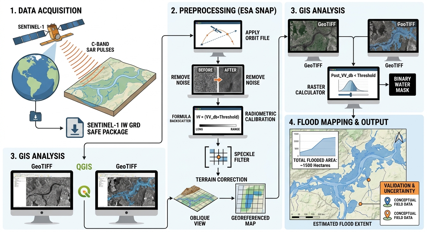
Introduction to SAR (Synthetic Aperture Radar) Data for Beginners: Sentinel-1 Workflow

SAR Synthetic Aperture Radar Sentinel 1 GIS

Introduction to SAR (Synthetic Aperture Radar) Data for Beginners: Sentinel-1 Workflow   1. Introduction: What Is Synthetic Aperture Radar (SAR)? Synthetic Aperture Radar (SAR) is an active remote sensing technology that transmits microwave pulses toward Earth’s surface and records the energy scattered back to the satellite. By processing these radar echoes, SAR systems produce images … Read more

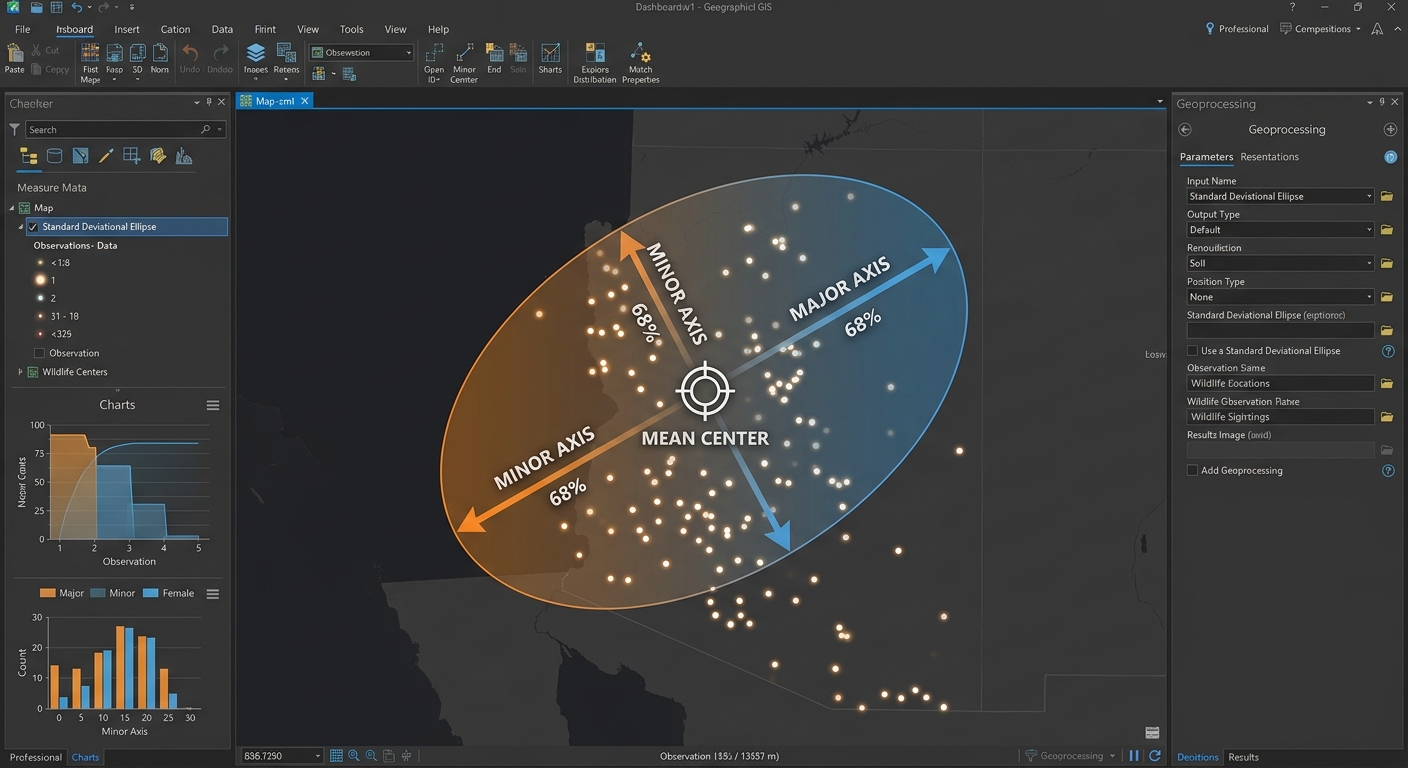
Standard Deviational Ellipse & Mean Center Analysis: Mapping Spatial Directional Trends

Standard Deviational Ellipse Mean Center GIS

Standard Deviational Ellipse & Mean Center Analysis: Mapping Spatial Directional Trends   1. Introduction: Why Analyze Spatial Distribution? Imagine you have collected 5,000 wildlife sightings, mapped thousands of disease cases, or recorded customer locations for a chain of retail stores. A point map shows where the observations occur, but it may not immediately reveal the … Read more

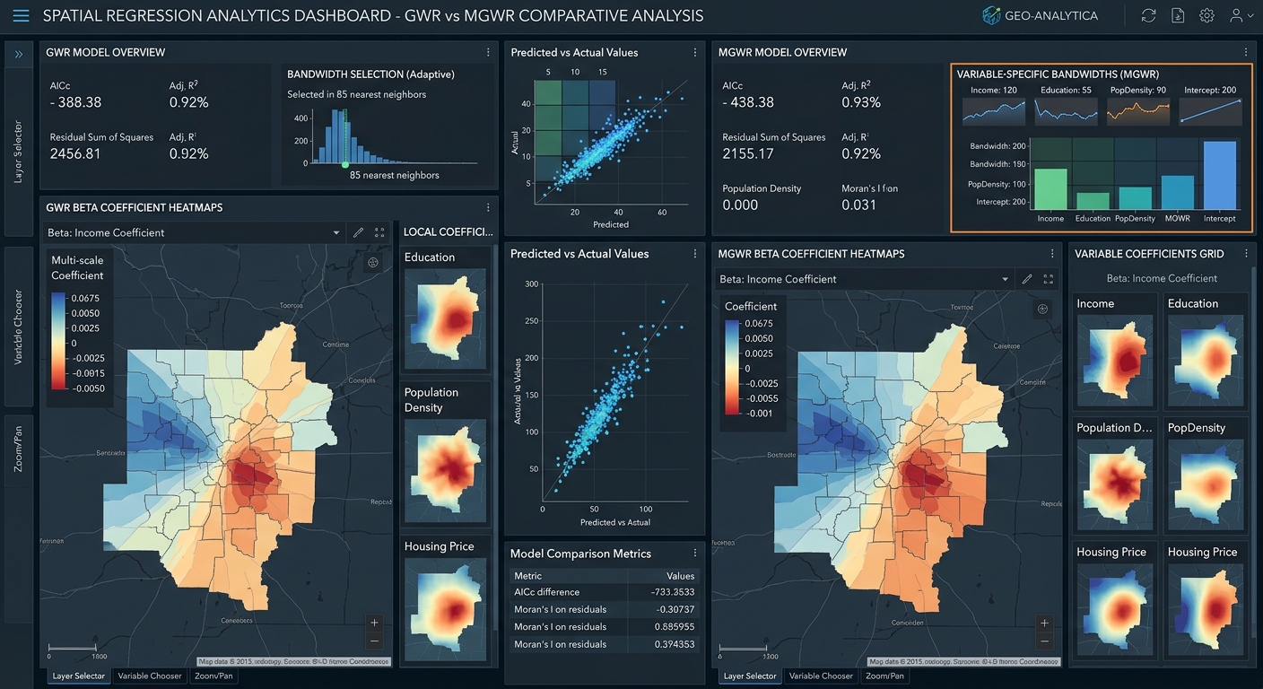
GWR vs MGWR GIS: Compare bandwidths, local regression, and spatial scales in QGIS and Python.

GWR vs MGWR GIS

Geographically Weighted Regression (GWR) vs. Multiscale GWR (MGWR): A Practical GIS Guide   1. Introduction: Why Spatial Relationships Change Across Geography Imagine you are studying housing prices across a city. You want to understand how distance to the city centre, household income, and access to public transport influence property prices. A conventional regression model might … Read more

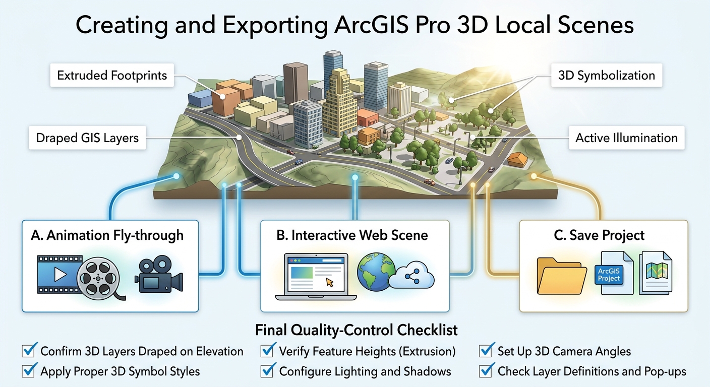
3D Scene Creation in ArcGIS Pro: Converting 2D Features into Elevation-Aware Models

3D Scene ArcGIS Pro 2D features workflow diagram

3D Scene Creation in ArcGIS Pro: Converting 2D Features into Elevation-Aware Models   1. Introduction: Why Create 3D GIS Scenes? When learning how to build a 3D Scene ArcGIS Pro 2D features project, analysts must first understand the transition from flat 2D surfaces to elevation-aware models.Traditional GIS maps display geographic information on a flat, two-dimensional … Read more