Geocoding Addresses in GIS: 5 Easy Steps to Map Excel Data

Geocoding Addresses in GIS: 5 Easy Steps to Map Excel Data Introduction Geocoding addresses in GIS is the process of converting descriptive location information—such as a street address, place name, or postal address—into geographic coordinates that GIS software can display as points on a map. This becomes especially useful when your lecturer gives you an … Read more
Convert KML to Shapefile in GIS: 3 Fast Methods

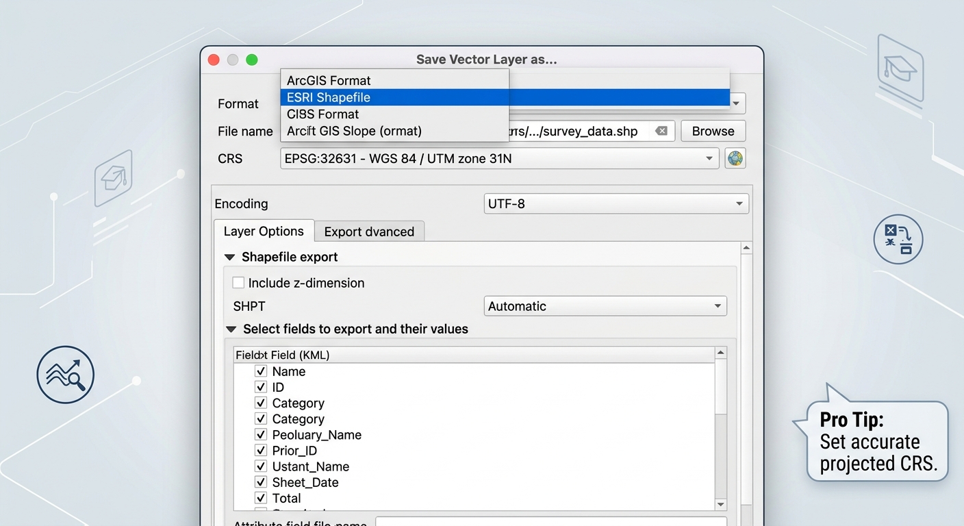
Infographic detailing quality control steps for verifying converted ESRI Shapefile attribute tables and geometry accuracy

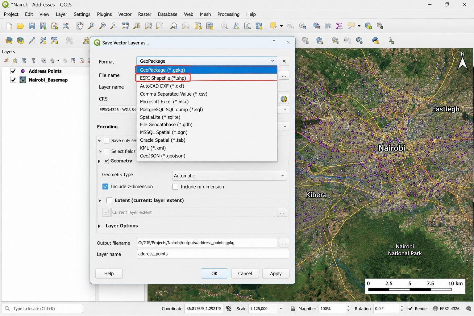
Convert KML to Shapefile in GIS: 3 Fast Methods If your professor sends you a Google Earth file for a project, knowing how to convert KML to Shapefile is essential for running spatial analysis in QGIS or ArcGIS Pro. These formats are useful for displaying locations in Google Earth, but they are not always convenient … Read more

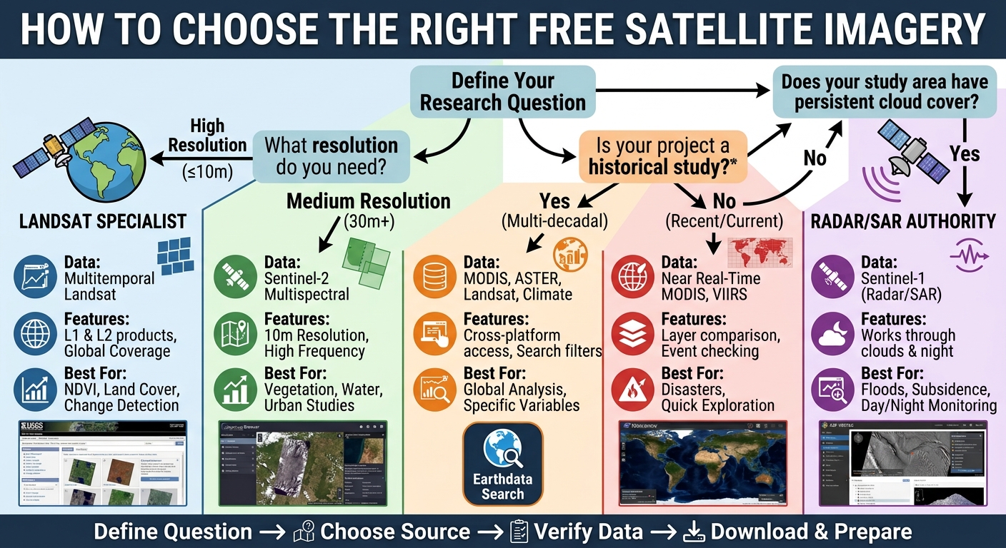
A decision tree flowchart infographic titled 'HOW TO CHOOSE THE RIGHT FREE SATELLITE IMAGERY,' guiding GIS students through sequential questions on image resolution, study type, and cloud cover to select the best free data source, such as USGS EarthExplorer, Copernicus Browser, or ASF Vertex.

Free Satellite Imagery for GIS: Top 5 Free Sources Introduction Finding free satellite imagery for GIS assignments can be surprisingly frustrating. You may know that you need a Landsat or Sentinel image, but then run into confusing portals, dozens of datasets, cloud-cover problems, incompatible file formats, or imagery that does not cover your study area. … Read more

ow to Georeference an Image in QGIS: 7 Easy Steps

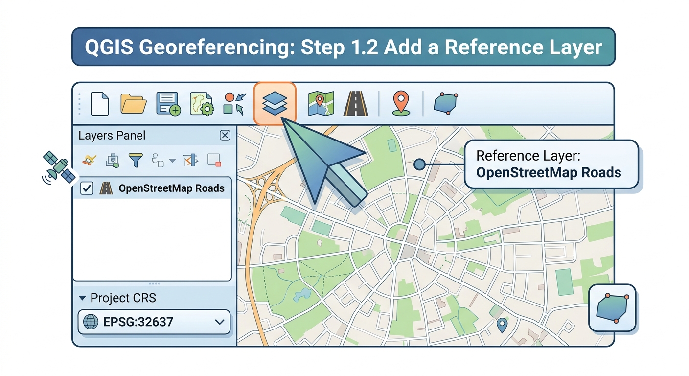
How to Georeference an Image in QGIS: A Complete Step-by-Step Workflow Georeferencing assigns real-world geographic coordinates to an image that does not already contain spatial reference information. In this guide, you will learn how to georeference an image in QGIS using a scanned historical map, CAD print, aerial photograph, or other unreferenced raster. The process … Read more

Network Analysis in GIS Shortest Path: 5 Best Steps

Network Analysis in GIS Shortest Path: 2 Powerful Routing Tutorials for Students Finding the shortest route between two locations sounds simple: identify the two points and calculate the distance between them. However, real transportation networks are more complicated. Network analysis in GIS shortest path workflows consider how roads actually connect and how vehicles move through … Read more

How to Create Interactive Web Map QGIS: 7 Best Steps

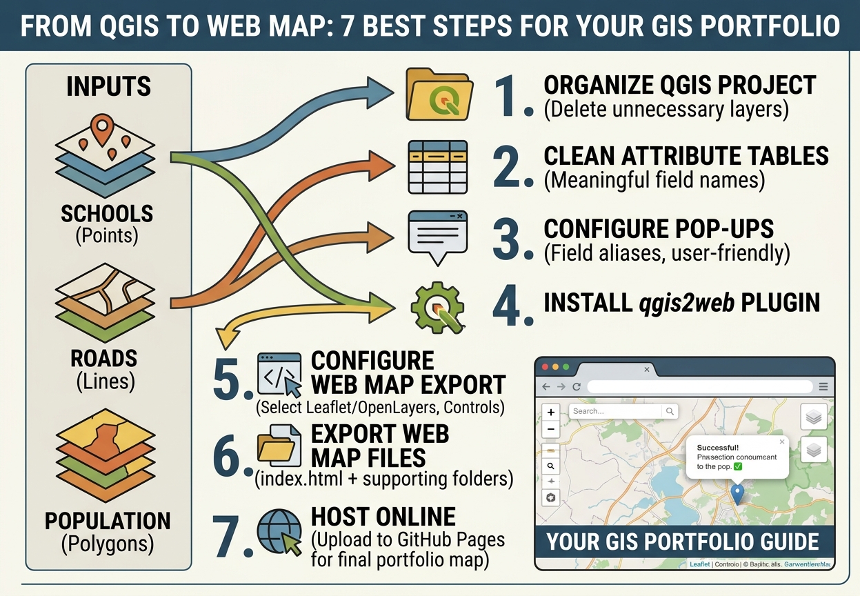
Flowchart mapping the 7 best steps to create interactive web map QGIS exports using qgis2web for a GIS portfolio

How to Create Interactive Web Map QGIS: Turn Your GIS Project into a Web GIS Portfolio Introduction Learning how to create interactive web map QGIS projects allows students and professionals to turn static GIS analyses into dynamic Web GIS applications. A well-designed GIS project should not have to end as a static PDF. Today, students … Read more

Multi Criteria Evaluation GIS Site Selection: 7 Best Steps

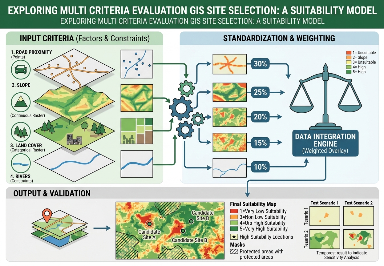
Flowchart and spatial analysis diagram for Multi Criteria Evaluation GIS Site Selection showing input factors, standardization, weighted overlay, and final suitability map

  Multi Criteria Evaluation GIS Site Selection: A Step-by-Step Site Suitability Tutorial Introduction: What Is Multi-Criteria Evaluation in GIS? Multi criteria evaluation GIS site selection is a spatial decision-making approach used to identify locations that best satisfy several criteria at the same time. A typical site-selection problem might ask: Where should a new hospital, school, … Read more

Python Script for GIS Automation: 5 Best Steps for Arc

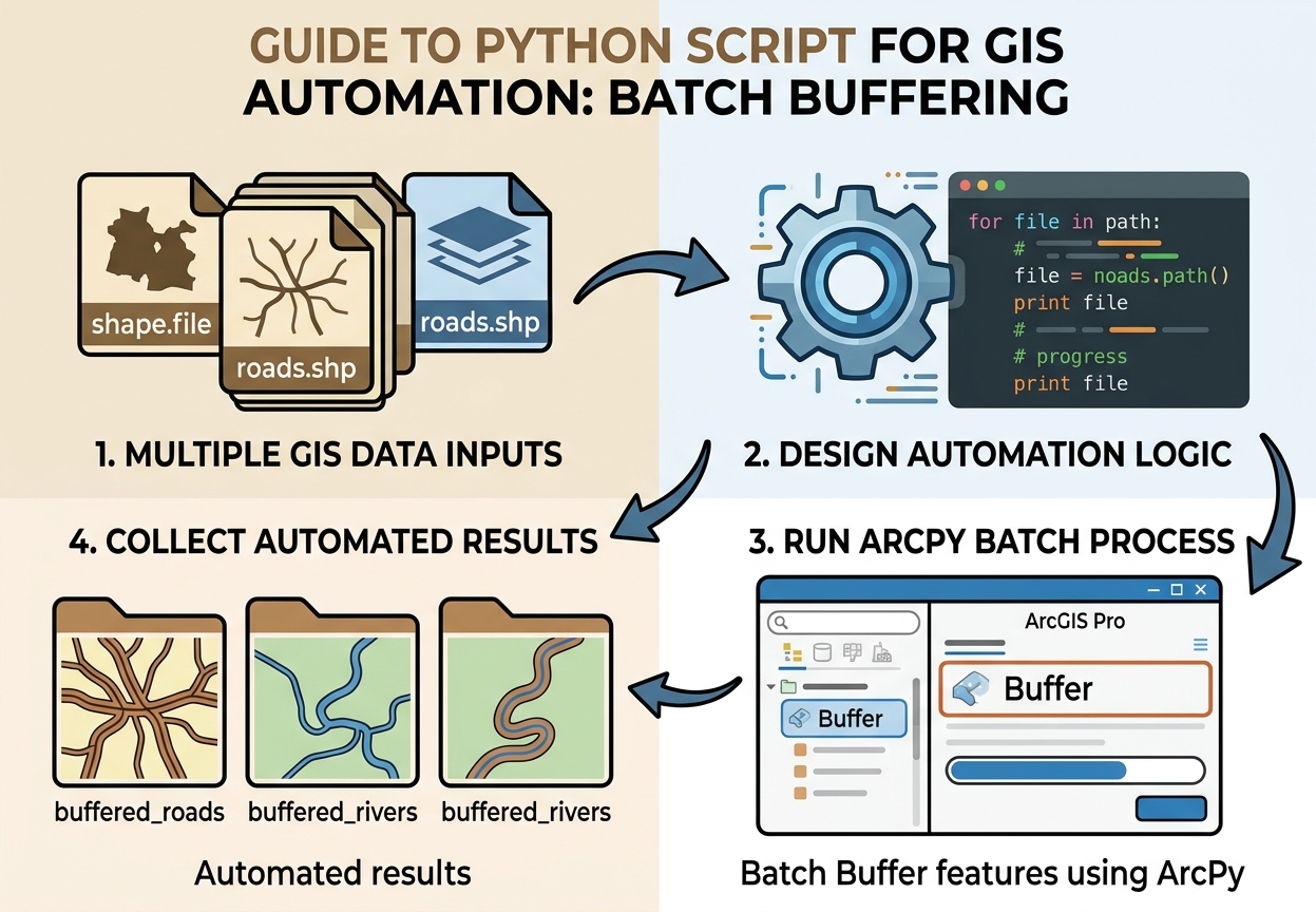
Flowchart illustrating a Python script for GIS automation batch buffering shapefiles using ArcPy in ArcGIS Pro

Here is a beginner-friendly tutorial built around a real automation task: taking many shapefiles from one folder and automatically creating buffered outputs with Python. Python Script for GIS Automation: Batch Buffer Shapefiles with ArcPy Introduction: Why GIS Students Should Learn Python A Python script for GIS automation can turn repetitive GIS work from a manual, … Read more

Spatial Join in ArcGIS Pro: 7 Best Steps for GIS Students

Spatial Join in ArcGIS Pro: A Hands-On Guide for GIS Students A spatial join in ArcGIS Pro combines information from two datasets based on their geographic relationship rather than a common attribute field. Unlike a traditional attribute join, which connects records using something like Student_ID or County_ID, a spatial join asks questions such as “Which … Read more

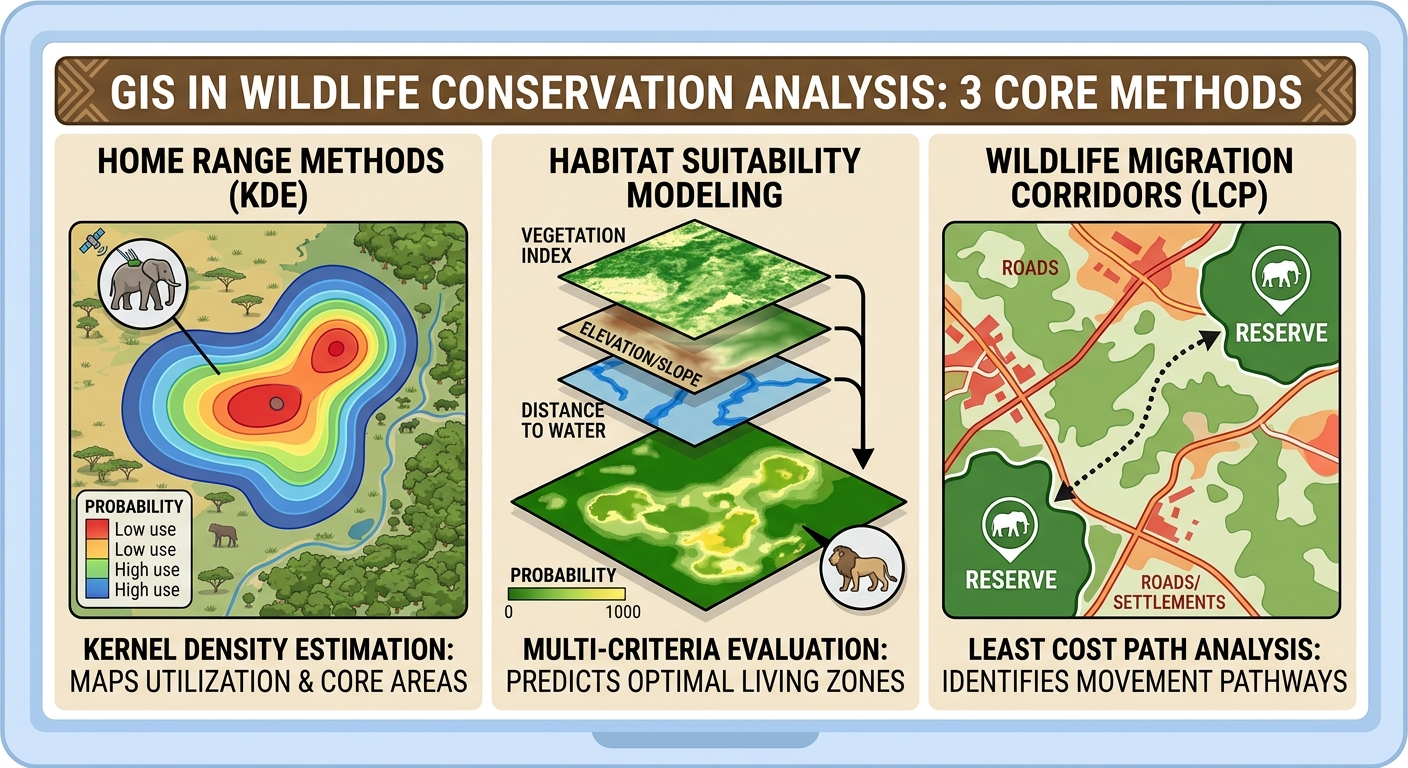
GIS in Wildlife Conservation Analysis: 3 Core Methods

GIS in wildlife conservation analysis framework showing kernel density estimation home range habitat suitability modeling and wildlife migration corridors

GIS in Wildlife Conservation Analysis: A Practical Guide to Home Range  Methods Wildlife conservation increasingly depends on understanding where animals move, where suitable habitat occurs, and how landscapes connect or fragment those habitats. Geographic Information Systems (GIS) provides the spatial framework for combining wildlife tracking data with satellite imagery, land-cover maps, terrain models, roads, rivers, … Read more