Getis-Ord Gi Hot Spot Analysis GIS Guide: 5 Steps

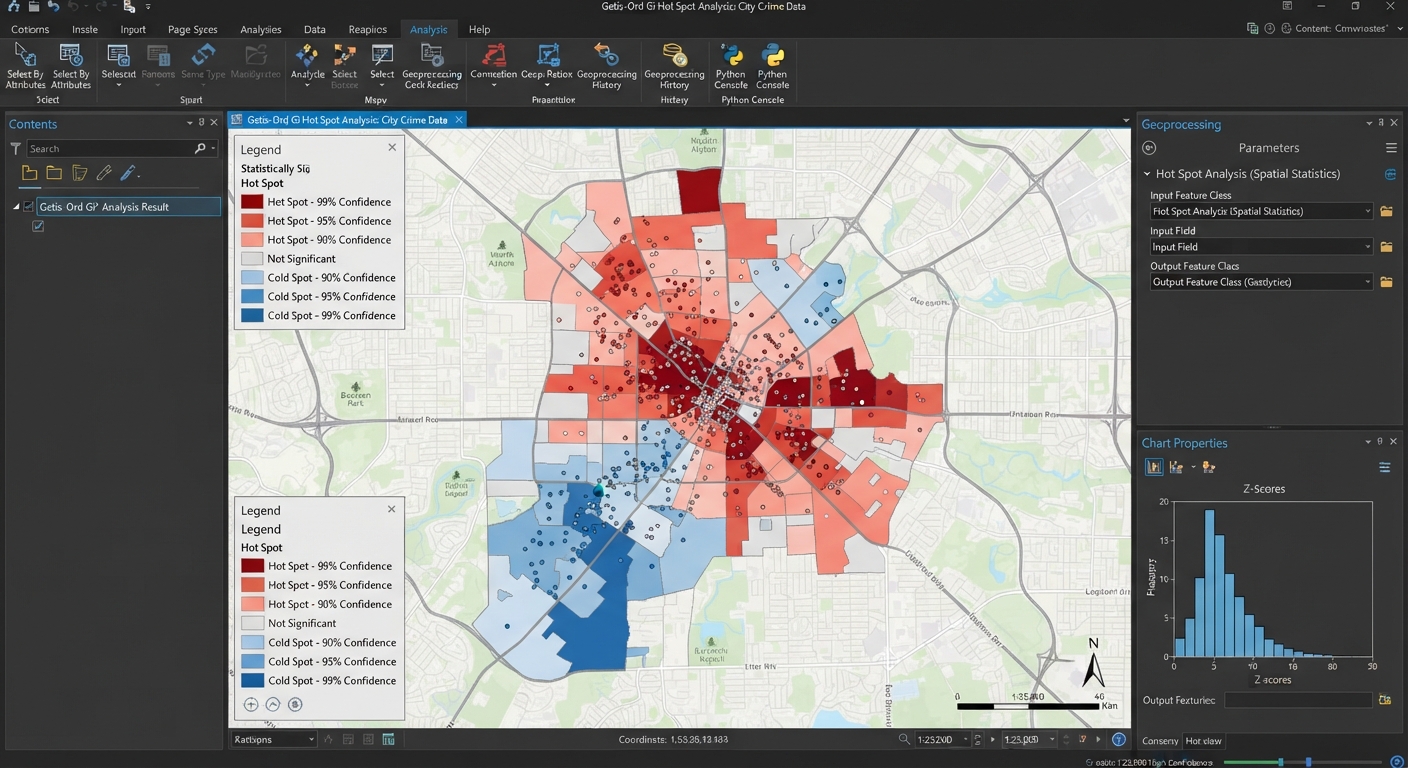
An ArcGIS Pro map interface displaying the results of a getis-ord gi hot spot analysis gis with statistical hot and cold spot clusters.

Getis-Ord Gi Hot Spot Analysis GIS Guide: 5 Steps When examining spatial distributions of phenomena such as crime events, disease outbreaks, traffic accidents, or environmental contamination, visual inspection of point locations can easily be deceiving. A map showing dense clusters of points might simply reflect underlying population density rather than a true statistical anomaly. Performing … Read more
How to Digitize Boundaries in GIS: 6 Easy Steps

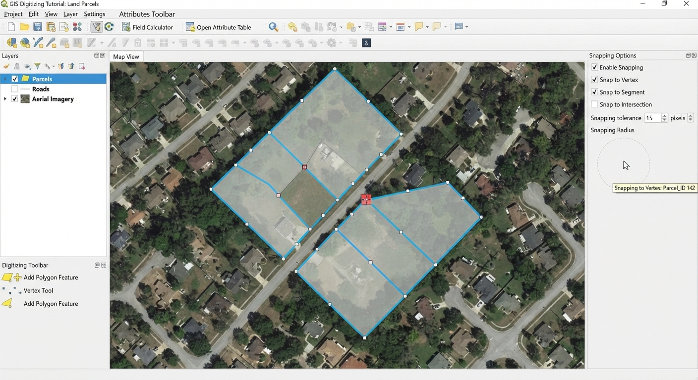
An educational GIS software interface demonstrating how to digitize boundaries in GIS using vector polygon editing tools over a satellite basemap.

How to Digitize Boundaries in GIS: 6 Easy Steps   When starting introductory Geographic Information Systems (GIS) coursework, university students often face a fundamental task: turning raw imagery into usable vector data. Learning how to digitize boundaries in GIS applications is an essential skill, whether you are creating land-use polygons from georeferenced historical maps, tracing … Read more

Attribute Table in GIS: 7 Essential Skills

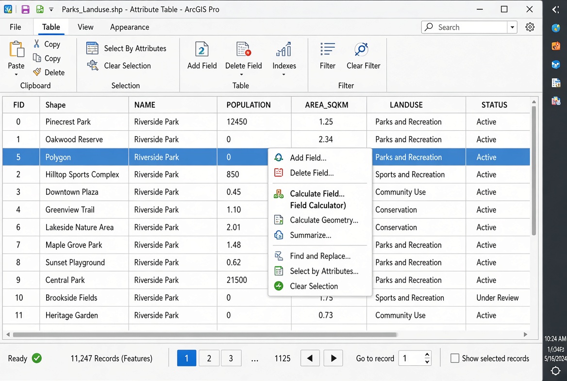
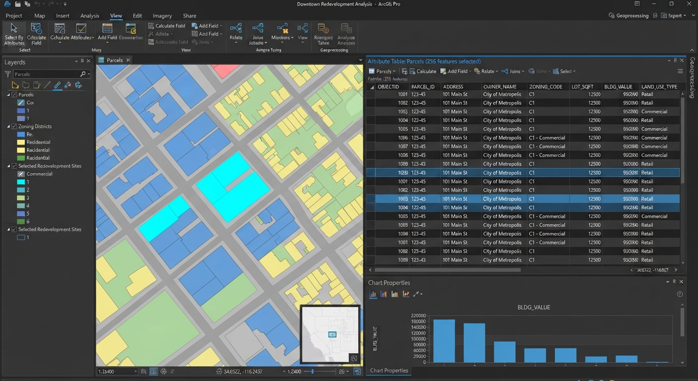
An overview interface displaying an attribute table in GIS open alongside a spatial map

Attribute Table in GIS: 7 Essential Skills for Beginners     An attribute table in GIS is the tabular database attached to a spatial layer that stores descriptive information about geographic features. Each row represents a feature, while each column stores an attribute describing that feature, such as population, name, area, or land-use type. For … Read more

Create Network Dataset ArcGIS Pro: 5-Step Guide

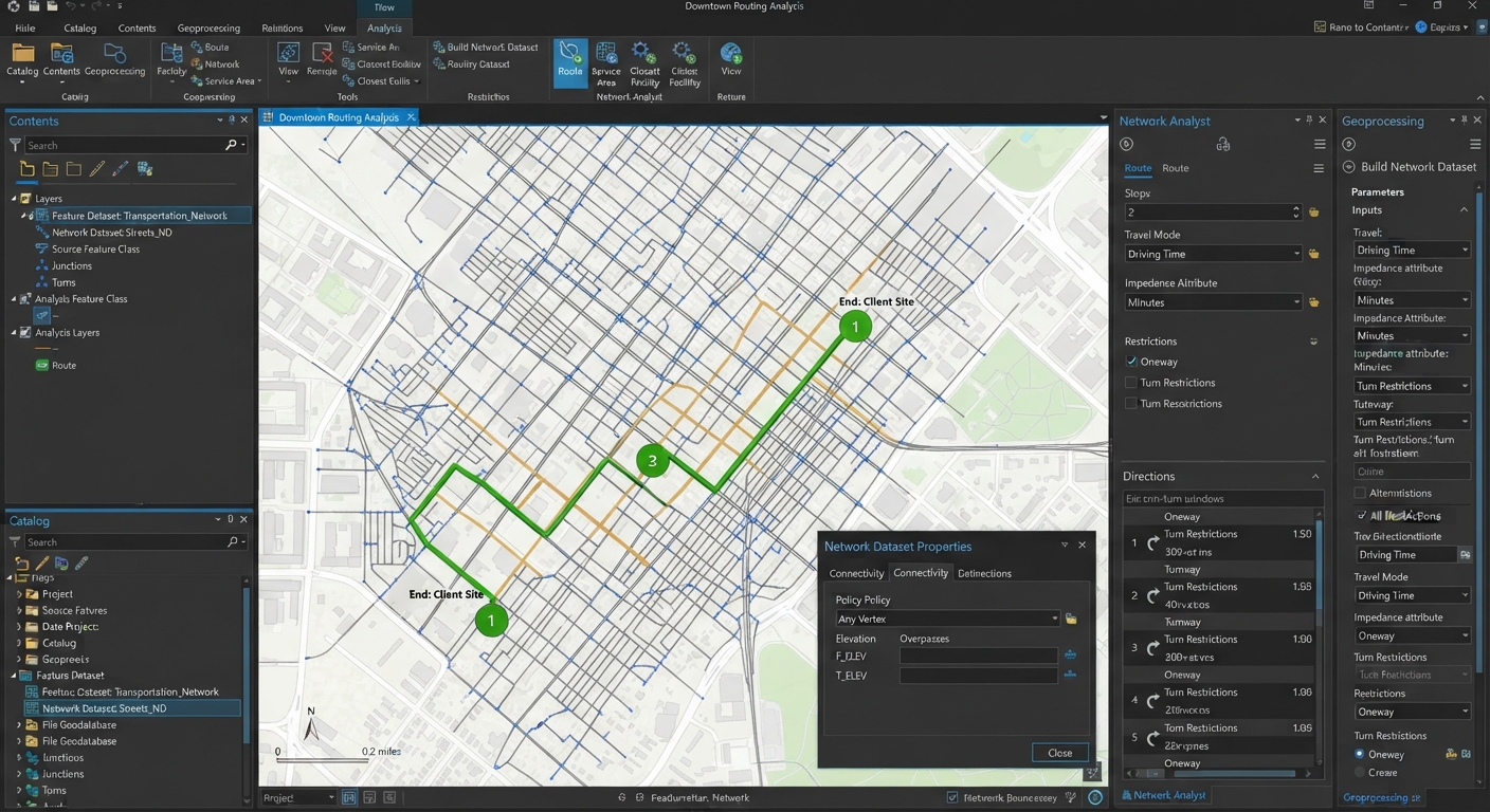
An ArcGIS Pro interface demonstrating the workflow to create network dataset arcgis pro for urban street routing and network analysis.

Create Network Dataset ArcGIS Pro: Step-by-Step Guide When completing transportation or urban planning assignments in desktop GIS, standard straight-line Euclidean distance calculations are rarely sufficient. Real-world mobility depends on transportation infrastructure: streets, one-way restrictions, speed limits, overpasses, and turn rules. Knowing how to create network dataset ArcGIS Pro structures from raw line centerlines is a … Read more

Attribute Table in GIS: 5 Essential Skills

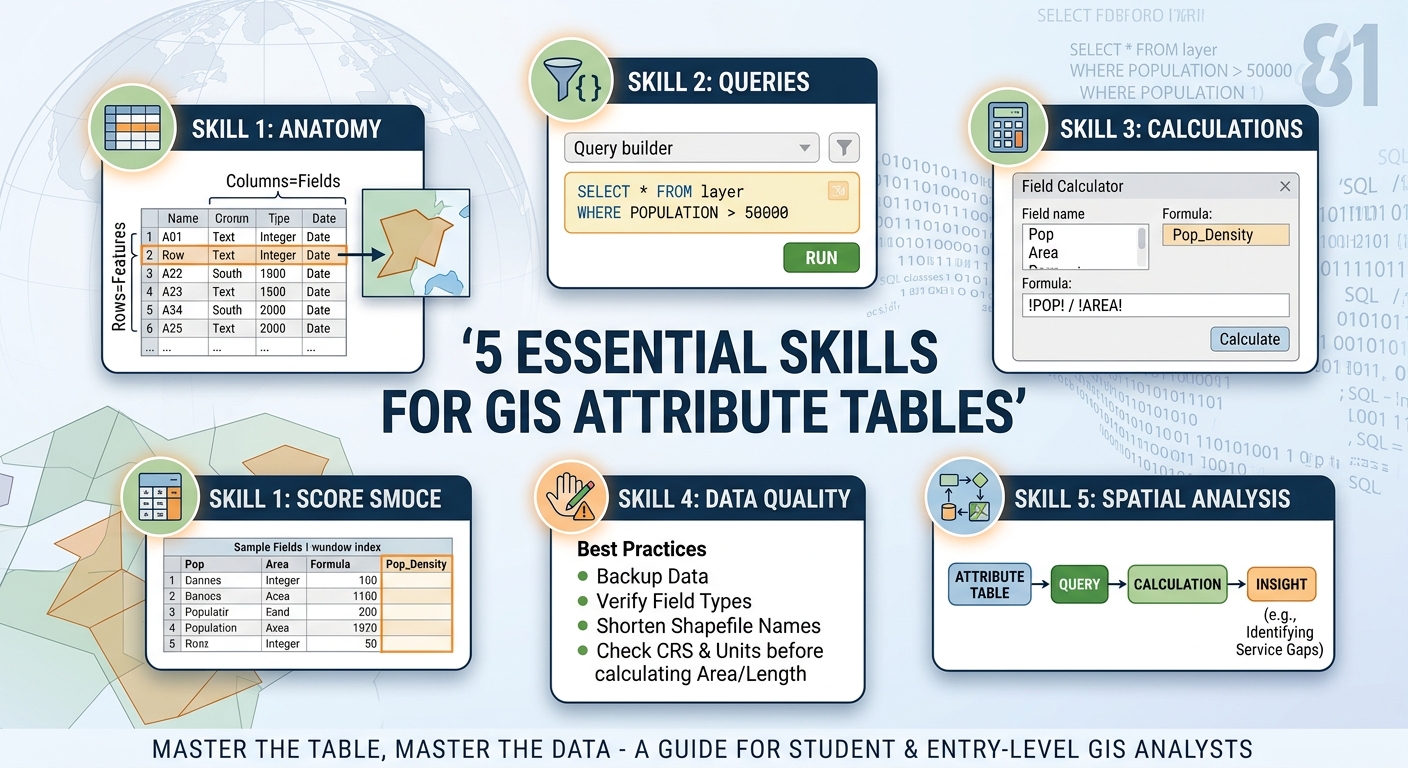
A comprehensive infographic detailing 5 essential skills for managing an attribute table in GIS, including sections on anatomy, queries, calculations, data quality, and spatial analysis.

Attribute Table in GIS: 5 Essential Skills An attribute table in GIS is a structured table that stores descriptive information about the geographic features in a GIS layer. Each row represents a feature, while each column stores an attribute or property describing that feature. If the map is the “where,” the attribute table is the … Read more

How to Calculate Field Values in ArcGIS & QGIS: 5 Steps.

How to Calculate Field Values in ArcGIS & QGIS: 5 Steps. Knowing how to calculate field values ArcGIS QGIS is an essential GIS skill when working with attribute tables. If you need to create new fields, populate calculated values, convert text to numbers, or calculate geometric measurements, knowing how to calculate field values ArcGIS QGIS … Read more

Dissolve vs Merge vs Union GIS: 3 Essential Vector Tools

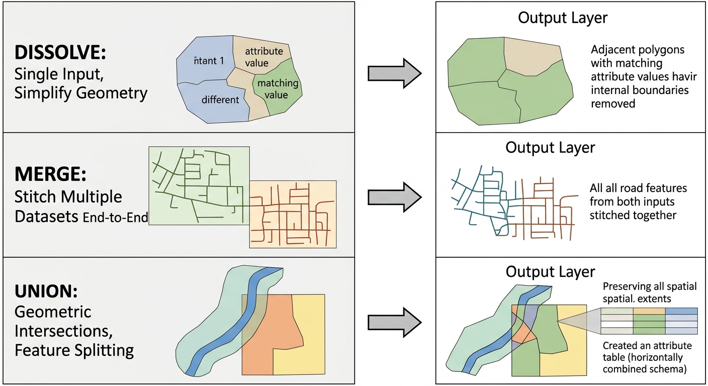
technical diagram explaining the differences between dissolve vs merge vs union GIS operations

Dissolve vs Merge vs Union GIS Guide: Which Vector Tool Should You Use? Choosing the right geoprocessing tool in software like QGIS or ArcGIS Pro can easily make or break your spatial analysis. When working on a vector analysis lab or putting together a comprehensive GIS assignment, combining spatial features is one of the most … Read more

Network Analysis GIS Shortest Path: 5 Best Rules

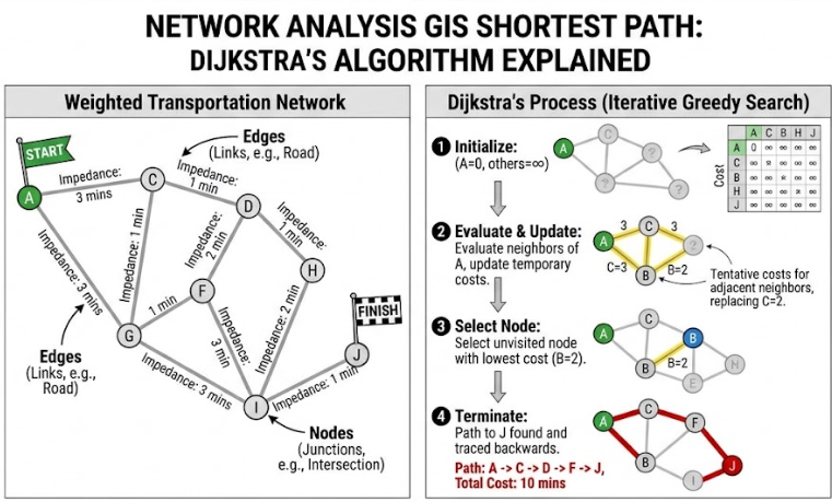
network-analysis-gis-shortest-path diagram illustrating a weighted network with edges and nodes

Network Analysis GIS Shortest Path: Routing Algorithms and Service Areas Explained Whether you are optimizing emergency response routes, modeling public transit accessibility, or planning supply chain logistics, spatial connectivity plays a central role in real-world geography. In computer mapping, analyzing how entities move through interconnected lines is known as network analysis If you are looking … Read more

Raster Calculator Expressions GIS: 5 Essential Formulas

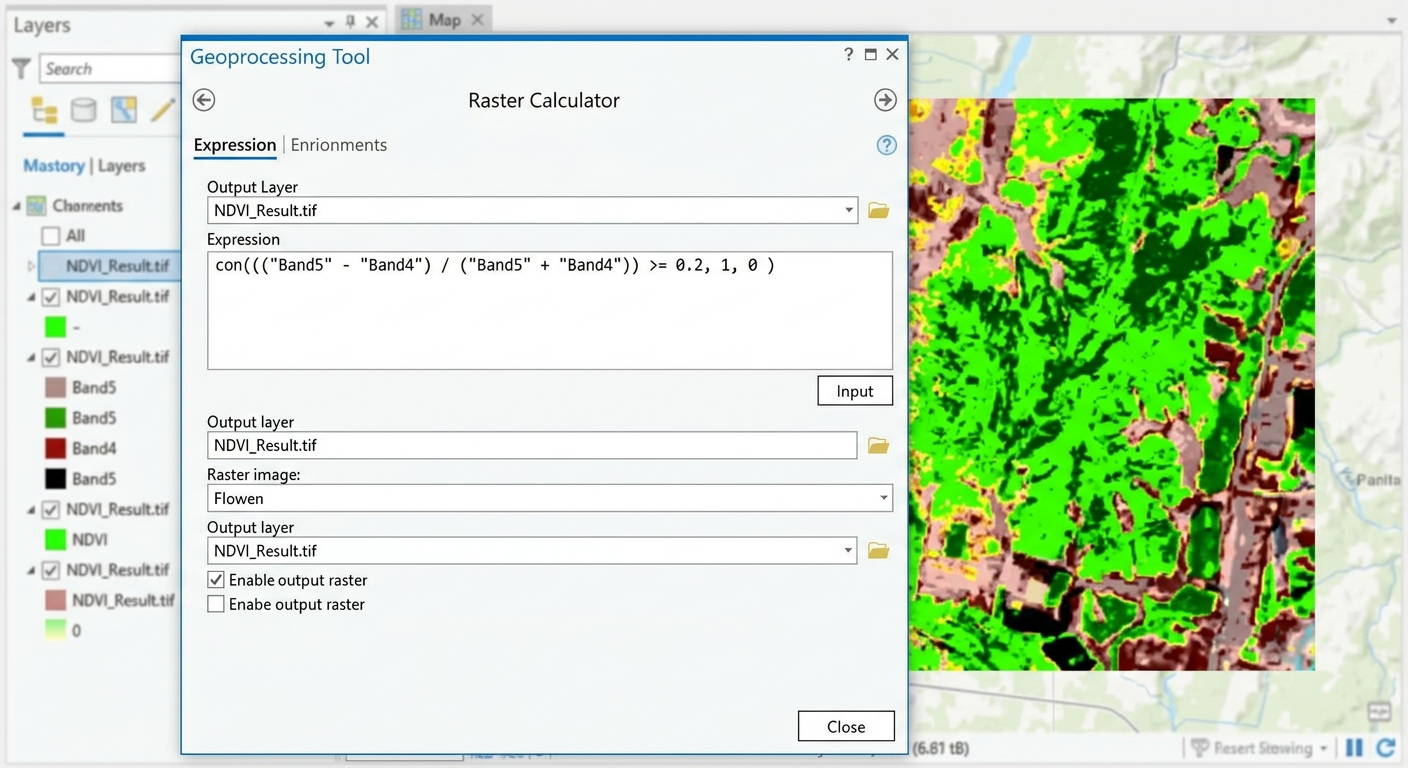
raster calculator expressions gis ndvi formula

Raster Calculator Expressions GIS: 5 Essential Formulas In spatial analysis and remote sensing lab assignments, grid-based cell manipulation is a foundational skill. Mastering raster calculator expressions GIS syntax allows you to run complex Map Algebra operations—ranging from spectral band math and unit conversions to multi-criteria land suitability modeling. However, students frequently run into syntax errors, … Read more

5 Key Differences Between IDW vs Kriging GIS Methods

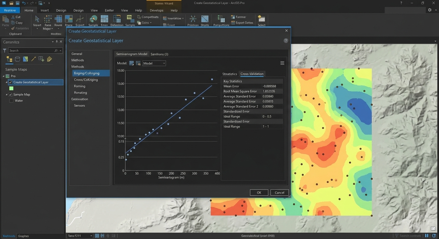
IDW vs Kriging GIS

5 Key Differences Between IDW vs Kriging GIS Methods   When working with GIS lab assignments, you may have a dataset containing sample points for rainfall, temperature, air quality, soil properties, or groundwater levels. The challenge is turning those discrete observations into a continuous surface that can be mapped and analyzed. Understanding IDW vs Kriging … Read more