Building Custom Leaflet Plugins: Creating a Scalable Legend and Layer Switcher

Building Custom Leaflet Plugins: Creating a Scalable Legend and Layer Switcher Introduction Interactive web maps often start with Leaflet’s default controls for zooming, selecting layers, and displaying attribution. These controls provide a practical foundation, but enterprise Web GIS applications frequently require more specialized interfaces: categorized datasets, dynamic legends, grouped overlays, collapsible panels, and consistent styling … Read more
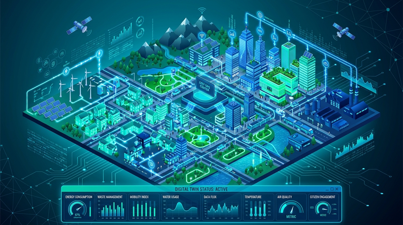
Estimating Building Energy Consumption Using 3D City Models (CityGML) in QGIS

3d city models (citygml) in qgis

Estimating Building Energy Consumption Using 3D City Models (CityGML) in QGIS Introduction Urban energy planning increasingly relies on three-dimensional representations of buildings rather than conventional two-dimensional maps. With the development of urban digital twins, planners can combine building geometry, construction characteristics, meteorological observations, and energy data to investigate how buildings perform within their surrounding environment. … Read more

Automated Cartographic Generalization in QGIS: Simplifying Complex Vector Boundaries

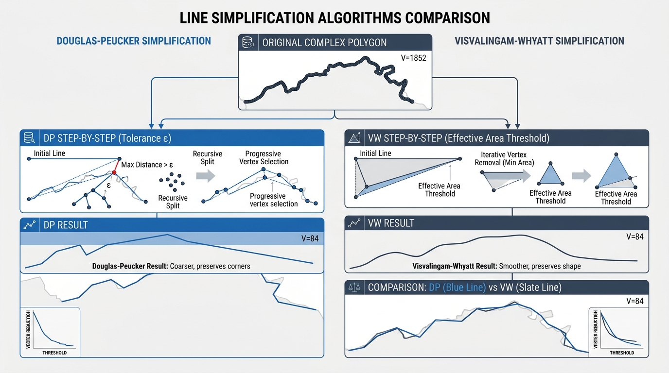
Visual comparison of line simplification algorithms used during automated cartographic generalization in qgis.

Automated Cartographic Generalization in QGIS: Simplifying Complex Vector Boundaries Cartographic design at reduced scales presents a persistent technical challenge: balancing geometric fidelity with visual legibility. When high-resolution vector data—such as sub-meter cadastral boundaries, intricate administrative districts, or detailed natural coastlines digitized at 1:1,000 scale—are rendered on small-scale regional, national, or global maps (e.g., 1:1,000,000), the … Read more

Setting Up an OGC-Compliant Metadata Catalog with PyCSW

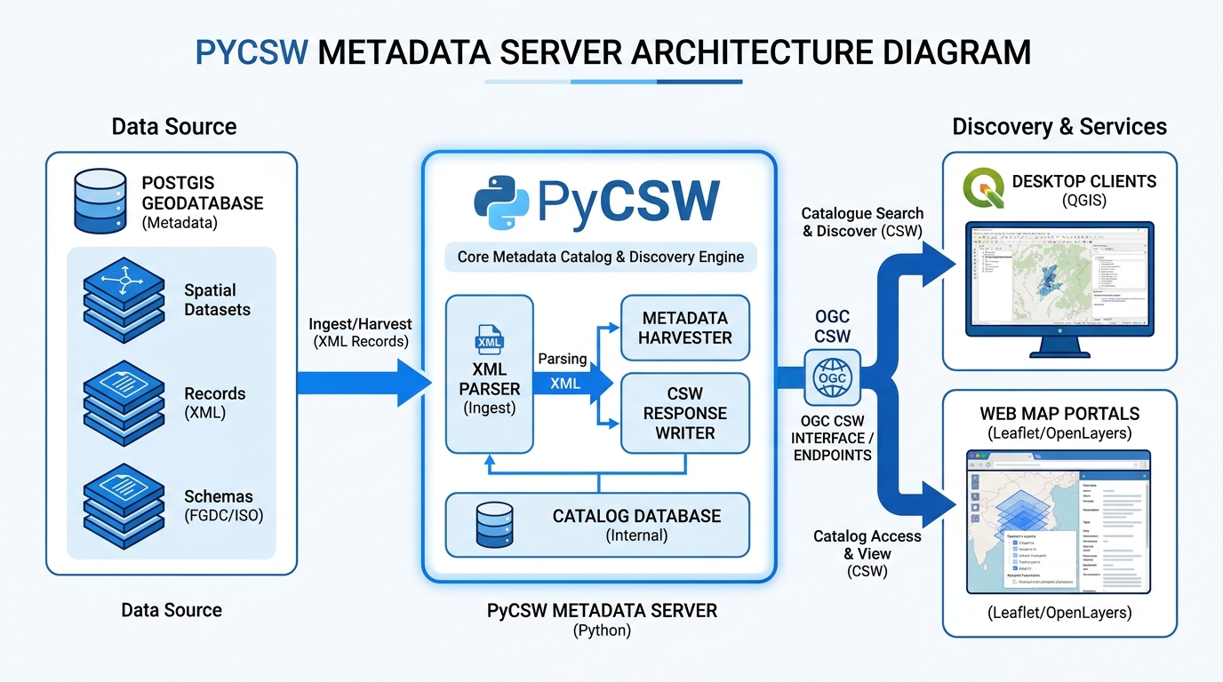
System architecture diagram illustrating PyCSW metadata server parsing XML records from PostGIS and serving OGC CSW endpoints to QGIS and web map portals.

Setting Up an OGC-Compliant Metadata Catalog with PyCSW Introduction A Spatial Data Infrastructure (SDI) is more than a collection of spatial databases and web maps. It also needs a reliable way for people and applications to discover what datasets exist, understand their characteristics, evaluate their quality, and locate the resources required to access them. Without … Read more

Analyzing Urban Healthcare Deserts: Measuring Spatial Mismatch and Accessibility Gaps

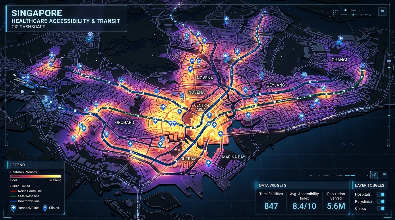
Analyzing Urban Healthcare Deserts Measuring Spatial Mismatch and Accessibility Gaps - 3D GIS healthcare accessibility heatmaps and transit network visualization

Analyzing Urban Healthcare Deserts: Measuring Spatial Mismatch and Accessibility Gaps Introduction to Analyzing Urban Healthcare Deserts: Measuring Spatial Mismatch and Accessibility Gaps A hospital can be geographically close to a neighborhood without being practically accessible to its residents. A clinic may be located two kilometers away, yet reaching it could require multiple public transport transfers, … Read more

Multi-Temporal Remote Sensing Change Detection Using Google Earth Engine and Random Forest Classifiers

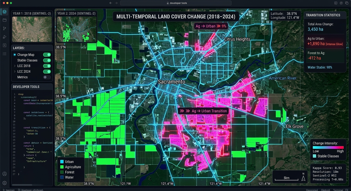
Multi-Temporal Remote Sensing Change Detection Using Google Earth Engine and Random Forest Classifiers

Multi-Temporal Remote Sensing Change Detection Using Google Earth Engine and Random Forest Classifiers Monitoring landscape transformations over decadal timescales requires moving beyond simple spectral indices. Traditional bi-temporal approaches—such as manual image differencing or post-classification comparison using heuristic thresholds—frequently fall short when applied to complex, multi-year land-use and land-cover (LULC) change detection. Factors like inter-annual phenological … Read more

Spatial Index Tuning and Database Partitioning Strategies for Billion-Row PostGIS Tables

Spatial Index Tuning and Database Partitioning Strategies for Billion-Row PostGIS Tables Introduction: Scaling PostGIS Beyond a Single Large Table Effective management of enterprise geospatial workflows requires comprehensive PostGIS Table Partitioning Spatial Index Tuning to maintain high query performance. Enterprise geospatial systems increasingly process billions of GPS observations, satellite-derived features, road-network segments, environmental measurements, and administrative … Read more

Managing Spatio-Temporal Data Streams with Apache Kafka and PostGIS

Managing Spatio-Temporal Data Streams Apache Kafka PostGIS

Managing Spatio-Temporal Data Streams with Apache Kafka and PostGIS Introduction: Managing Spatio-Temporal Data Streams Apache Kafka PostGIS When implementing **Managing Spatio-Temporal Data Streams Apache Kafka PostGIS** pipelines, high-velocity, continuous telemetry streams present unique architectural challenges. High-velocity, continuous telemetry streams—such as connected vehicle location tracking, dynamic fleet management, mobile delivery platforms, and smart-city IoT sensor grids—present … Read more

Spatial Multi-Criteria Decision Analysis (MCDA) in Python: Automating Weighted Linear Combinations

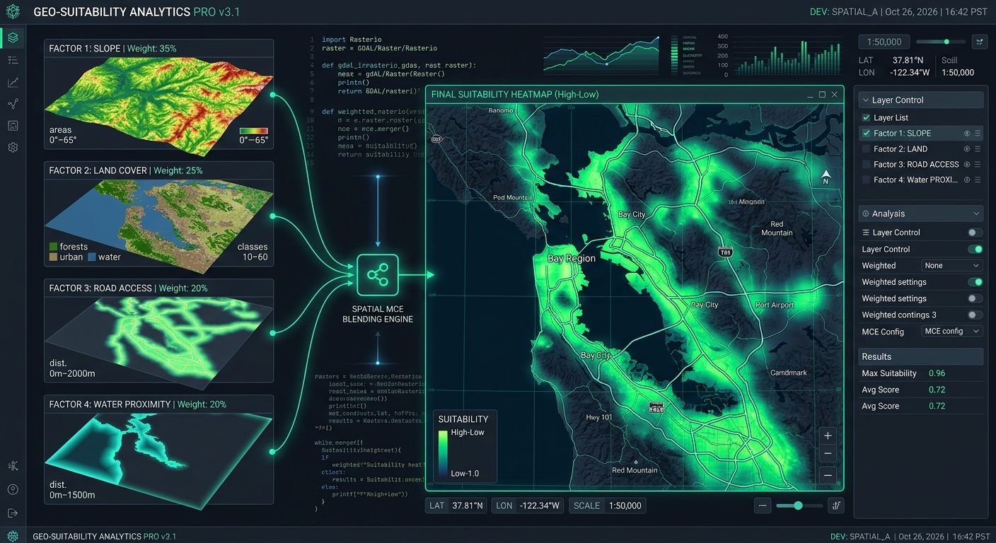
Spatial MCDA Python Weighted Linear Combinations

Spatial Multi-Criteria Decision Analysis (MCDA) in Python: Automating Weighted Linear Combinations Introduction “When applying Spatial MCDA Python Weighted Linear Combinations workflows, geospatial analysts often need to automate multi-factor suitability evaluations efficiently. Selecting the best locations for solar farms, hospitals, conservation areas, or infrastructure projects often requires evaluating multiple geographic factors simultaneously. A site may have … Read more

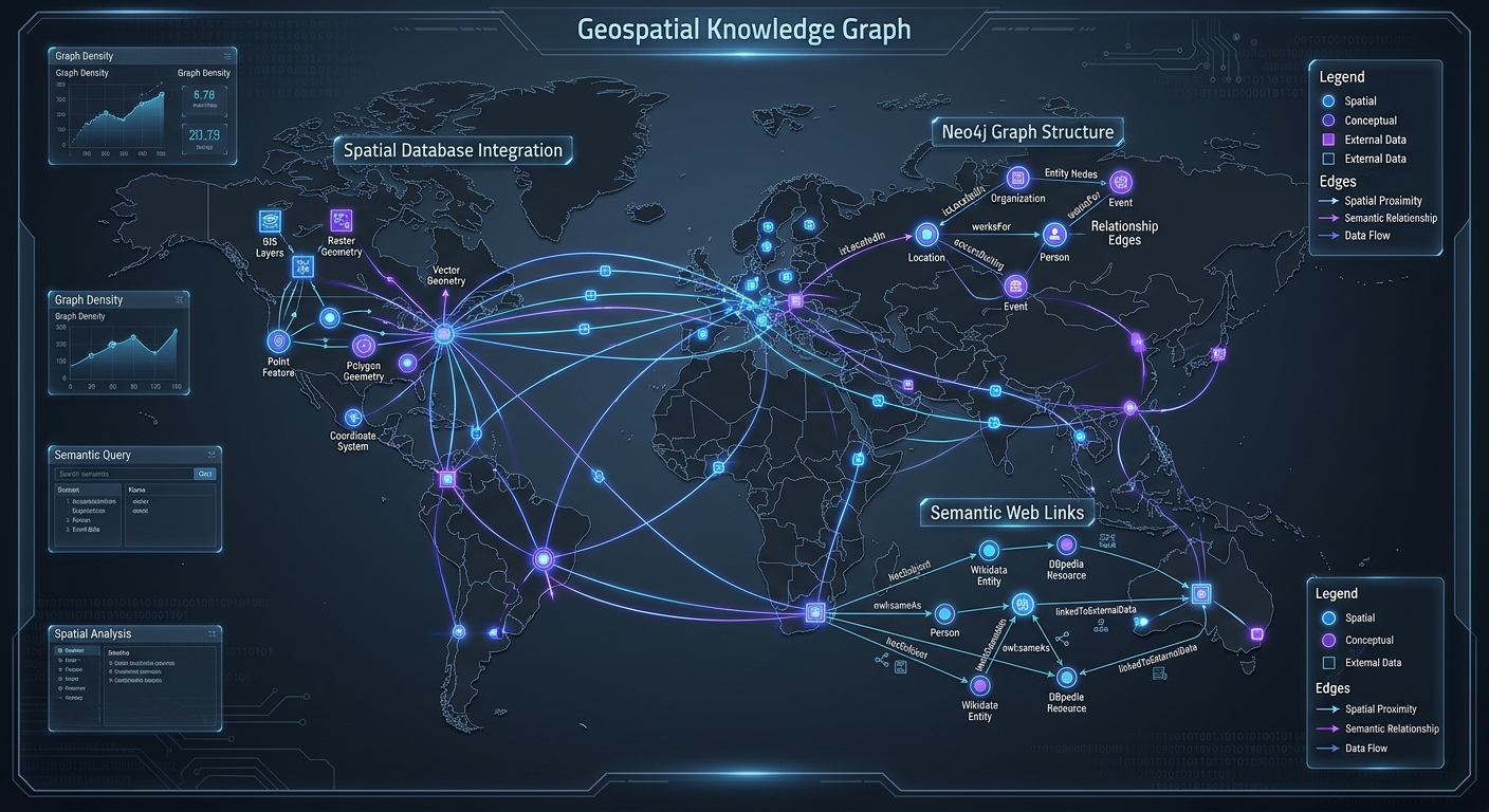
Geospatial Knowledge Graphs: Querying Connected Spatial Entities with Neo4j and SPARQL

Geospatial Knowledge Graphs Neo4j SPARQL

Geospatial Knowledge Graphs: Querying Connected Spatial Entities with Neo4j and SPARQL 1. Introduction: Why Geospatial Data Needs Graph-Based Modeling To build Geospatial Knowledge Graphs Neo4j SPARQL architectures effectively, traditional geographic information systems (GIS) rely heavily on relational databases. Traditional geographic information systems (GIS) rely heavily on relational databases, where spatial features are stored as records … Read more