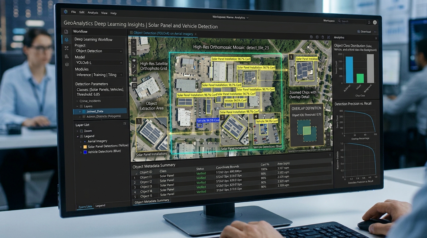
Fine-Tuning YOLOv8 for Automated Object Detection on High-Resolution Satellite Orthophotos

Fine-Tuning YOLOv8 model training and custom object detection output

Fine-Tuning YOLOv8 for Automated Object Detection on High-Resolution Satellite Orthophotos Introduction In the fields of Geographic Information Systems (GIS) and remote sensing, extracting features from high-resolution aerial and satellite imagery has traditionally relied on pixel-based classification, spectral indices (such as NDVI or NDBI), and classic morphological image processing. While these methods are computationally lightweight, they … Read more
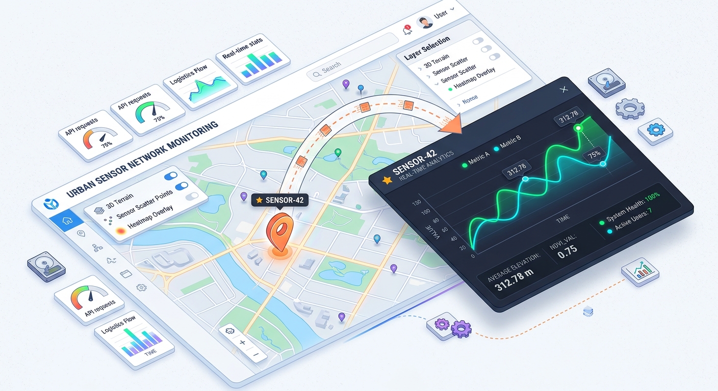
Building Web GIS Feature Popups with Chart.js Integration for Dynamic Attribute Visualization

web GIS feature popup architecture and chart integration

Building Web GIS Feature Popups with Chart.js Integration for Dynamic Attribute Visualization Welcome to the world of interactive web mapping! If you have ever built a web map, you know how useful traditional feature popups are for displaying static attributes like text or numbers when a user clicks on a map marker. But what if … Read more

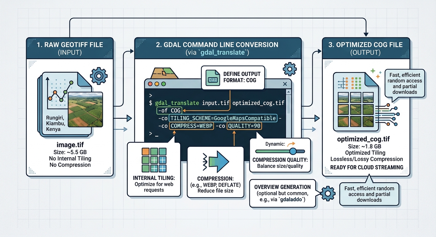
Optimizing Enterprise Web Maps with Cloud-Optimized GeoTIFF (COG) Architecture

Cloud-Optimized GeoTIFF web map architecture

Optimizing Enterprise Web Maps with Cloud-Optimized GeoTIFF (COG) Architecture Introduction: Rethinking Raster Delivery for Enterprise Web GIS Adopting Cloud-Optimized GeoTIFF web map architecture transforms how enterprise mapping systems handle large raster datasets, shifting from traditional server-side tile rendering to direct cloud object storage delivery. Enterprise web mapping systems frequently depend on large raster datasets, including … Read more

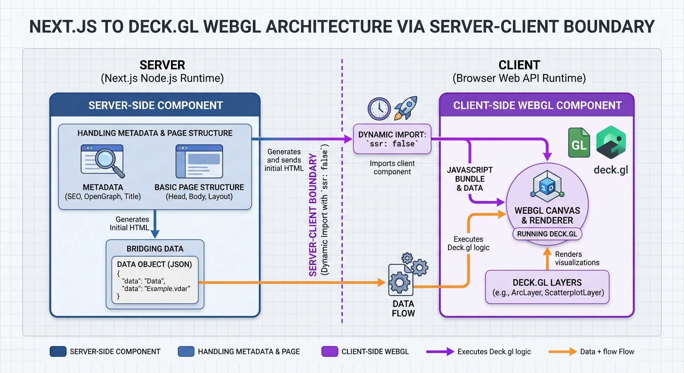
Integrating Deck.gl Spatial Layers into Next.js Server-Side Rendered Applications

deck.gl Next.js SSR dynamic import architectural boundary

Integrating Deck.gl Spatial Layers into Next.js Server-Side Rendered Applications Introduction Implementing deck.gl Next.js spatial layers enables developers to render millions of data points and complex movement flows with GPU acceleration inside modern server-side rendered applications. Modern web GIS applications increasingly need to visualize datasets containing millions of points, complex movement trajectories, and aggregated spatial patterns. … Read more

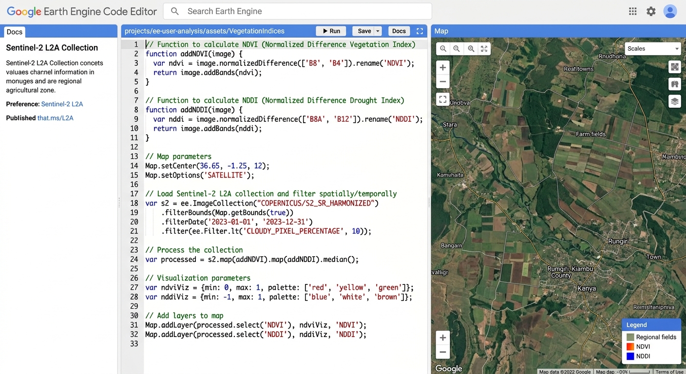
Automating Drought Monitoring with NDVI, NDWI, and NDDI Time Series in GEE

Google Earth Engine code editor drought monitoring script

Automating Drought Monitoring with NDVI, NDWI, and NDDI Time Series in GEE Introduction Agricultural drought can develop gradually as rainfall decreases, soil moisture declines, and vegetation becomes stressed. Identifying these changes early helps environmental scientists, agricultural planners, and water-resource managers evaluate potential impacts across large regions. Satellite remote sensing provides a repeatable way to monitor … Read more

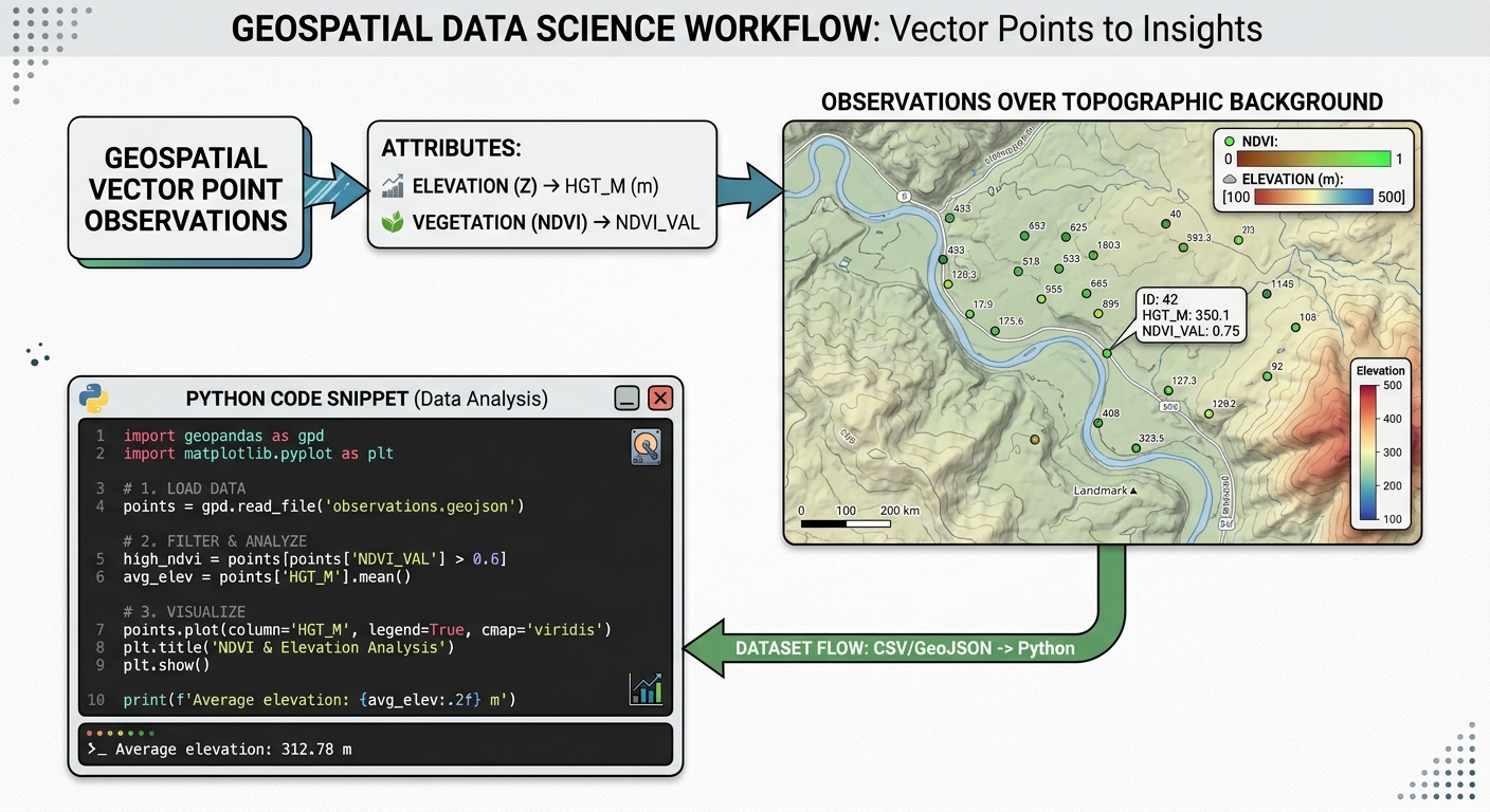
Spatial Interpolation with Artificial Neural Networks (ANN) in Python

spatial interpolation training points and covariates

Spatial Interpolation with Artificial Neural Networks (ANN) in Python Spatial interpolation is a core discipline in spatial data science, environmental modeling, and geostatistics. The objective is to estimate unknown values at unsampled locations using observations from a finite set of sample points. For decades, traditional geostatistical methods such as Ordinary Kriging (OK), Inverse Distance Weighting … Read more

Mapping Forest Canopy Biomass Using Airborne LiDAR and Random Forest Regression

Mapping Forest Canopy Biomass Using Airborne LiDAR and Random Forest Regression Introduction Accurately measuring forest above-ground biomass (AGB) is essential for forest management, carbon accounting, biodiversity conservation, and climate-change mitigation. Traditional forest inventories provide detailed measurements of tree diameter, height, and species composition, but collecting these measurements across extensive forest landscapes is expensive and time-consuming. … Read more

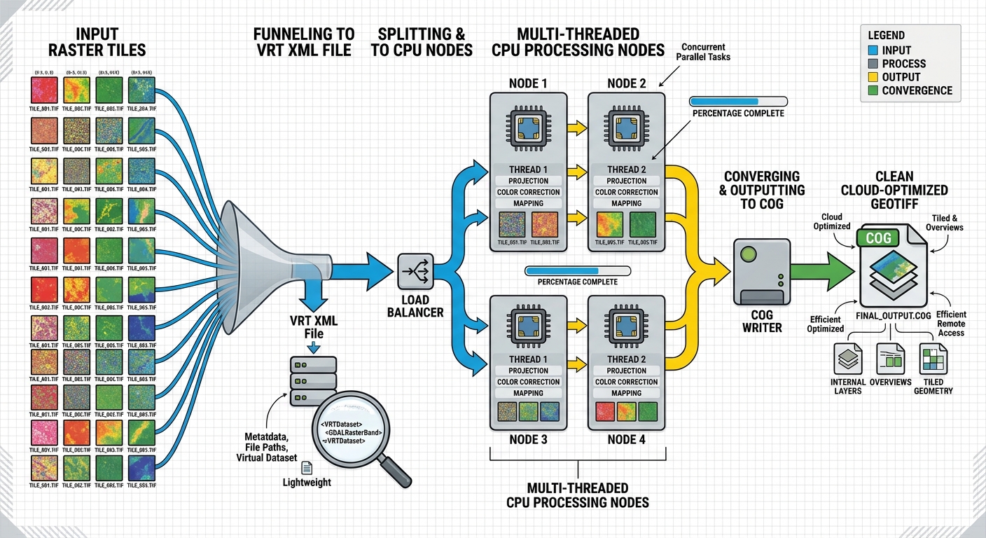
Optimizing Raster Processing Performance with GDAL Multi-Threading and VRT (Virtual Raster) Files

GDAL multi-threading raster processing pipeline workflow

Optimizing Raster Processing Performance with GDAL Multi-Threading and VRT (Virtual Raster) Files Processing a handful of GeoTIFF files is rarely a performance problem. The situation changes dramatically when a workflow involves hundreds of multi-gigabyte satellite scenes, DEM tiles, orthophotos, or other raster datasets. A conventional raster workflow may repeatedly read source tiles, create intermediate files, … Read more

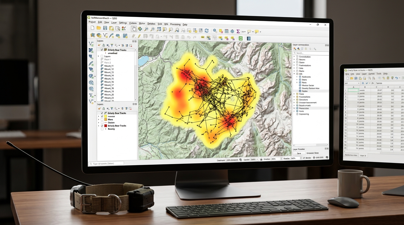
Integrating GPS Telemetry Data with Open-Source GIS for Wildlife Tracking and Home Range Analysis

GPS telemetry data visualization in QGIS for wildlife tracking

Integrating GPS Telemetry Data with Open-Source GIS for Wildlife Tracking and Home Range Analysis Modern wildlife conservation and spatial ecology rely heavily on high-resolution GPS satellite telemetry. Traditional VHF radio-tracking methods—while foundational—have largely been superseded by collars equipped with GPS, Iridium, Argos, or cellular data transmission. These advanced devices log thousands of precise coordinate locations … Read more