Top 5 Common Map Projections Every GIS Student Needs to Know

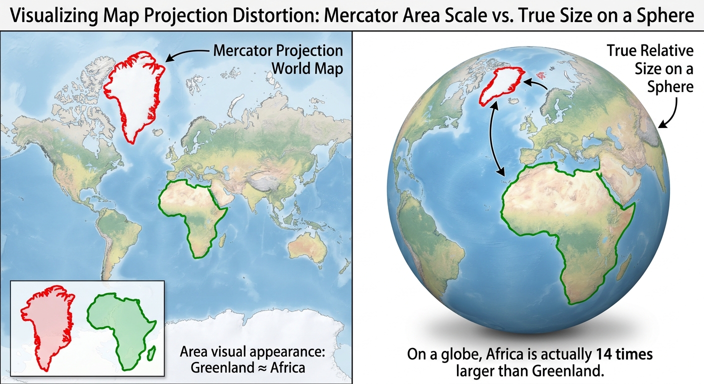
A visual comparison showing how the Mercator projection GIS uses distorts the true area of landmasses like Greenland and Africa.

Top 5 Common Map Projections Every GIS Student Needs to Know (Plus the Distortion Trade-Offs That Decide Your Grade) Introduction: Why You Can’t Flatten a Sphere Without Breaking Something Whether you are preparing for a lab practical or writing a research paper, mastering common map projections GIS professionals rely on is essential for preventing costly … Read more

How to Calculate NDVI in QGIS: 10 Easy Steps

How to Calculate NDVI in QGIS: A Step-by-Step Guide for Students If you are learning how to calculate NDVI in QGIS, you are working with one of the most widely used vegetation indices in remote sensing. The Normalized Difference Vegetation Index (NDVI) uses the relationship between Near Infrared (NIR) and Red wavelengths to estimate the … Read more