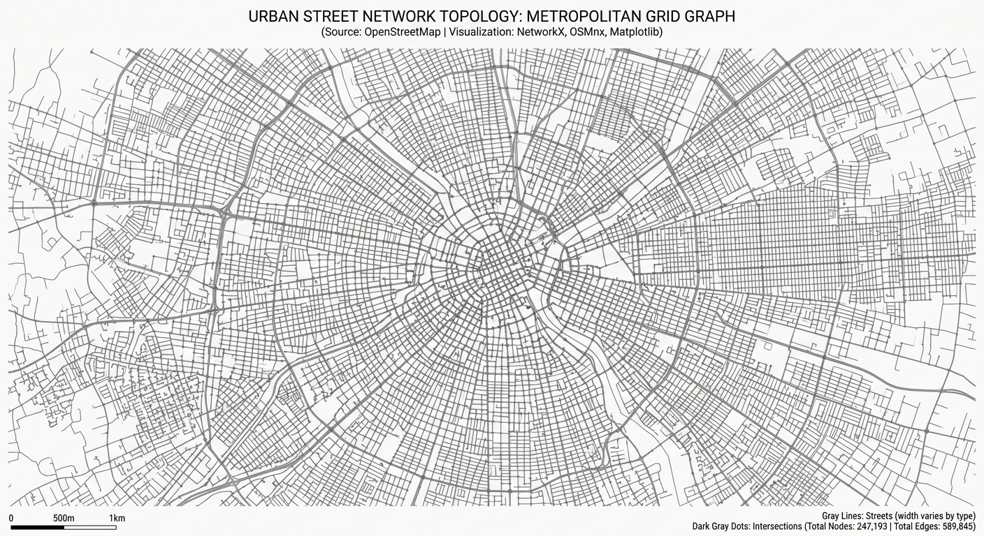
Analyzing Spatial Networks in Python with OSMnx and NetworkX

workflow diagram for OSMnx NetworkX Python spatial network analysis

Analyzing Spatial Networks in Python with OSMnx and NetworkX Introduction Urban street networks shape how people move through cities and access essential services. The arrangement of intersections, road segments, and pedestrian pathways influences travel distance, route choice, and accessibility to schools, hospitals, public transport, and employment. For urban planners and geospatial analysts, understanding these relationships … Read more
Processing LiDAR Point Clouds: Extracting Canopy Height Models (CHM) in QGIS & CloudCompare

Processing LiDAR Point Clouds: Extracting Canopy Height Models (CHM) in QGIS & CloudCompare 1. Processing LiDAR Point Clouds: Extracting Canopy Height Models (CHM) in QGIS & CloudCompare: Introduction Light Detection and Ranging (LiDAR) is a remote sensing technology that uses laser pulses to measure distances between a sensor and objects on the Earth’s surface. Airborne … Read more

Client-Side Spatial Analysis in Web GIS Using Turf.js and Mapbox GL JS

Client-Side Spatial Analysis in Web GIS Using Turf.js and Mapbox GL JS 1. Introduction to Client-Side Spatial Analysis in Web GIS Using Turf.js and Mapbox GL JS Traditional web GIS applications often send spatial queries to a backend service, which processes the request using a spatial database or geoprocessing engine before returning the results to … Read more

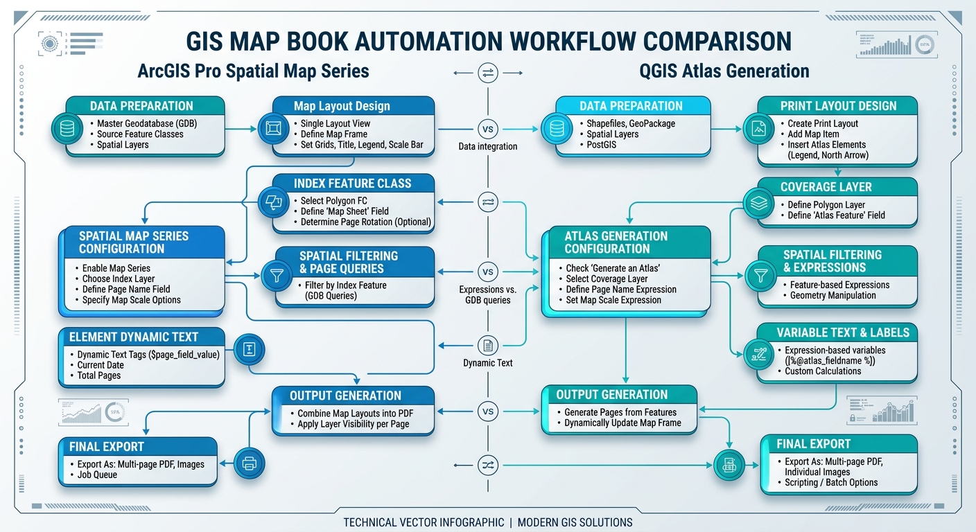
Automating PDF Map Books and Atlases in ArcGIS Pro and QGIS

Automating PDF Map Books and Atlases in ArcGIS Pro and QGIS workflow comparison diagram

Automating PDF Map Books and Atlases in ArcGIS Pro and QGIS Introduction to Automating PDF Map Books and Atlases in ArcGIS Pro and QGIS Manually producing multi-page map series for extensive linear infrastructure (such as highways, pipelines, transmission corridors, and rivers) or multi-district administrative reporting is an inefficient and error-prone process. Creating individual layouts for … Read more

Building Custom Leaflet Control Widgets for Interactive Spatial Filtering

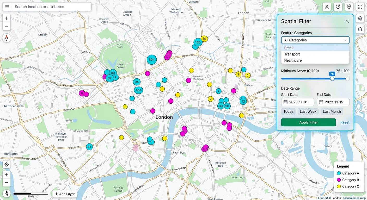
Building Custom Leaflet Control Widgets for Interactive Spatial Filtering user interface preview on a web map

Building Custom Leaflet Control Widgets for Interactive Spatial Filtering: Introduction 1.Building Custom Leaflet Control Widgets for Interactive Spatial Filtering: Introduction Leaflet provides built-in map controls for zooming, layer selection, scale display, and attribution. These controls are essential for navigation, but advanced Web GIS applications often require more specialized interactions. Consider a web mapping application used … Read more

Vector Tiles vs Traditional Raster Tiles: GIS Performance

Vector Tiles vs Traditional Raster Tiles: GIS Performance Introduction: The Evolution of Web Mapping Tiles Web mapping systems must deliver geographic information quickly while supporting smooth navigation, readable labels, and interactive spatial features. From national-scale basemaps to urban infrastructure dashboards, the tile architecture used to deliver map data has a direct impact on bandwidth consumption, … Read more

Time Series Analysis of Satellite Imagery Using the Google Earth Engine Python API

Time Series Analysis of Satellite Imagery Using the Google Earth Engine Python API Introduction: Cloud-Native Remote Sensing for Multi-Year Analysis Monitoring vegetation dynamics, agricultural productivity, deforestation, drought, and land-cover change often requires satellite observations collected over multiple years. Processing this data locally can quickly become computationally expensive, particularly when an analysis involves thousands of satellite … Read more

Object Based Image Analysis (OBIA) vs Pixel Based Classification

Object Based Image Analysis (OBIA) vs Pixel Based Classification Introduction: From Individual Pixels to Geographic Objects Remote sensing classification transforms satellite or aerial imagery into meaningful geographic information, such as buildings, forests, agricultural fields, roads, wetlands, and urban land-cover classes. The analytical approach used to classify an image determines how spatial patterns are represented, how … Read more

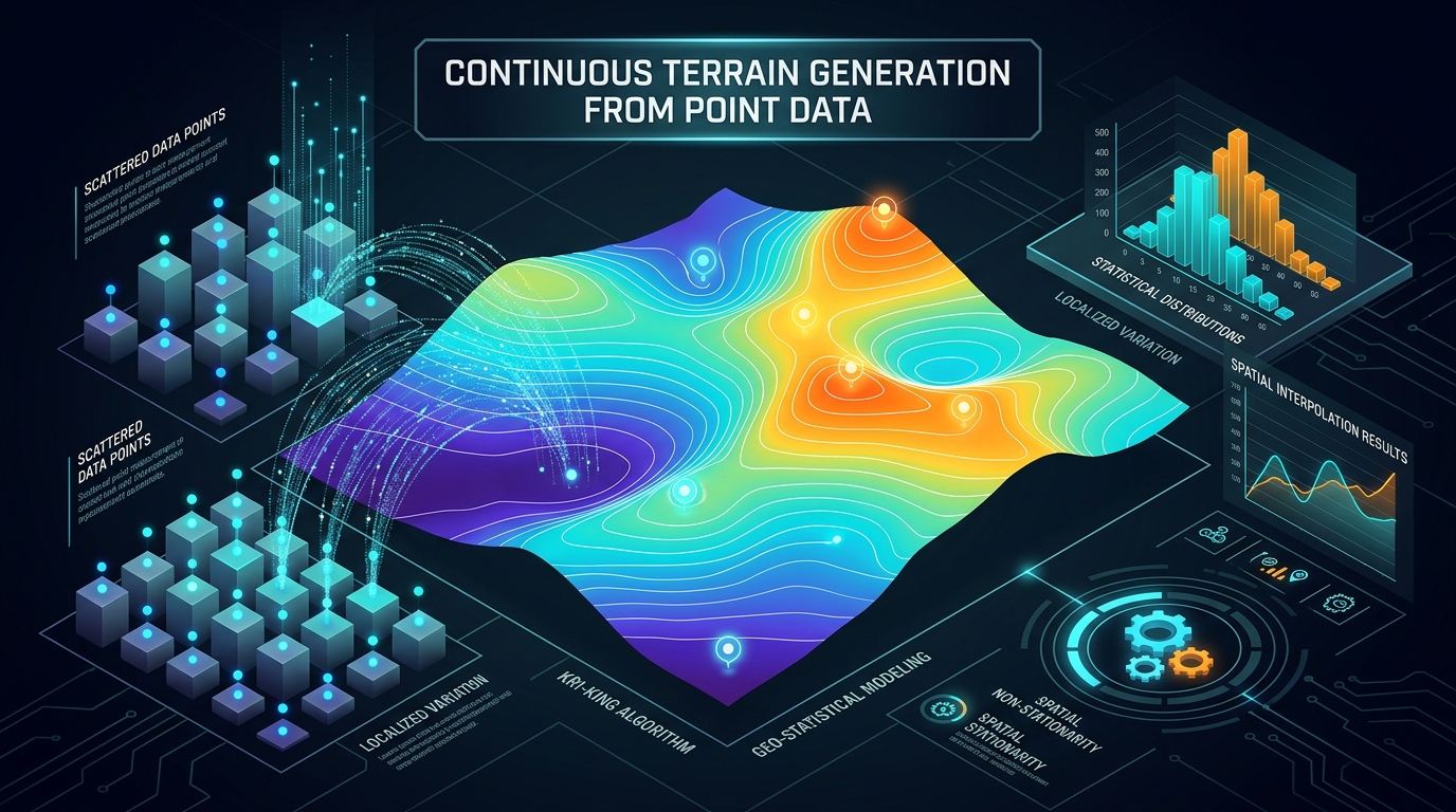
Spatial Interpolation in Python: Kriging and IDW using PyKrige and SciPy

Spatial Interpolation in Python transforming scatter points into continuous prediction surfaces.

Spatial Interpolation in Python: Kriging and IDW using PyKrige and SciPy Introduction Spatial interpolation transforms scattered point observations into a continuous surface by estimating values at locations where measurements are unavailable. It is widely used to map rainfall, groundwater levels, soil properties, air pollution, temperature, and other environmental variables. Performing Spatial Interpolation in Python using … Read more

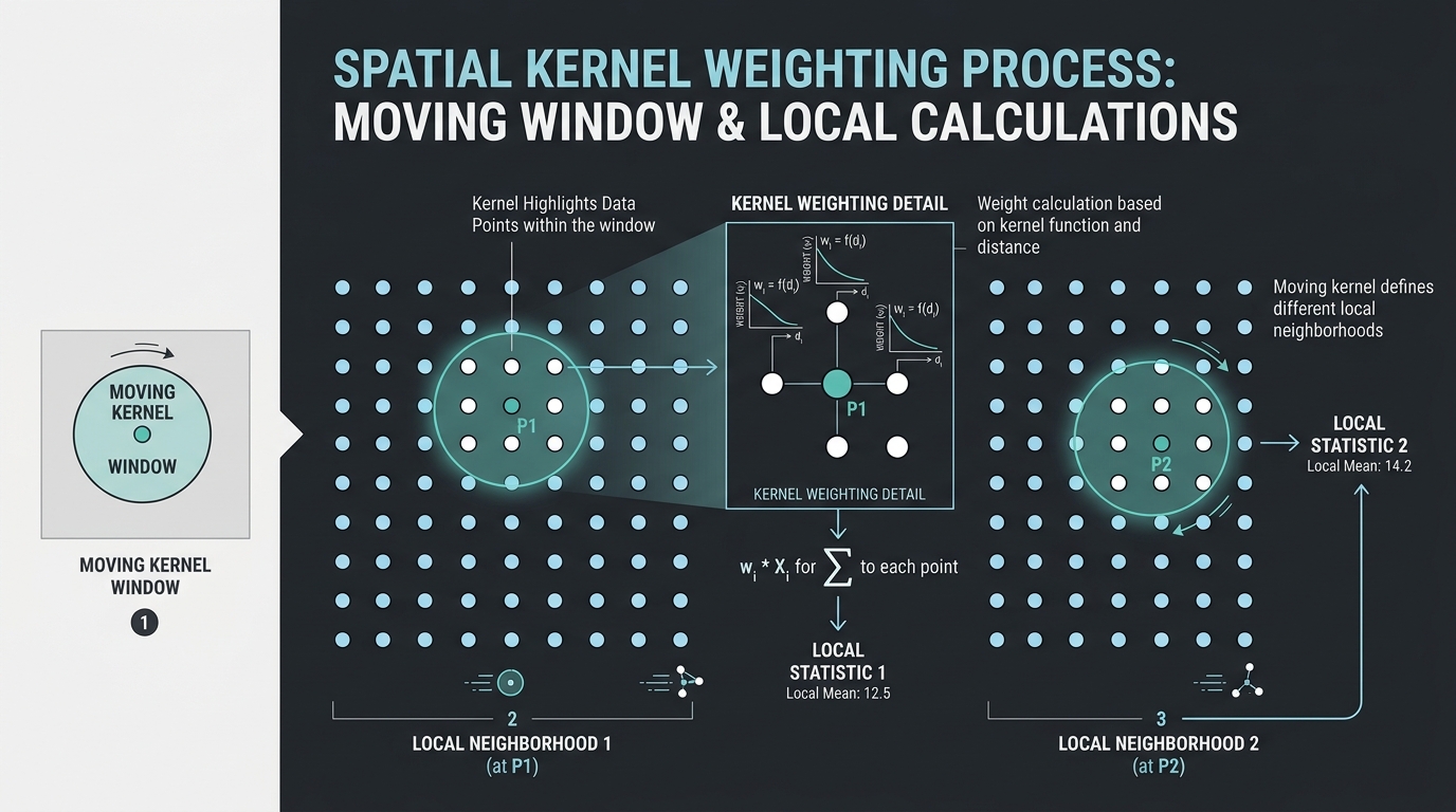
Geographically Weighted Principal Component Analysis (GWPCA) in GIS

Geographically Weighted Principal Component Analysis showing local spatial bandwidth windows and coordinate weights.

Geographically Weighted Principal Component Analysis (GWPCA) in GIS Introduction: Why Spatial Data Needs Local Multivariate Analysis Principal Component Analysis (PCA) is a multivariate statistical technique used to reduce a large set of correlated variables into a smaller number of components that summarize the dominant patterns of variation in the data. It is widely used in … Read more