Spatial Interpolation with Artificial Neural Networks (ANN) in Python

spatial interpolation training points and covariates

Spatial Interpolation with Artificial Neural Networks (ANN) in Python Spatial interpolation is a core discipline in spatial data science, environmental modeling, and geostatistics. The objective is to estimate unknown values at unsampled locations using observations from a finite set of sample points. For decades, traditional geostatistical methods such as Ordinary Kriging (OK), Inverse Distance Weighting … Read more
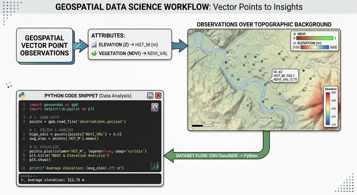
Mapping Forest Canopy Biomass Using Airborne LiDAR and Random Forest Regression

Mapping Forest Canopy Biomass Using Airborne LiDAR and Random Forest Regression Introduction Accurately measuring forest above-ground biomass (AGB) is essential for forest management, carbon accounting, biodiversity conservation, and climate-change mitigation. Traditional forest inventories provide detailed measurements of tree diameter, height, and species composition, but collecting these measurements across extensive forest landscapes is expensive and time-consuming. … Read more

Optimizing Raster Processing Performance with GDAL Multi-Threading and VRT (Virtual Raster) Files

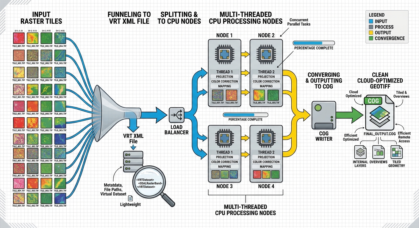
GDAL multi-threading raster processing pipeline workflow

Optimizing Raster Processing Performance with GDAL Multi-Threading and VRT (Virtual Raster) Files Processing a handful of GeoTIFF files is rarely a performance problem. The situation changes dramatically when a workflow involves hundreds of multi-gigabyte satellite scenes, DEM tiles, orthophotos, or other raster datasets. A conventional raster workflow may repeatedly read source tiles, create intermediate files, … Read more

Integrating GPS Telemetry Data with Open-Source GIS for Wildlife Tracking and Home Range Analysis

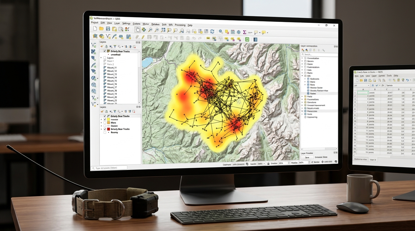
GPS telemetry data visualization in QGIS for wildlife tracking

Integrating GPS Telemetry Data with Open-Source GIS for Wildlife Tracking and Home Range Analysis Modern wildlife conservation and spatial ecology rely heavily on high-resolution GPS satellite telemetry. Traditional VHF radio-tracking methods—while foundational—have largely been superseded by collars equipped with GPS, Iridium, Argos, or cellular data transmission. These advanced devices log thousands of precise coordinate locations … Read more

Building Custom Leaflet Plugins: Creating a Scalable Legend and Layer Switcher

Building Custom Leaflet Plugins: Creating a Scalable Legend and Layer Switcher Introduction Interactive web maps often start with Leaflet’s default controls for zooming, selecting layers, and displaying attribution. These controls provide a practical foundation, but enterprise Web GIS applications frequently require more specialized interfaces: categorized datasets, dynamic legends, grouped overlays, collapsible panels, and consistent styling … Read more

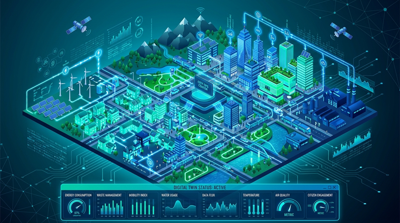
Estimating Building Energy Consumption Using 3D City Models (CityGML) in QGIS

3d city models (citygml) in qgis

Estimating Building Energy Consumption Using 3D City Models (CityGML) in QGIS Introduction Urban energy planning increasingly relies on three-dimensional representations of buildings rather than conventional two-dimensional maps. With the development of urban digital twins, planners can combine building geometry, construction characteristics, meteorological observations, and energy data to investigate how buildings perform within their surrounding environment. … Read more

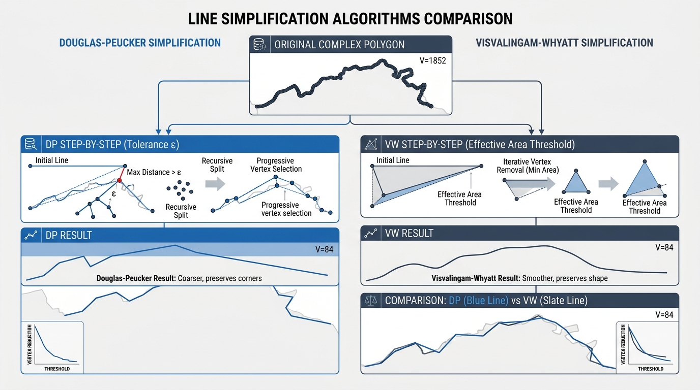
Automated Cartographic Generalization in QGIS: Simplifying Complex Vector Boundaries

Visual comparison of line simplification algorithms used during automated cartographic generalization in qgis.

Automated Cartographic Generalization in QGIS: Simplifying Complex Vector Boundaries Cartographic design at reduced scales presents a persistent technical challenge: balancing geometric fidelity with visual legibility. When high-resolution vector data—such as sub-meter cadastral boundaries, intricate administrative districts, or detailed natural coastlines digitized at 1:1,000 scale—are rendered on small-scale regional, national, or global maps (e.g., 1:1,000,000), the … Read more

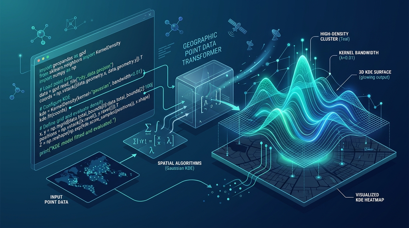
Spatial Point Pattern Analysis of Crime Data Using Kernel Density Estimation (KDE) in Python

Visualizing spatial point pattern analysis results using a 3D Kernel Density Estimation surface in Python.

Spatial Point Pattern Analysis of Crime Data Using Kernel Density Estimation (KDE) in Python Understanding the spatial distribution of point events is a foundational pillar of quantitative geography, urban criminology, and emergency resource allocation. Whether analyzing urban crime incidents, vehicular collisions, or disease outbreaks, spatial analysts seek to uncover underlying clustering patterns rather than merely … Read more

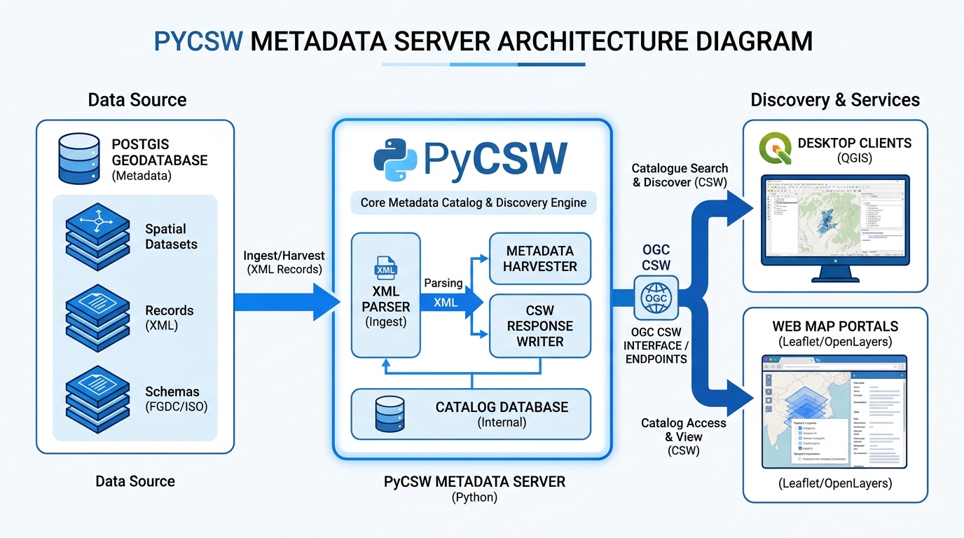
Setting Up an OGC-Compliant Metadata Catalog with PyCSW

System architecture diagram illustrating PyCSW metadata server parsing XML records from PostGIS and serving OGC CSW endpoints to QGIS and web map portals.

Setting Up an OGC-Compliant Metadata Catalog with PyCSW Introduction A Spatial Data Infrastructure (SDI) is more than a collection of spatial databases and web maps. It also needs a reliable way for people and applications to discover what datasets exist, understand their characteristics, evaluate their quality, and locate the resources required to access them. Without … Read more

Analyzing Urban Healthcare Deserts: Measuring Spatial Mismatch and Accessibility Gaps

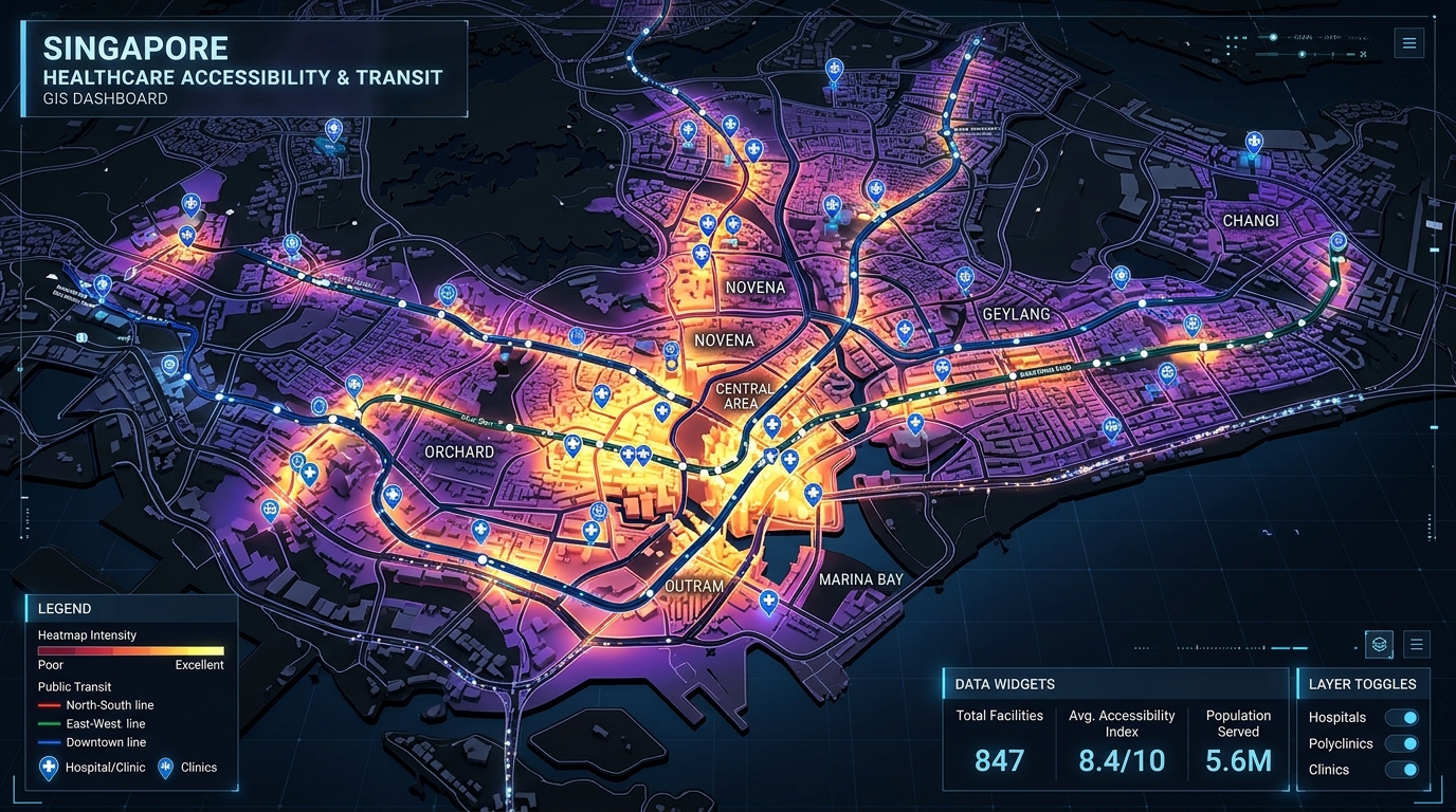
Analyzing Urban Healthcare Deserts Measuring Spatial Mismatch and Accessibility Gaps - 3D GIS healthcare accessibility heatmaps and transit network visualization

Analyzing Urban Healthcare Deserts: Measuring Spatial Mismatch and Accessibility Gaps Introduction to Analyzing Urban Healthcare Deserts: Measuring Spatial Mismatch and Accessibility Gaps A hospital can be geographically close to a neighborhood without being practically accessible to its residents. A clinic may be located two kilometers away, yet reaching it could require multiple public transport transfers, … Read more