
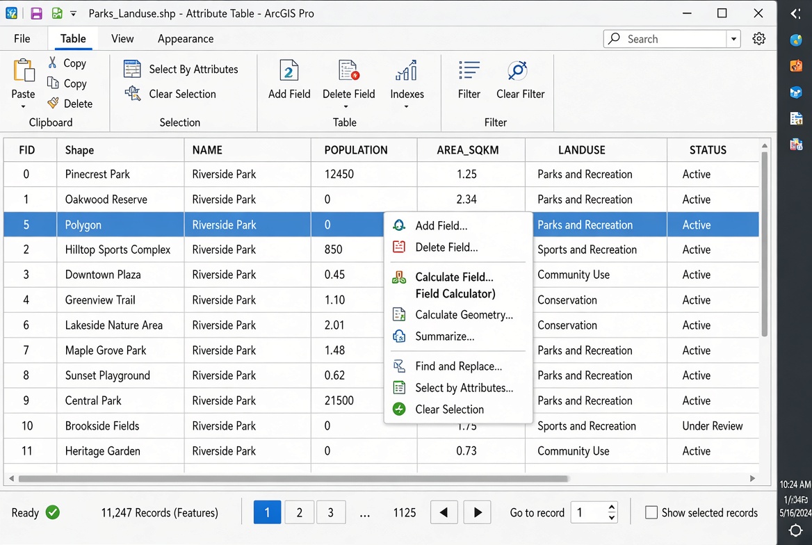
How to Calculate Field Values in ArcGIS & QGIS: 5 Steps.
Knowing how to calculate field values ArcGIS QGIS is an essential GIS skill when working with attribute tables. If you need to create new fields, populate calculated values, convert text to numbers, or calculate geometric measurements, knowing how to calculate field values ArcGIS QGIS is an essential GIS skill.
For university GIS assignments, Field Calculator tools can save significant time compared with manually entering values. You can calculate polygon areas, line lengths, classify features, combine text fields, perform mathematical operations, and create conditional categories without writing a complete script.
This guide demonstrates the workflow in both QGIS and ArcGIS Pro.
Quick workflow
- Open the layer’s attribute table.
- Create a field with the correct data type.
- Open Field Calculator or Calculate Field.
- Build and test an expression.
- Apply the calculation and verify the results.
1. Set Up Your Fields Before Calculating Values
Before calculating anything, determine what type of information the new field will store.
Choosing the wrong field type is one of the most common causes of problems in GIS assignments. For example, an area measurement should normally use a numeric field rather than a text field.
Common GIS field data types
| Field Type | Typical Use | Example |
|---|---|---|
| Short Integer | Small whole numbers | 1, 25, 100 |
| Long Integer | Larger whole numbers | Population counts |
| Float | Decimal numbers with moderate precision | 12.45 |
| Double | More precise decimal values | Area, coordinates |
| Text/String | Words and characters | “Nairobi” |
| Date | Dates and times | 2026-10-08 |
The exact names vary slightly between QGIS and ArcGIS Pro.
For measurements such as area, perimeter, distance, elevation, or population density, a Double field is often a good choice because it can store decimal values with greater precision.
Create a new field
Open the attribute table and locate the option for creating a new field.
In QGIS, this is usually done through Field Calculator → Create a new field.
In ArcGIS Pro, you can add a field through the attribute table’s Add Field option or the Fields view.
Give the field a meaningful name such as:
area_m2length_kmpopulationdensityfull_namerisk_class
Avoid vague names such as Field1 or Calc2. Clear field names make your GIS workflow easier to understand when writing your lab report.
Pro Tip: Check your geometry and CRS
Area and distance calculations depend heavily on the coordinate reference system (CRS).
If your layer uses geographic coordinates such as latitude and longitude, the geometry may be expressed in angular units such as degrees. Calculating an area directly can therefore produce values in square degrees rather than useful units such as square metres.
For most local or regional measurements, use an appropriate projected CRS with linear units such as metres.
Pro Tip: A value such as
0.000012may look like a calculation error, but it could simply be an area expressed in square degrees. Always check the layer’s CRS and geometry units before interpreting your results.
2. QGIS Field Calculator Walkthrough
QGIS provides a powerful Field Calculator and expression system for calculating attribute values and geometry measurements.
The calculator can perform mathematical operations, manipulate strings, work with dates, access geometry properties, and create conditional expressions.
Step 1: Open the Field Calculator
Open your layer’s attribute table.
Click Field Calculator.
You will normally see options for:
- Creating a new field
- Updating an existing field
- Selecting fields
- Expression functions
- Operators
- Existing attributes
For an assignment, creating a new field is usually safer because you preserve the original data.
Step 2: Calculate polygon area with $area
Suppose you have a polygon layer representing administrative boundaries and want to calculate their area.
Create a new field called:
area_m2
Choose an appropriate decimal field type.
In the expression box, enter:
$areaQGIS calculates the area of each polygon and writes the result into the new field.
The actual units depend on the layer’s CRS and QGIS’s geometry calculation settings.
For example, if the layer is appropriately projected in metres, the resulting value may represent square metres.
Step 3: Calculate line length with $length
For a road, river, pipeline, or other line layer, you can calculate feature length using:
$lengthCreate a field such as:
length_m
Then apply the expression.
For kilometres, you can divide the result by 1,000:
$length / 1000Name the resulting field:
length_km
This is particularly useful when preparing transportation, drainage, road-network, or river analysis assignments.
Step 4: Combine text using concat()
Suppose your attribute table contains:
first_namelast_name
You can create a full_name field using:
concat("first_name", ' ', "last_name")The space between the names is represented by ' '.
For example:
John
Smith
becomes:
John SmithQGIS’s concat() function is useful for addresses, names, labels, identifiers, and descriptive fields.
Step 5: Convert text to uppercase
You can use the upper() function to standardize text.
For example:
upper("county")If the original value is:
Nairobithe result becomes:
NAIROBIThis can help standardize attribute data before joining tables or performing classification.
Handling missing values
Null values require additional care when combining text.
For example, if one field is NULL, your output may not behave as expected depending on the expression being used.
A safer approach can involve functions such as coalesce():
concat(coalesce("first_name", ''), ' ', coalesce("last_name", ''))This substitutes an empty string when a field contains NULL.
Step 6: Create categories with CASE WHEN
Conditional calculations are extremely useful for GIS assignments.
Suppose you have a population-density field called density.
You could classify features as follows:
CASE
    WHEN "density" >= 1000 THEN 'High'
    WHEN "density" >= 500 THEN 'Medium'
    ELSE 'Low'
END
The expression examines each feature and assigns a category.
The resulting attribute might look like:
| Density | Category |
|---|---|
| 1250 | High |
| 750 | Medium |
| 230 | Low |
This technique can be adapted for flood risk, land-use classification, population density, road condition, environmental suitability, and many other GIS assignments.
[IMAGE PLACEHOLDER: QGIS Field Calculator showing $area expression and calculated field configuration | Alt Text: QGIS Field Calculator area expression calculate field values ArcGIS QGIS]
QGIS Expression Builder Documentation
[External Link Placeholder: QGIS Expression Builder Documentation]
Use the official QGIS expression documentation when you need to find functions for mathematical calculations, strings, geometry, dates, or conditional logic.
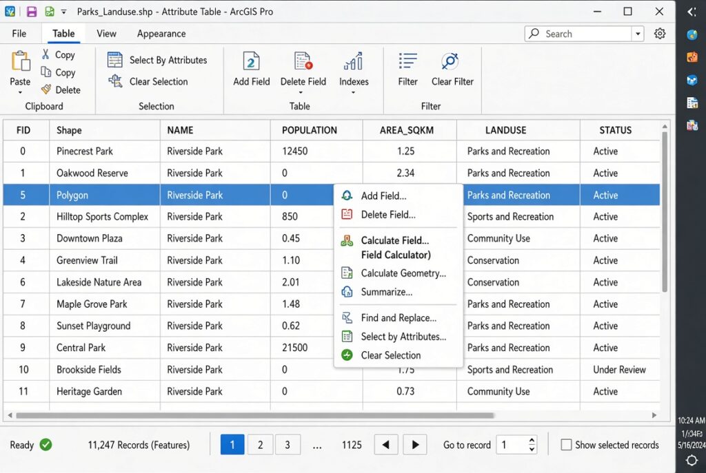
3. ArcGIS Pro Calculate Field Walkthrough
ArcGIS Pro provides the Calculate Field tool for populating attribute fields using expressions.
Unlike QGIS, ArcGIS Pro can use different expression languages, including Arcade and Python.
For many modern ArcGIS workflows, Arcade is an excellent choice because it is designed specifically for expressions across the ArcGIS platform.
Step 1: Open Calculate Field
Open the layer’s attribute table.
Right-click the field you want to calculate and choose Calculate Field.
Alternatively, use the Calculate Field geoprocessing tool.
You can then select the expression language or parser available for your workflow.
Step 2: Calculate geometry
Suppose you want to calculate polygon area.
Create a field such as:
Area_m2
Set its type to a suitable numeric type such as Double.
In ArcGIS Pro, geometry calculations can be performed through the field calculation interface or geometry-specific field options.
With the Python parser, geometry properties can be accessed using expressions such as:
!shape.area!The precise units depend on the coordinate system and calculation context.
For example, a projected dataset measured in metres can produce an area in square metres.
Pro Tip: Never assume that
!shape.area!automatically means square metres. Check the layer’s coordinate system and the units being used by the calculation.
Step 3: Calculate line length
For line features, Python expressions can access geometry properties such as length.
For example:
!shape.length!You could calculate kilometres using:
!shape.length! / 1000This is useful for road, stream, railway, pipeline, and boundary datasets.
Step 4: Combine text fields
Suppose your table contains:
FirstNameLastName
A Python expression can concatenate the fields:
!FirstName! + " " + !LastName!The output would be:
John SmithFor more complicated calculations, Python allows you to use helper functions in the Code Block section.
For example:
def combine_names(first, last):
    if first is None:
        first = ""
    if last is None:
        last = ""
    return (first + " " + last).strip()
The expression could then call:
combine_names(!FirstName!, !LastName!)This approach is particularly useful when your dataset contains missing values.
Step 5: Use Arcade expressions
Arcade provides another way to calculate field values.
A simple concatenation expression can look like:
$feature.FirstName + ' ' + $feature.LastNameArcade accesses the current feature using $feature.
You can also use functions to make calculations more robust.
For example:
Concatenate([
    $feature.FirstName,
    $feature.LastName
], ' ')
Arcade is especially useful when your workflow may later be used in web maps, pop-ups, labels, or other ArcGIS environments.
[IMAGE PLACEHOLDER: ArcGIS Pro Calculate Field dialog showing Arcade parser and expression | Alt Text: ArcGIS Pro Calculate Field Arcade expression field calculator]
Python vs Arcade in ArcGIS Pro
| Feature | Arcade | Python |
|---|---|---|
| Syntax | GIS-specific expression language | General-purpose programming language |
| Current feature | $feature |
!field! |
| Geometry | Geometry functions/properties | !shape! properties |
| String operations | Strong | Very flexible |
| Complex scripting | Limited compared with Python | Excellent |
| Web GIS compatibility | Excellent | Primarily desktop/geoprocessing |
| Learning curve | Generally easier for GIS expressions | Broader programming concepts |
For a simple attribute calculation, Arcade is often straightforward. Python becomes particularly powerful when calculations require custom functions or more complex logic.
ArcGIS Arcade Language Reference
[External Link Placeholder: Esri Arcade Language Reference]
Use the official Arcade documentation when you need syntax for functions, geometry operations, text manipulation, conditional expressions, or feature attributes.
4. Calculate Field Values ArcGIS QGIS: Common Assignment Examples
The same GIS problem can often be solved using different expressions in QGIS and ArcGIS Pro.
| Task | QGIS | ArcGIS Pro Python |
|---|---|---|
| Polygon area | $area |
!shape.area! |
| Line length | $length |
!shape.length! |
| Uppercase text | upper("name") |
!name!.upper() |
| Combine names | concat("first",' ',"last") |
!first! + " " + !last! |
| Conditional classification | CASE WHEN |
Python if/else |
| Current feature in expression | Geometry/fields | !field! |
The important lesson is not to memorize every expression.
Instead, understand the logic:
input fields → expression → output field → validation.
That workflow applies across most attribute-table calculations.
5. Calculate Field Values ArcGIS QGIS: Troubleshooting Errors
Field calculations can fail for several reasons.
Error 1: Wrong field type
If you calculate a number into a Text field, you may create unexpected results or encounter conversion problems.
Check whether your destination field should contain text, integers, or decimal values.
Error 2: NULL values
Missing values can cause string concatenation or mathematical calculations to behave unexpectedly.
For example, combining a valid first name with a NULL last name may produce an incomplete result.
Use appropriate NULL-handling functions or conditional logic.
Error 3: Incorrect geometry units
A calculation can be mathematically correct but scientifically wrong if the CRS is inappropriate.
For example, calculating area from geographic coordinates can result in angular measurements rather than the square-metre values expected in your assignment.
Error 4: Overwriting the original field
Be careful when updating an existing field.
If you accidentally overwrite raw survey data, population values, or original measurements, recovering the previous values may be difficult.
A safer workflow is to create a new calculated field.
Error 5: String and numeric values are mixed
Suppose a population field was imported as text.
You cannot always perform numerical calculations on it directly.
In QGIS, you may need to convert it using a function such as:
to_int("population")or:
to_double("population")After conversion, mathematical operations can be performed.
[IMAGE PLACEHOLDER: Attribute table before and after a calculated field operation showing original and calculated values | Alt Text: GIS attribute table calculated field values before and after]
Validating Your Calculated Fields
Do not finish your GIS assignment immediately after clicking Calculate.
Always inspect the resulting values.
First, sort the field from smallest to largest and look for obvious anomalies.
Then check a few records manually.
For area calculations, select a feature and compare the calculated value with the geometry’s expected size. For text calculations, check records containing NULL values, spaces, punctuation, or unusual characters.
You should also confirm that your units are correct.
For example, if your assignment asks for area in hectares but your field contains square metres, convert the values:
hectares = square metres / 10,000Document the calculation in your methodology section.
A strong GIS lab report might state that a new area field was created using the polygon geometry and that the resulting values were recorded in square metres before conversion to hectares.
Practical Mini-Workflow for a GIS Assignment
Imagine your assignment asks you to identify administrative areas with high population density.
Your workflow could be:
Step 1: Open the administrative boundary layer.
Step 2: Inspect the attribute table and identify the population field.
Step 3: Create a Double field called area_km2.
Step 4: Calculate polygon area.
Step 5: Convert square metres to square kilometres if necessary.
Step 6: Create a density field.
Step 7: Calculate:
population / area_km2Step 8: Create a classification field.
Step 9: Use conditional logic to categorize density as Low, Medium, or High.
Step 10: Symbolize the resulting categories on your map.
This demonstrates how attribute-table calculations connect directly to spatial analysis and cartographic visualization.
Best Practices for Field Calculator Work
Follow these habits when completing GIS laboratory assignments:
- Create new fields rather than overwriting source data.
- Choose the correct data type before calculating.
- Use descriptive field names.
- Check your CRS before calculating geometry.
- Handle NULL values explicitly.
- Test expressions on a small dataset when possible.
- Inspect the output after calculation.
- Document formulas in your methodology.
- Record the units of calculated measurements.
- Save your edited dataset after verifying the results.
These practices reduce errors and make your analysis reproducible.
Frequently Asked Questions (FAQ)
Why is my area calculation outputting negative numbers or zeros?
Check the geometry for errors, invalid polygons, empty geometries, and multipart features. Also verify the coordinate system and calculation method. A zero value may indicate empty or invalid geometry rather than a problem with the Field Calculator itself.
What is the difference between Arcade and Python parsers in ArcGIS Pro?
Arcade is a GIS-focused expression language designed for ArcGIS workflows, including web maps and pop-ups. Python is a general-purpose programming language that provides greater flexibility for complex calculations, custom functions, and automation.
How do I combine two text columns into a single field using Field Calculator?
In QGIS, use an expression such as concat("FirstName",' ',"LastName"). In ArcGIS Pro Python, use !FirstName! + " " + !LastName!. Always account for NULL values when your dataset contains missing records.
Conclusion: Mastering Field Calculations in GIS
Learning how to calculate field values ArcGIS QGIS is one of the most useful skills you can develop for GIS laboratory assignments.
Field Calculator tools allow you to transform raw attribute data into useful analytical information. You can calculate polygon areas, line lengths, population densities, classifications, identifiers, labels, and other derived variables without manually editing every record.
The key is to follow a consistent workflow: choose the correct field type, build the expression, check geometry and units, handle NULL values, calculate the field, and validate the output.
QGIS uses its Expression Builder and functions such as $area, $length, concat(), upper(), and CASE WHEN. ArcGIS Pro provides both Arcade and Python options, with expressions such as $feature.FieldName and !shape.area!.
Once you understand these fundamentals, more advanced GIS analysis becomes much easier.
Need help with a specific GIS calculation? Share the fields in your attribute table and describe the result you need. You can ask for a specific QGIS expression, Arcade expression, or Python Calculate Field code snippet and adapt it directly to your GIS assignment.
This version is ready for publication and can also be expanded with actual QGIS/ArcGIS Pro screenshot captions and step-numbered figure references if you want to make it more suitable for an academic GIS portal.