
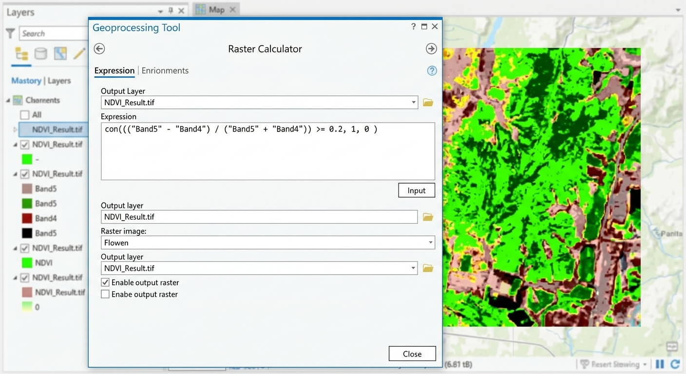
Raster Calculator Expressions GIS: 5 Essential Formulas
In spatial analysis and remote sensing lab assignments, grid-based cell manipulation is a foundational skill. Mastering raster calculator expressions GIS syntax allows you to run complex Map Algebra operations—ranging from spectral band math and unit conversions to multi-criteria land suitability modeling.
However, students frequently run into syntax errors, incorrect boolean logic operators, or unexpected
NoData outputs when entering expressions in desktop GIS tools. This tutorial provides a developer-friendly reference guide covering five essential Map Algebra formulas, detailing exact syntax rules for both QGIS and ArcGIS Pro.Quick Navigation / Table of Contents
-
Core Concepts: Map Algebra Operators & Data Types
-
5 Essential Raster Calculator Expressions GIS Formulas
-
Formula 1: Normalized Difference Vegetation Index (NDVI)
-
Formula 2: Conditional Masking (
Con/IF) -
Formula 3: Unit Conversions (Elevation & Temperature)
-
Formula 4: Multi-Criteria Binary Overlay Modeling
-
Formula 5: Replacing
NoDataPixels with Constant Values
-
-
Software Comparison: QGIS vs. ArcGIS Pro Syntax Rules
-
Pro Tip: Managing Spatial Resolution, Extents, and Cell Alignment
-
Frequently Asked Questions (FAQ)
-
Conclusion & Syntax Reference Summary
1. Fundamentals of Map Algebra in GIS
Map Algebra is the mathematical language used to manipulate geographic raster grids. Operations process datasets on a cell-by-cell basis across aligned layers.
+-------------------------------------------------------------------------+
|                        INPUT RASTER GRID LAYERS                         |
|             Aligned Cell Grids (Band 4, Band 5, DEM, Land Cover)        |
+------------------------------------+------------------------------------+
                                     |
                                     v
                  +-------------------------------------+
                  |      MAP ALGEBRA EXPRESSION ENGINE  |
                  |  Mathematical, Relational, Logical  |
                  +------------------+------------------+
                                     |
            +------------------------+------------------------+
            |                                                 |
            v                                                 v
  [ Arithmetic Operators ]    [ Relational Operators ]     [ Logical / Conditional ]
  + , - , * , / , ^           > , < , == , >= , <= , !=   AND (&) , OR (|) , Con / IF
Master raster calculator expressions gis formulas in QGIS and ArcGIS Pro. Learn Map Algebra syntax for land suitability, masking, and NDVI.
Map Algebra Category Breakdown
-
Arithmetic Operations: Basic math functions calculated cell-by-cell ($+$, $-$, $*$, $/$).
-
Relational Operations: Comparative evaluations that return boolean values ($1$ for True, $0$ for False).
-
Logical Operations: Combine multiple criteria using boolean operators (
AND,OR,NOT). -
Conditional Statements: Evaluate conditions per cell and assign dynamic output values based on whether the statement evaluates to True or False.
2. 5 Essential Raster Calculator Expressions GIS Formulas
Formula 1: Normalized Difference Vegetation Index (NDVI)
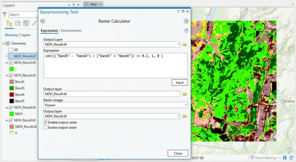
NDVI quantifies vegetation health by measuring the difference between Near-Infrared (NIR) light (which healthy vegetation strongly reflects) and Red light (which vegetation absorbs).
Mathematical Formula
$$\text{NDVI} = \frac{\text{NIR} – \text{Red}}{\text{NIR} + \text{Red}}$$
Expression Syntax
-
ArcGIS Pro (Raster Calculator / Spatial Analyst):
Python
(Float("Landsat8_B5.tif") - Float("Landsat8_B4.tif")) / (Float("Landsat8_B5.tif") + Float("Landsat8_B4.tif")) -
QGIS (Raster Calculator):
SQL
("Landsat8_B5@1" - "Landsat8_B4@1") / ("Landsat8_B5@1" + "Landsat8_B4@1")
Syntax Note: In ArcGIS Pro, integer rasters perform integer division by default. Wrapping band variables in theFloat()function ensures floating-point calculations with decimal values between-1.0and+1.0.
Formula 2: Conditional Statements for Suitability Masking
Conditional logic allows you to isolate pixels that meet specific criteria when building raster calculator expressions gis models.
Scenario
Select elevation pixels higher than 1,500 meters and assign them a value of
1. Reassign all lower elevations to 0.Expression Syntax
-
ArcGIS Pro (
ConTool / Map Algebra):Python
Con("DEM_Meters.tif" > 1500, 1, 0) -
QGIS (
IFStatement):SQL
if("DEM_Meters@1" > 1500, 1, 0)
Formula 3: Unit Conversions
Lab assignments often require converting measurement units across spatial datasets using simple raster calculator expressions gis syntax.
Elevation: Convert Meters to Feet
$$\text{Feet} = \text{Meters} \times 3.28084$$
-
ArcGIS Pro:
Python
"Elevation_m.tif" * 3.28084 -
QGIS:
SQL
"Elevation_m@1" * 3.28084
Temperature: Convert Celsius to Fahrenheit
$$\text{Fahrenheit} = (\text{Celsius} \times 1.8) + 32$$
-
ArcGIS Pro:
Python
("Temp_Celsius.tif" * 1.8) + 32 -
QGIS:
SQL
("Temp_Celsius@1" * 1.8) + 32
Formula 4: Combining Multi-Criteria Layers into Binary Suitability Maps
Syntax errors usually stem from missing parentheses or incorrect boolean operators when constructing raster calculator expressions gis statements.
Scenario
Identify suitable construction sites that satisfy three conditions:
-
Slope is less than 10 degrees.
-
Distance to roads is less than 500 meters.
-
Land cover category equals
5(cleared grassland).
Expression Syntax
-
ArcGIS Pro (Python Bitwise Syntax):
Python
("Slope.tif" < 10) & ("Road_Distance.tif" < 500) & ("LandCover.tif" == 5) -
QGIS (Relational Logical Syntax):
SQL
("Slope@1" < 10) AND ("Road_Distance@1" < 500) AND ("LandCover@1" = 5)
Result: Cells that satisfy all three criteria evaluate to1(Suitable), while all other cells return0(Unsuitable). For details on weighted overlay models, see our article onFor details on weighted overlay models, see our article on [Multi Criteria Evaluation GIS Guide]
Formula 5: Replacing NoData Values with Zero
When combining rasters using addition or multiplication, any pixel intersecting a
NoData cell evaluates to NoData. Replacing null values with zero prevents dataset gaps during overlay modeling.Expression Syntax
-
ArcGIS Pro (
IsNull+Con):Python
Con(IsNull("Precipitation.tif"), 0, "Precipitation.tif") -
QGIS (
NO_DATANull Clause):SQL
if("Precipitation@1" IS NULL, 0, "Precipitation@1")
Pro Tip: Preventing Spatial Alignment & Grid Mismatch Errors
Executing raster calculations on layers with mismatched cell sizes, extent boundaries, or coordinate systems can lead to misaligned grid outputs or distorted results.Best Practices Before Executing Expressions:
3. Software Comparison: QGIS vs. ArcGIS Pro Syntax Rules
| Syntax Feature | QGIS Raster Calculator | ArcGIS Pro Raster Calculator |
| Layer Variables | Enclosed in double quotes with band suffix: "Layer@1" |
Enclosed in quotes or referenced as layer objects: "Layer.tif" |
| Equality Operator | Single equals sign: = |
Double equals sign: == |
| Conditional Function | if(condition, true_value, false_value) |
Con(condition, true_value, false_value) |
| Logical AND | Written word: AND |
Bitwise ampersand: & |
| Logical OR | Written word: OR |
Bitwise pipe: ` |
| Null Value Test | layer IS NULL |
IsNull(layer) |
4. Frequently Asked Questions (FAQ)
Why am I getting a syntax error in my Map Algebra expression?
Syntax errors usually stem from missing parentheses, using a single equals (
=) instead of a double equals (==) in ArcGIS Pro, forgetting Float() conversions during integer division, or missing double quotes around layer names.How do I write a conditional IF statement in QGIS Raster Calculator?
In QGIS, use the syntax structure
if(condition, value_if_true, value_if_false). For example, if("DEM@1" > 500, 1, 0) assigns 1 to elevation cells over 500 meters and 0 to all other cells.Why does my raster output result in all 0s or NoData?
Outputs evaluate entirely to
0 or NoData when input layers do not spatially overlap, when coordinate systems are mismatched, or when boolean statements contain mutually exclusive conditions (e.g., value > 10 AND value < 5).5. Conclusion & Summary
Mastering raster calculator expressions GIS syntax is a crucial step toward executing advanced spatial modeling, remote sensing index calculations, and site suitability workflows. By following platform-specific syntax rules, handling
NoData values cleanly, and standardizing layer projections before processing, you can execute error-free Map Algebra operations in any lab assignment.Key Takeaways:
-
Use
Float()in ArcGIS Pro to enforce decimal outputs during division. -
Match conditional functions to your software:
Con()in ArcGIS Pro vs.if()in QGIS. -
Use double equals (
==) for equality tests in ArcGIS Pro and single equals (=) in QGIS. -
Verify layer extents, pixel resolutions, and coordinate systems before running calculations.