
Spatial Window Functions in PostGIS: Analyzing Spatio-Temporal Trajectories and Moving Objects
Introduction
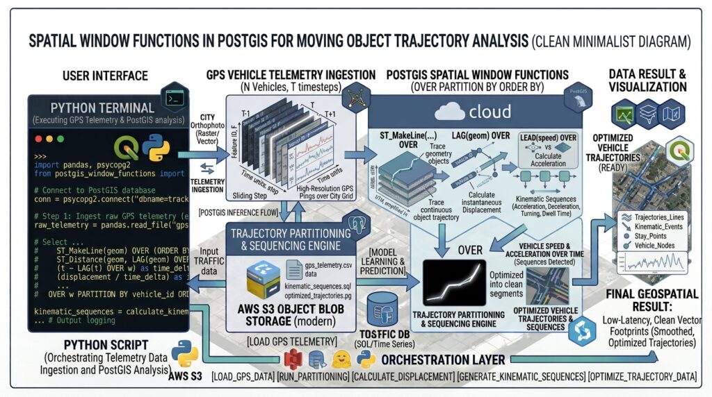
Tracking moving entities—whether commercial delivery fleets, migrating wildlife, marine vessels, or cellular devices—generates massive, high-frequency streams of coordinate fixes known as trajectories. In enterprise GIS and spatial database administration, raw GPS pings are notoriously noisy, unordered, and difficult to interpret without context. Traditional procedural scripts or expensive external analytics runtimes often struggle to process millions of moving object records efficiently.
PostgreSQL and PostGIS provide a powerful, native solution: window functions coupled with advanced spatial operators. By leveraging clauses such as
OVER (PARTITION BY entity_id ORDER BY timestamp), database engineers can inspect preceding and succeeding coordinate rows without costly self-joins. This enables real-time computation of instantaneous velocity, bearing vectors, moving averages, and stop-event detection directly inside the relational database engine.Core SQL Implementation
To illustrate advanced trajectory analytics, we will design an end-to-end PostGIS SQL workflow assuming a telemetry table named
vehicle_telemetry containing entity identifiers, timestamps, and GEOMETRY(Point, 4326) coordinates.1. Structuring GPS Point Streams into Ordered Spatio-Temporal Sequences Using Spatial Window Functions in PostGIS
When processing enterprise datasets, applying Spatial Window Functions in PostGIS ensures precise chronologically ordered trajectories.
Before computing kinematics, telemetry data must be ordered chronologically per tracked entity. We use common table expressions (CTEs) to establish sequence integrity and eliminate out-of-order packet arrivals.
SQL
CREATE TABLE IF NOT EXISTS vehicle_telemetry (
    telemetry_id BIGSERIAL PRIMARY KEY,
    vehicle_id VARCHAR(64) NOT NULL,
    recorded_at TIMESTAMPTZ NOT NULL,
    geom GEOMETRY(Point, 4326) NOT NULL
);

-- Indexing for high-performance spatial-temporal window partitioning
CREATE INDEX idx_telemetry_vehicle_time ON vehicle_telemetry (vehicle_id, recorded_at);
CREATE INDEX idx_telemetry_geom ON vehicle_telemetry USING GIST (geom);
2. Calculating Instantaneous Speed, Acceleration, and Bearing Angles
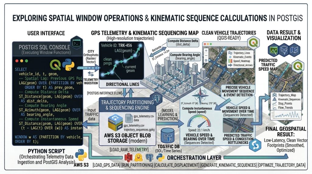
Using window functions like
LAG(), we extract the previous coordinate and timestamp for every point in a vehicle’s journey. We then apply ST_Distance (on projected metrics) and ST_Azimuth to compute instantaneous speed, bearing, and acceleration. Using Spatial Window Functions in PostGIS allows developers to compute precise speed and bearing metrics without leaving the database.SQL
WITH ordered_fixes AS (
    SELECT
        vehicle_id,
        recorded_at,
        geom,
        -- Retrieve previous record's geometry and timestamp within the same vehicle partition
        LAG(geom, 1) OVER w AS prev_geom,
        LAG(recorded_at, 1) OVER w AS prev_time
    FROM vehicle_telemetry
    WINDOW w AS (PARTITION BY vehicle_id ORDER BY recorded_at)
),
kinematics AS (
    SELECT
        vehicle_id,
        recorded_at,
        -- Calculate distance in meters using ST_Transform to EPSG:3857 (Web Mercator) or UTM
        ST_Distance(geom::geography, prev_geom::geography) AS distance_meters,
        EXTRACT(EPOCH FROM (recorded_at - prev_time)) AS time_delta_seconds,
        -- Compute heading / bearing angle in radians, converted to degrees (0-360)
        DEGREES(ST_Azimuth(prev_geom, geom)) AS bearing_degrees
    FROM ordered_fixes
    WHERE prev_geom IS NOT NULL AND prev_time IS NOT NULL
)
SELECT
    vehicle_id,
    recorded_at,
    ROUND(distance_meters::numeric, 2) AS dist_m,
    ROUND(time_delta_seconds::numeric, 1) AS dt_sec,
    -- Speed in meters per second, converted to km/h
    ROUND(((distance_meters / NULLIF(time_delta_seconds, 0)) * 3.6)::numeric, 2) AS speed_kmh,
    ROUND(bearing_degrees::numeric, 1) AS heading
FROM kinematics;
3. Applying Moving Averages and Smoothing Location Noise
Raw GPS sensors suffer from urban canyon multipath interference, causing position jitter. We can smooth trajectory coordinates and speed metrics using moving window frames (
ROWS BETWEEN 2 PRECEDING AND CURRENT ROW). Smoothing out GPS telemetry noise is efficiently handled by leveraging Spatial Window Functions in PostGIS across sliding partitions.SQL
WITH base_metrics AS (
    SELECT
        vehicle_id,
        recorded_at,
        geom,
        LAG(geom, 1) OVER w AS prev_geom,
        LAG(recorded_at, 1) OVER w AS prev_time
    FROM vehicle_telemetry
    WINDOW w AS (PARTITION BY vehicle_id ORDER BY recorded_at)
),
raw_speeds AS (
    SELECT
        vehicle_id,
        recorded_at,
        geom,
        COALESCE(
            (ST_Distance(geom::geography, prev_geom::geography) /
             NULLIF(EXTRACT(EPOCH FROM (recorded_at - prev_time)), 0)) * 3.6,
            0.0
        ) AS instant_speed
    FROM base_metrics
    WHERE prev_geom IS NOT NULL
)
SELECT
    vehicle_id,
    recorded_at,
    ROUND(instant_speed::numeric, 2) AS instant_speed_kmh,
    -- 5-point moving average window to smooth out GPS noise
    ROUND(
        AVG(instant_speed) OVER (
            PARTITION BY vehicle_id
            ORDER BY recorded_at
            ROWS BETWEEN 4 PRECEDING AND CURRENT ROW
        )::numeric, 2
    ) AS smoothed_speed_kmh
FROM raw_speeds;
4. Detecting Stop Events (Dwell Time Clustering)
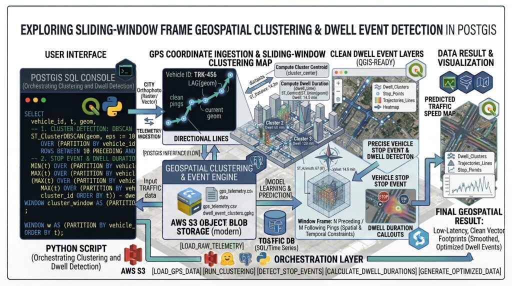
Identifying when an entity remains stationary for an extended period (e.g., delivery stops, wildlife resting sites) is achieved by combining temporal grouping with spatial proximity predicates. Isolating dwell times and stop clusters becomes seamless when combining temporal grouping with Spatial Window Functions in PostGIS.
SQL
WITH lagged_data AS (
    SELECT
        vehicle_id,
        recorded_at,
        geom,
        LAG(recorded_at, 1) OVER w AS prev_time,
        ST_Distance(
            geom::geography,
            LAG(geom, 1) OVER w AS
        ) AS dist_from_prev
    FROM vehicle_telemetry
    WINDOW w AS (PARTITION BY vehicle_id ORDER BY recorded_at)
),
stop_flags AS (
    SELECT
        vehicle_id,
        recorded_at,
        prev_time,
        dist_from_prev,
        -- Flag as a stop if movement is less than 15 meters from previous fix
        CASE WHEN dist_from_prev <= 15.0 THEN 1 ELSE 0 END AS is_stopped
    FROM lagged_data
)
SELECT
    vehicle_id,
    MIN(prev_time) AS stop_start_time,
    MAX(recorded_at) AS stop_end_time,
    EXTRACT(EPOCH FROM (MAX(recorded_at) - MIN(prev_time))) / 60 AS dwell_duration_minutes
FROM (
    SELECT
        vehicle_id,
        recorded_at,
        prev_time,
        -- Group consecutive stops using island-and-gap technique
        SUM(CASE WHEN is_stopped = 0 THEN 1 ELSE 0 END) OVER (PARTITION BY vehicle_id ORDER BY recorded_at) as stop_group
    FROM stop_flags
    WHERE is_stopped = 1
) grouped_stops
GROUP BY vehicle_id, stop_group
HAVING EXTRACT(EPOCH FROM (MAX(recorded_at) - MIN(prev_time))) >= 300; -- Filter stops >= 5 minutes
Visualizing Results
Enterprise Optimization & Best Practices
When scaling moving object telemetry databases to ingest millions of daily records, database administrators must implement robust architectural strategies:
-
Table Partitioning: Implement native range partitioning by date and list partitioning by vehicle fleet using techniques outlined in PostGIS table partitioning guides to ensure partition pruning during window queries.
-
Stream Processing Integration: For real-time monitoring dashboards, offload high-throughput ingestion bottlenecks by streaming raw GPS packets through Apache Kafka real-time streaming architectures before bulk-loading into PostgreSQL.
-
Specialized Tracking Domains: Adapt these window functions for specialized ecological studies, such as analyzing wildlife GPS telemetry tracking datasets to detect home ranges and behavioral corridors.
Summary
PostGIS spatial window functions eliminate the need for cumbersome external data science pipelines when analyzing moving object trajectories. By executing operations like
LAG(), LEAD(), and moving averages directly inside PostgreSQL, database engineers achieve unprecedented speed, ACID compliance, and spatial precision for tracking enterprise assets and environmental telemetry.Mastering Spatial Window Functions in PostGIS provides database administrators with the tools needed for high-performance moving object analytics. Mastering Spatial Window Functions in PostGIS provides database administrators with the tools needed for high-performance moving object analytics.