
H3 Spatial Indexing vs. Geohash vs. S2: Choosing the Right Discrete Global Grid System (DGGS)
Introduction
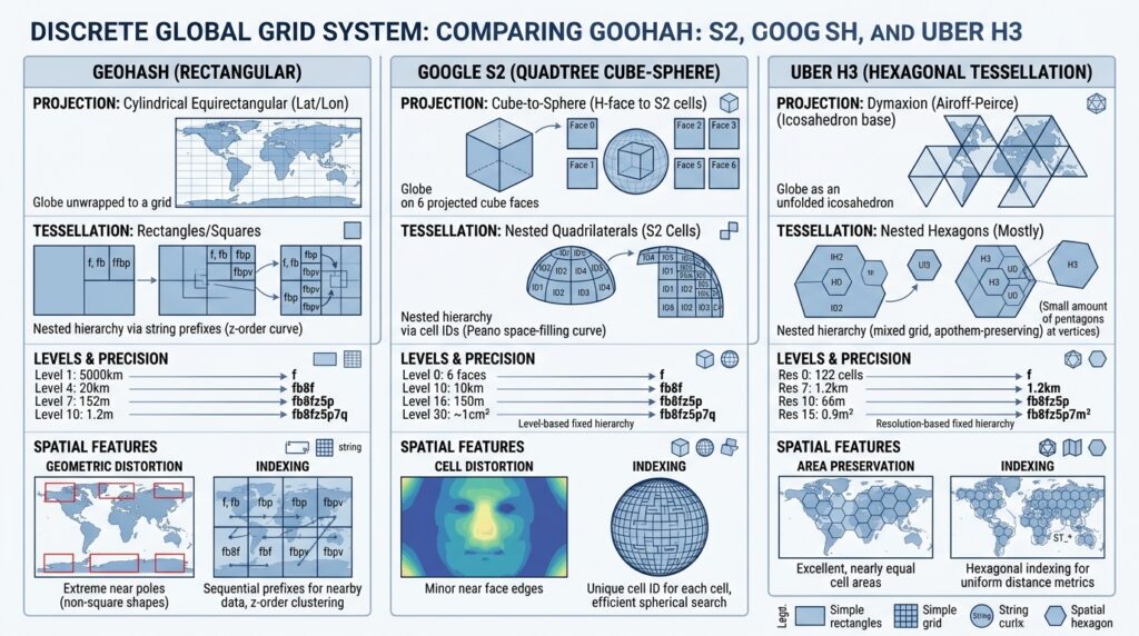
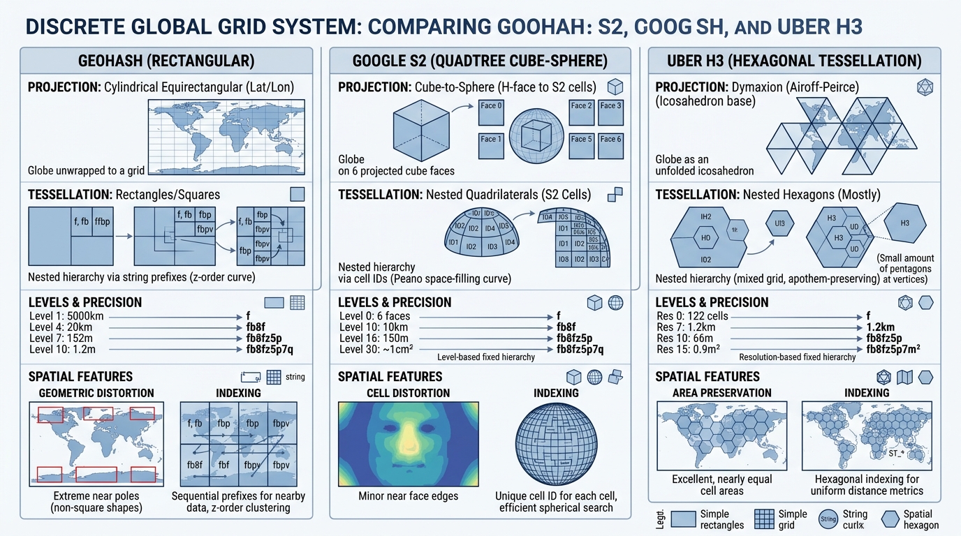
When evaluating Spatial Indexing vs Geohash vs S2, modern data architectures must balance spatial precision with computational scalability. In modern big data analytics and distributed geospatial systems, handling spatial data via traditional computational geometry algorithms—such as arbitrary bounding box queries, complex polygon overlays, and continuous R-tree indices—presents severe scaling bottlenecks. Computing dynamic spatial joins across billions of telemetry points, mobile pings, or IoT sensor streams on-the-fly in distributed query engines like Apache Spark, Trino, or DuckDB causes memory bloat, network shuffling overhead, and latency spikes.
To bypass these computational barriers, modern spatial data architectures rely on Discrete Global Grid Systems (DGGS). A DGGS partitions the continuous surface of the Earth into hierarchical, space-filling tessellations of uniform cells. By mapping continuous latitude-longitude coordinates to discrete, fixed-size cell identifiers (IDs), spatial queries are transformed into simple string or integer hash comparisons. This eliminates costly geometric intersections, replacing them with exact equality checks and lightning-fast spatial aggregations.
Choosing the right DGGS—whether Uber’s H3, Google’s S2, or the traditional Geohash—dictates the performance, accuracy, and memory footprint of large-scale spatial analytics pipelines.
Deep Dive into the Top Three Systems
1. Geohash: The String-Based Hierarchical Rectangular Grid
Developed in 2008 by Gustavo Niemeyer, Geohash is a hierarchical spatial index that encodes geographic locations into short alphanumeric strings. It recursively subdivides the WGS84 geographic coordinate space (latitude and longitude bounds of $[-90, 90]$ and $[-180, 180]$) into alternating binary quadrants (base-32 encoded).
-
Mechanism & Hierarchy: Each character added to a Geohash string refines the spatial resolution by dividing the bounding box into a 4×8 or 8×4 grid. Prefix sharing (
9q8vs9q8y) implies spatial proximity, making it exceptionally easy to implement in key-value stores like Redis or DynamoDB for bounding box prefix scans. -
Distortion & Edge Issues: Because Geohash projects latitude and longitude onto a flat plate carrée rectangular grid, area distortion is severe. Cells near the equator are roughly square, but as latitude approaches the poles, cells become compressed longitudinally. Furthermore, Geohash suffers from the boundary problem: two points situated mere centimeters apart can fall on opposite sides of a primary quadtree cell boundary, resulting in completely different hash strings (e.g., crossing the prime meridian or equator).
2. Google S2: The Cube-Sphere Quadtree Projection
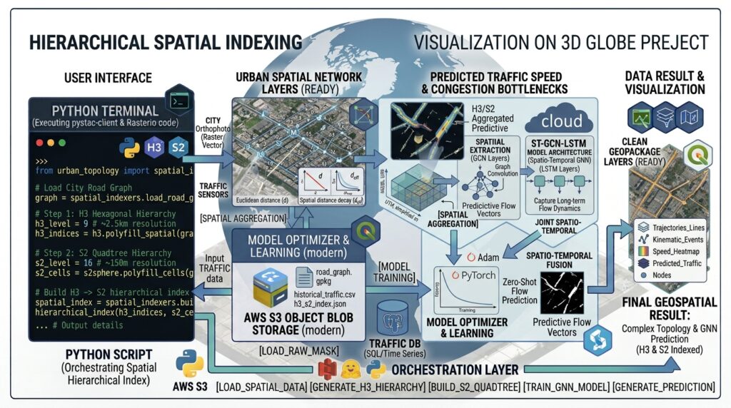
Google S2 is a robust spatial indexing library designed to map the Earth’s spherical surface onto a cube, and then recursively subdivide each cube face using a quadtree structure.
-
Mechanism & Hierarchy: S2 projects the sphere onto the six faces of a cube using central projection and quadratic transformations to minimize area distortion. Each face is subdivided into hierarchical quadtree cells identified by a 64-bit unsigned integer (or a compact string representation). S2 supports arbitrary cell hierarchies down to level 30 (sub-centimeter accuracy).
-
Geometric Rigor: Unlike Geohash, S2 operates natively on the sphere, avoiding polar singularities and severe area distortion. It provides advanced region covering algorithms, allowing complex polygon boundaries to be precisely approximated by a union of S2 cells at varying resolutions. This makes S2 the foundational engine behind Google Maps, regional geofencing, and distributed spatial databases.
3. Uber H3: The Hexagonal Hierarchical Spatial Index
Developed by Uber to optimize dynamic pricing, surge calculation, and supply-demand matching in ride-sharing, H3 is a discrete global grid system based on a regular hexagonal tessellation projected onto an icosahedron.
-
Mechanism & Hierarchy: H3 projects the Earth onto a regular icosahedron (a 20-faced polyhedron), which is unfolded into a flat plane and tiled with hexagons across 16 discrete resolution tiers (Res 0 down to Res 15). Because a sphere cannot be perfectly tiled by flat hexagons alone, H3 introduces exactly 12 pentagons per resolution tier to close the icosahedral vertices.
-
Topological Superiority: The core architectural advantage of H3 lies in equidistant neighbor adjacency. In rectangular grids (Geohash and S2 quadtrees), diagonal neighbors share only a single vertex, and distance between adjacent cell centers varies inconsistently. In a hexagonal grid, every neighboring cell shares an entire edge, and the distance from a cell center to all immediate neighbors is strictly constant. This uniform adjacency eliminates directional bias, making H3 the gold standard for spatial smoothing, gradient calculations, and flow modeling.
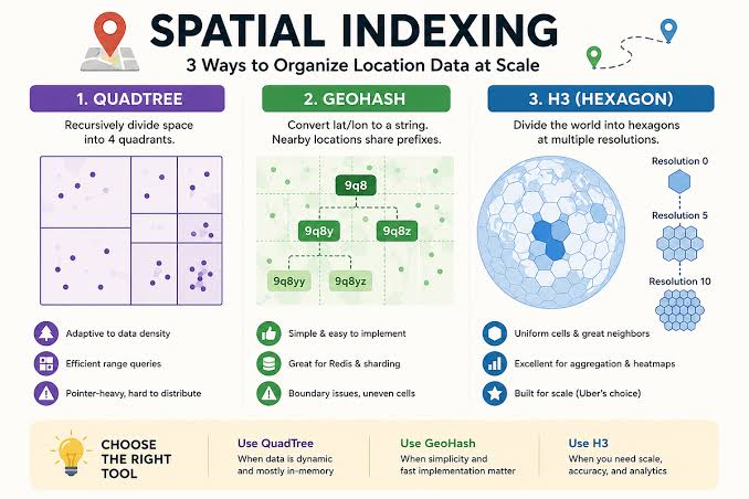
Visualizing Spatial Indexing Architectures
Benchmark & Selection Framework
When designing an enterprise spatial data platform, architects must evaluate DGGS solutions across computational performance, memory consumption, and analytical suitability.
| Evaluation Metric | Geohash | Google S2 | Uber H3 |
| Cell Geometry | Rectangular ($N \times S$) | Quadrilateral (Quadtree) | Hexagonal (with 12 Pentagons) |
| Data Representation | Variable-length ASCII Strings | 64-bit Unsigned Integers (uint64) |
64-bit Hexadecimal Integers (uint64) |
| Neighbor Adjacency | Variable (Edge + Corner sharing) | Consistent 4-way neighbors | Uniform 6-way ring neighbors |
| Area Distortion | Extreme near poles (Plate Carrée) | Moderate (Cube face projection) | Minimal (Icosahedral projection) |
| Primary Database Support | Universal (Redis, Postgres, DynamoDB) | C++, Python, Go, Java libraries | Python, Java, C++, Postgres (h3-pg) |
| Best Use Case | Simple prefix range filters & key-value lookups | Complex polygon coverings & point-in-polygon containment | Heatmaps, spatial smoothing, ride-sharing, and mobility analytics |
Architectural Recommendations
-
Choose Geohash only when building lightweight legacy applications requiring simple string-prefix range queries in key-value stores (e.g., Redis geofencing) where sub-millimeter polar accuracy is irrelevant.
-
Choose Google S2 when your pipeline requires complex polygon-to-region coverings, exact spherical distance calculations, or hierarchical containment queries across massive distributed datasets.
-
Choose Uber H3 when performing high-frequency spatial aggregations, origin-destination flow matrices, heatmaps, or machine learning feature engineering where spatial neighbor uniformity and gradient smoothing are critical.
Enterprise Integration and Analytics Pipelines
To operationalize DGGS indices at scale, data architects integrate spatial indexing directly into modern analytical storage engines and data lakehouses:
-
Lakehouse Storage: Precompute H3 or S2 cell IDs during ingestion and store partitioned datasets in DuckDB spatial lakehouse storage instances for sub-second analytical queries.
-
Cloud Optimization: Serialize spatial tables using GeoParquet S3 querying specifications, enabling distributed query engines to prune irrelevant spatial partitions before scanning raw disk blocks.
-
Statistical Modeling: Feed aggregated H3 cell counts directly into advanced spatial statistics algorithms, such as point pattern KDE analysis, to model urban density hotspots and anomaly detection.
Conclusion
Discrete Global Grid Systems transform spatial computing by replacing expensive continuous geometry operations with discrete hashing and integer arithmetic. While Geohash offers simplicity and S2 provides robust spherical quadtree geometry, Uber H3’s hexagonal topology offers unmatched advantages for spatial aggregations and mobility analytics. Selecting the correct DGGS ensures that modern spatial data architectures scale efficiently from gigabytes to petabytes without compromising analytical precision. Comparing spatial Indexing vs Geohash vs S2 ensures enterprise geospatial data pipelines select the ideal discrete global grid system.