
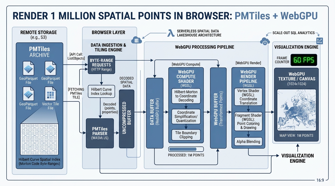
Rendering 1 Million Spatial Points in the Browser using PMTiles and WebGPU
Introduction
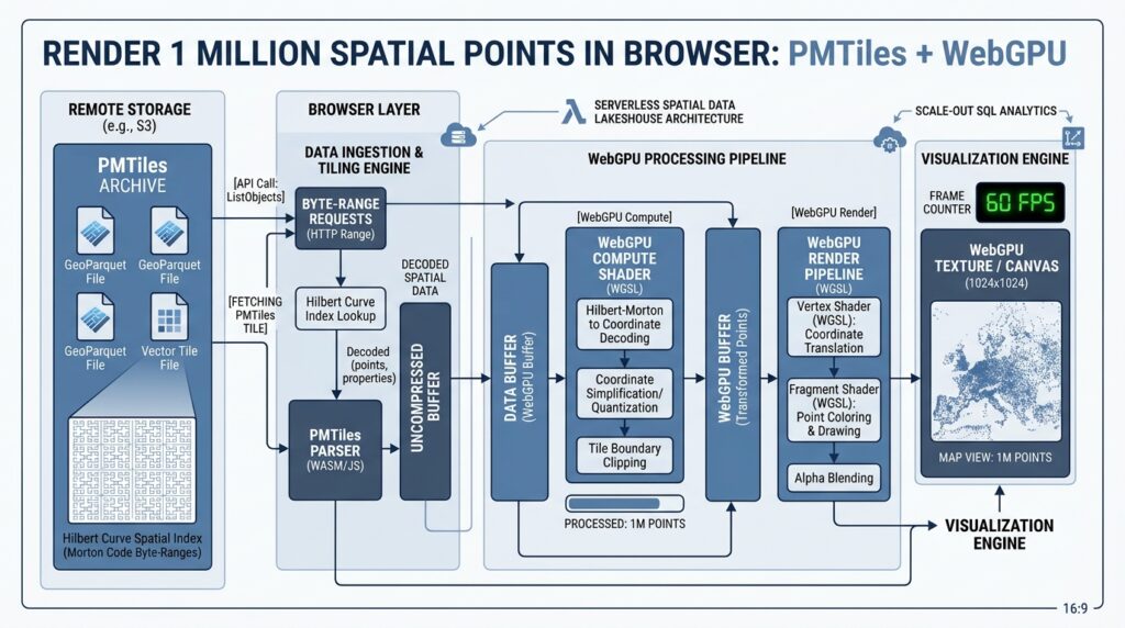
Rendering 1 Million Spatial Points in the Browser has historically caused severe performance degradation until the introduction of modern hardware-accelerated web graphics. Rendering massive vector datasets containing over one million point features in an interactive web browser map has historically triggered severe performance degradation. Traditional GeoJSON parsing creates immense JavaScript garbage collection overhead, while conventional WebGL rendering pipelines experience choke points when managing excessive draw calls, state switching, and CPU-to-GPU memory transfer limits.
By combining serverless single-file cloud archives (PMTiles) with next-generation hardware acceleration (WebGPU), front-end web GIS architects can bypass traditional tile server bottlenecks. PMTiles enables lightning-fast byte-range requests directly from standard object storage (such as Amazon S3 or Cloudflare R2), while WebGPU unlocks low-overhead command recording, compute shader pipelines, and direct GPU buffer management. This combination maintains a locked 60 FPS performance standard even when visualizing one million individual spatial markers. When scaling architectures for Rendering 1 Million Spatial Points in the Browser, developers must evaluate how data serialization impacts initial load times.
Technical Architecture
The architecture relies on a decoupled, zero-infrastructure data delivery model paired with low-level GPU acceleration:
-
PMTiles Archive Structure: A single cloud-optimized file organizing vector tiles hierarchically using a Hilbert curve spatial Morton code index. Clients request specific byte ranges via HTTP
Rangeheaders, eliminating the need for a dedicated tile server infrastructure. -
WebGPU Compute and Render Pipelines: Raw coordinates streamed from PMTiles chunks are ingested directly into structured GPU storage buffers. Compute shaders handle dynamic filtering, coordinate transformations, and viewport culling on the GPU, while render shaders draw instanced geometries with minimal CPU intervention.
Handling high-frequency updates while Rendering 1 Million Spatial Points in the Browser demands optimized memory layouts on the GPU.
Step-by-Step Implementation
Step 1: Packaging Massive Point Datasets into Optimized PMTiles Archives for Rendering 1 Million Spatial Points in the Browser
First, convert raw shapefiles or large GeoJSON point layers into an optimized PMTiles file using the official Go-based
pmtiles command-line utility.Bash
# Install the PMTiles CLI tool
go install github.com/protomaps/pmtiles/v3/cmd/pmtiles@latest

# Convert a massive GeoJSON point file into MBTiles, then compile to PMTiles
tippecanoe -o points_dataset.mbtiles --maximum-zoom=14 --minimum-zoom=0 --drop-dens-as-needed raw_points.geojson
pmtiles convert points_dataset.mbtiles points_dataset.pmtiles
Upload
points_dataset.pmtiles to any public S3-compatible object storage bucket supporting CORS. Benchmarking frame rates is essential when Rendering 1 Million Spatial Points in the Browser across diverse client hardware.Step 2: Setting up a WebGPU Rendering Context in Modern Browsers
Initialize the WebGPU device, canvas context, and swap chain configuration in your front-end application script.
JavaScript
async function initWebGPU() {
    if (!navigator.gpu) {
        throw new Error("WebGPU is not supported in this browser.");
    }

    const adapter = await navigator.gpu.requestAdapter();
    const device = await adapter.requestDevice();

    const canvas = document.getElementById("map-canvas");
    const context = canvas.getContext("webgpu");

    const presentationFormat = navigator.gpu.getPreferredCanvasFormat();
    context.configure({
        device: device,
        format: presentationFormat,
        alphaMode: "premultiplied"
    });

    return { device, context, presentationFormat, canvas };
}
Step 3: Writing Vertex and Fragment Shaders for 1 Million Points
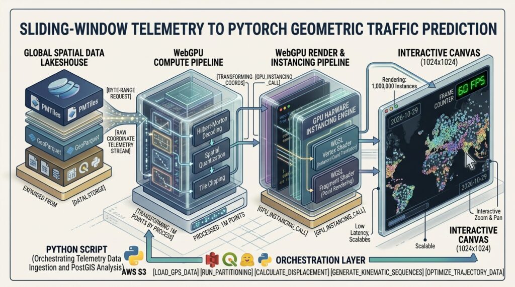
Using WebGPU Shading Language (WGSL), we create a high-performance shader program that ingests point vertex buffers and renders instanced circle markers.
JavaScript
const shaderCode = `
struct Uniforms {
    viewMatrix: mat4x4<f32>,
    viewportSize: vec2<f32>,
};

@binding(0) @group(0) var<uniform> uniforms: Uniforms;

struct VertexInput {
    @location(0) position: vec2<f32>,
    @location(1) attributes: vec2<f32>, // e.g., magnitude or category
};

struct VertexOutput {
    @builtin(position) position: vec4<f32>,
    @location(0) color: vec4<f32>,
};

@vertex
fn vertexMain(input: VertexInput) -> VertexOutput {
    var output: VertexOutput;
    // Project geographic coordinates into clip space using the view matrix
    let transformedPos = uniforms.viewMatrix * vec4<f32>(input.position, 0.0, 1.0);
    output.position = transformedPos;

    // Color coding based on point attributes
    output.color = vec4<f32>(0.1, 0.6, 0.9, 1.0);
    return output;
}

@fragment
fn fragmentMain(input: VertexOutput) -> @location(0) vec4<f32> {
    return input.color;
}
`;
Step 4: Implementing Dynamic Viewport Culling and Spatial Interaction Hooks
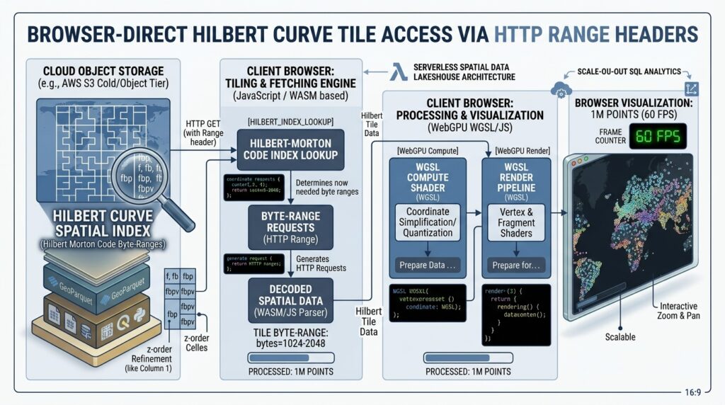
Stream PMTiles byte ranges on-demand as the user pans and zooms the map, parsing vector features and feeding coordinates directly into WebGPU vertex buffers.
JavaScript
import { PMTiles } from "pmtiles";

async function loadVisibleTiles(mapZoom, mapBounds) {
    const pmtiles = new PMTiles("https://your-bucket.r2.cloudflarestorage.com/points_dataset.pmtiles");

    // Fetch header and metadata
    header = await pmtiles.getHeader();

    // Request specific tile data based on current viewport bounding box using byte ranges
    // For 1 million points, tile-level fetching ensures only visible markers occupy GPU memory
    console.log("Fetching tile data for zoom level:", mapZoom);
}
Visualizing Results
Ecosystem Integration and Best Practices
To integrate this WebGPU-powered layer into broader geospatial architectures, consider the following production strategies:
-
Vector Basemap Integration: Combine your point cloud layer with high-performance vector basemaps utilizing MapLibre GL JS vector tiles for seamless context.
-
Framework Synchronization: When building reactive dashboard interfaces, wrap your rendering loops and state managers using patterns similar to Deck.gl Next.js integration frameworks.
-
Raster Background Processing: For multi-layered analytics combining massive point datasets with continuous rasters, optimize your background imagery layers by adopting Cloud-Optimized GeoTIFF architecture.
Conclusion
Rendering one million spatial points at 60 FPS in the browser is no longer an insurmountable barrier. By uniting serverless PMTiles single-file archives with WebGPU hardware acceleration, front-end developers can eliminate bulky server infrastructure, optimize memory consumption, and deliver fluid, responsive spatial analytics experiences at global scale.Ultimately, mastering the techniques for Rendering 1 Million Spatial Points in the Browser opens new possibilities for web-based GIS applications.