
Top 5 Free GIS Data Sources for University Projects
If you have ever spent three hours hunting for a usable GIS dataset only to discover that it is outdated, poorly documented, or locked behind a confusing download portal, you are not alone. For university GIS assignments, the difficult part is often finding reliable raw spatial data—not performing the analysis itself.
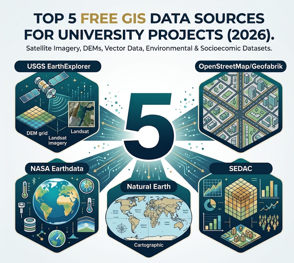
This guide cuts through that problem. Below are five authoritative free GIS data sources that cover everything from satellite imagery and terrain elevation to OpenStreetMap infrastructure, global boundaries, climate variables, population, and demographic data. Depending on the source, you can work with Shapefiles, GeoTIFFs, GeoJSON, KML, NetCDF, point-cloud-related products, and modern cloud-optimized formats.
The examples and recommendations below reflect modern workflows for using free GIS data sources, including QGIS, GDAL, GeoPackage, cloud-optimized GeoTIFFs (COGs), and analysis-ready dataset
Quick Comparison: 5 Free GIS Data Sources for University Projects
| Platform | Best Data Types | File Formats | Ideal University Project Use Case |
|---|---|---|---|
| USGS EarthExplorer | Satellite imagery, DEMs, elevation, aerial imagery | GeoTIFF, BIL, DTED, raster products | Remote sensing, terrain analysis, land-cover mapping |
| OpenStreetMap / Geofabrik | Roads, buildings, POIs, railways, waterways, land use | PBF, Shapefile, GeoPackage, OSM XML | Urban GIS, network analysis, infrastructure mapping |
| NASA Earthdata | Climate, environmental, atmospheric, satellite remote sensing | GeoTIFF, NetCDF, HDF5, HDF-EOS, KML, COG, JSON/CSV for some services | Climate, environmental change, remote sensing, Earth-system research |
| Natural Earth | Countries, states/provinces, coastlines, rivers, physical features | Shapefile, TIFF/TFW, SQLite, GeoPackage | Cartography, global maps, regional comparison |
| SEDAC | Population, demographics, human-environment datasets | Raster and vector products; commonly GeoTIFF, Shapefile and tabular formats depending on dataset | Population mapping, urbanization, human-environment analysis |
Quick rule: If your project is about terrain, start with USGS. If it is about roads or buildings, start with Geofabrik. For global environmental science, look at NASA Earthdata. For clean global cartographic boundaries, use Natural Earth. For population and human-environment relationships, investigate SEDAC.
1. USGS EarthExplorer — Best for Satellite Imagery and Elevation
USGS EarthExplorer is one of the premier free GIS data sources for downloading elevation grids. U.S. Geological Survey ‘s EarthExplorer is one of the most useful starting points for university remote-sensing and terrain projects. It provides access to extensive Earth-observation archives, including Landsat products and elevation datasets; its current catalog includes Landsat 8/9 Collection 2 Level-1 and Level-2 products and several DEM collections. EarthExplorer+1
Key Datasets for Students
Look particularly for:
-
Landsat 8 and Landsat 9
-
Multispectral imagery
-
Surface-reflectance products
-
Land-cover and vegetation analysis
-
Change detection
-
-
SRTM elevation data
-
Digital elevation models
-
Slope and aspect calculations
-
Watershed and drainage analysis
-
Terrain visualization
-
-
Other DEM/elevation products
-
Useful for topographic modelling and regional terrain studies
-
-
Landsat Collection 2 Analysis Ready Data (ARD)
-
Useful when you want imagery prepared for more streamlined analysis.
-
USGS documentation lists SRTM downloads in formats including GeoTIFF, BIL and DTED. GeoTIFF is generally the easiest option for a conventional QGIS workflow. USGS
Supported Export Formats
Depending on the dataset:
-
GeoTIFF
-
BIL
-
DTED
-
Other dataset-specific raster formats and metadata files
Pro-Tip for Assignments
Do not download an entire regional archive when one scene will do. Define your area of interest, acquisition dates, cloud conditions and dataset before downloading.
For a typical QGIS assignment, a Landsat Level-2 surface-reflectance product can save substantial preprocessing compared with starting from less-processed imagery.
Student shortcut: For a terrain assignment, download a GeoTIFF DEM, load it into QGIS, and generate slope, aspect, hillshade and contours using the Processing Toolbox rather than searching separately for each derivative.
Useful starting point: USGS EarthExplorer
2. OpenStreetMap + Geofabrik — Best for Local and Urban GIS
OpenStreetMap is a global collaborative geographic database containing features such as roads, buildings, waterways, railways, amenities and points of interest.When looking for free GIS data sources for urban and municipal mapping, OpenStreetMap is the most complete choice.
For university projects, Geofabrik is particularly convenient because it provides regional extracts of OpenStreetMap data rather than forcing you to process the entire global database. Its downloads are organized by continent, country and, in some cases, smaller administrative regions. Geofabrik
Key Datasets for Students
Depending on the region, you can obtain:
-
Road and street networks
-
Buildings
-
Railways
-
Airports
-
Waterways
-
Forests
-
Land-use features
-
Points of interest
-
Administrative features
-
Selected infrastructure layers
Geofabrik provides both raw .osm.pbf extracts and GIS-ready downloads. Its Shapefile extracts contain commonly used layers such as roads, railways, forests, water areas and many points of interest. Geofabrik
It increasingly makes sense to consider GeoPackage as well as Shapefile. For example, current regional downloads can include both .shp.zip and .gpkg.zip packages. Geofabrik Download Server
Supported Export Formats
Common options include:
-
OSM PBF (
.osm.pbf) -
ESRI Shapefile
-
GeoPackage
-
OSM XML
-
Change files such as
.osc.gz -
Experimental vector-tile formats for some regions
Pro-Tip for Assignments
Choose the smallest geographic extract that covers your study area.
Downloading a country’s complete OSM dataset can be unnecessary if your research question concerns one city or county. A smaller extract means faster loading, less RAM consumption and a cleaner QGIS project.
For very large datasets, consider keeping the source data in GeoPackage or PostGIS rather than converting everything into dozens of Shapefiles.
Important: Geofabrik’s OSM-derived downloads are provided under the Open Database License and require attribution to OpenStreetMap. Geofabrik
Useful starting point: Geofabrik OpenStreetMap Downloads
3. NASA Earthdata — Best for Global Environmental and Climate Data
As one of the most comprehensive environmental free GIS data sources, NASA Earthdata provides access to a huge collection of Earth-science observations spanning atmosphere, biosphere, climate, cryosphere, land surface, oceans and other disciplines.
Earthdata Search currently exposes more than 2.2 billion Earth observations, with spatial and temporal search tools for finding datasets by geographic area and date. Earthdata Search.Among environmental free GIS data sources, NASA Earthdata provides unmatched access to atmospheric and climate variables.
Key Datasets for Students
NASA Earthdata is particularly useful for:
-
Satellite remote sensing
-
Vegetation and land-surface studies
-
Climate variables
-
Atmospheric composition
-
Precipitation
-
Ocean observations
-
Cryosphere research
-
Environmental change
-
Earth-system modelling
Depending on your assignment, you may encounter datasets from NASA missions and Distributed Active Archive Centers (DAACs), including products based on MODIS, ASTER, satellite observations and numerous climate/environmental datasets.
Supported Export Formats
NASA’s Earth-science ecosystem uses a broad range of scientific and geospatial formats, including:
-
GeoTIFF
-
Cloud Optimized GeoTIFF (COG)
-
NetCDF / NetCDF-4
-
HDF5
-
HDF-EOS
-
KML
-
GeoJSON
-
Shapefile
-
JSON
-
CSV
-
Zarr
NASA documentation specifically identifies GeoTIFF, HDF5, NetCDF-4 and COG among its machine-actionable Earth-science formats. Earthdata Wiki+1
Pro-Tip for Assignments
Create your Earthdata account before your deadline. NASA data are openly available, but an Earthdata Login is required for downloading many products. Registration is free. Earthdata+1
When working with large raster products, check whether a COG or analysis-ready product is available. Modern GIS tools can work efficiently with appropriately structured cloud-optimized rasters, reducing the need to download and manipulate unnecessarily large files. Earthdata Wiki
Workflow tip: Search by geographic extent + date + variable, not simply by satellite name. This prevents you from ending up with an enormous archive of imagery that does not answer your research question.
Useful starting point: NASA Earthdata Search
4. Natural Earth — Best for Clean Global Vector Maps
Among vector-focused free GIS data sources, Natural Earth is designed specifically for producing clean, readable maps at small and medium scales. It is particularly useful when you need global boundaries and physical geography without the complexity or enormous file sizes of more detailed datasets.
Natural Earth provides data at 1:10 million, 1:50 million and 1:110 million scales, with cultural, physical and raster themes. Natural Earth Data
Key Datasets for Students
Commonly useful layers include:
When working with large raster products, check whether a COG or analysis-ready product is available. Modern GIS tools can work efficiently with appropriately structured cloud-optimized rasters, reducing the need to download and manipulate unnecessarily large files. Earthdata Wiki
Workflow tip: Search by geographic extent + date + variable, not simply by satellite name. This prevents you from ending up with an enormous archive of imagery that does not answer your research question.
-
Countries and country boundaries
-
States/provinces and other administrative boundaries
-
Coastlines
-
Land areas
-
Oceans
-
Rivers
-
Lakes and reservoirs
-
Populated places
-
Roads
-
Physical geography
-
Cultural features
-
Raster background layers
Natural Earth is especially strong for cartographic assignments, global comparison maps and map layouts where visual clarity matters more than street-level detail.
Supported Export Formats
Natural Earth provides:
-
ESRI Shapefile
-
TIFF + world file
-
SQLite
-
GeoPackage for its full vector collections
Its vector data use WGS84, and the project explicitly describes Shapefile as its standard vector distribution format. Natural Earth Data+1
Pro-Tip for Assignments
Do not use Natural Earth for street-level analysis.
Its strength is scale-appropriate cartography. A country boundary from Natural Earth may be perfect for a global population map but unsuitable for analysing individual buildings or local roads.
The project’s scale choices are deliberate: 1:10m is the most detailed, while 1:110m is intended for highly generalized world maps. Natural Earth Data
Cartography tip: Match your dataset’s scale to your map’s intended scale. More detailed data are not automatically better if your final map covers an entire continent or the world.
Useful starting point: Natural Earth Downloads.
Choosing from these free GIS data sources depends primarily on your study area and scale.
5. SEDAC — Best for Population and Human-Environment Research
The Socioeconomic Data and Applications Center (SEDAC), operated by Columbia University’s Center for International Earth Science Information Network (CIESIN), focuses on the relationship between human populations and the physical environment.
For university research, that makes SEDAC particularly useful when your GIS question crosses the boundary between physical geography and human geography.
Key Datasets for Students
Useful themes include:
-
Population distribution
-
Population density
-
Demographic characteristics
-
Urbanization
-
Human settlements
-
Poverty and socioeconomic indicators
-
Human-environment interactions
-
Environmental health
-
Climate vulnerability
-
Geographic boundaries and spatial indicators
One of the major strengths of SEDAC is its ability to support questions such as:
-
Where are populations concentrated?
-
How does population density vary with elevation?
-
Which communities are exposed to environmental hazards?
-
How does urbanization relate to land-cover change?
-
How do demographic patterns vary between regions?
Supported Export Formats
Formats vary considerably by dataset, but students commonly encounter:
-
GeoTIFF
-
Shapefile
-
Raster grids
-
CSV/tabular data
-
Other dataset-specific formats
Always inspect the individual dataset’s documentation before downloading because the available formats, resolution, geographic coverage and licensing/usage requirements can differ between collections.
Pro-Tip for Assignments
Pay attention to resolution and year.
A population raster at 1-km resolution and a demographic boundary dataset represent fundamentally different kinds of information. Likewise, combining a 2020 population dataset with a 2010 land-use dataset may introduce a temporal mismatch that needs to be acknowledged in your methodology.
Research tip: Before running a spatial correlation, write down the year, spatial resolution, geographic coverage and measurement unit of every dataset. This simple step prevents many methodological errors.
Useful starting point: SEDAC — Columbia University
How to Choose Free GIS Data Sources for Your Project
You do not need to search all five repositories for every assignment. Start with the geographic scale and analytical question. Evaluating free GIS data sources requires matching the dataset’s resolution to your study area.
If your project is global
Start with:
-
Natural Earth for boundaries and cartographic reference layers
-
NASA Earthdata for environmental and climate variables
-
SEDAC for population and human-environment variables
Typical projects:
-
Global population distribution
-
Climate change mapping
-
Country-level environmental comparison
-
Global land-cover analysis
If your project is local or urban
Start with:
-
OpenStreetMap / Geofabrik
Look for:
-
Roads
-
Buildings
-
Public facilities
-
Railways
-
Waterways
-
Land use
-
Points of interest
This is especially useful for proximity analysis, accessibility studies, urban morphology and network analysis.
If your project involves terrain
Start with:
-
USGS EarthExplorer
Look for:
-
SRTM or other DEMs
-
Landsat imagery
-
Elevation derivatives
-
Satellite imagery for land-cover analysis
Typical workflow:
DEM → hillshade → slope → aspect → contours → spatial analysis
If your project involves climate or environmental change
Start with:
-
NASA Earthdata
-
USGS EarthExplorer
-
SEDAC, where human exposure or population is part of the question
A strong research workflow may combine an environmental raster with a population raster to investigate who or what is exposed to a particular environmental condition.
A 6-Step Student Workflow for Finding GIS Data
Step 1: Define the research question
Do not start by downloading data.
Instead of:
“I need GIS data about Nairobi.”
Define something measurable:
“How does building density vary within 500 m of major roads?”
Now you know that you need buildings + roads + an appropriate study boundary.
Step 2: Define your geographic extent
Is the project:
-
Global?
-
Continental?
-
National?
-
Regional?
-
City-wide?
-
Campus-scale?
Your geographic extent determines which repository and resolution make sense.
Step 3: Choose raster or vector
Use vector for discrete features:
-
Roads
-
Buildings
-
Boundaries
-
Points of interest
-
Rivers
Use raster for continuous surfaces:
-
Elevation
-
Temperature
-
Precipitation
-
Vegetation indices
-
Satellite imagery
-
Population density grids
Step 4: Check metadata before downloading
Record:
-
Dataset name
-
Provider
-
Date/year
-
Spatial resolution
-
Coordinate reference system
-
Processing level
-
File format
-
License
-
Citation requirements
This metadata belongs in your project methodology—not just in your Downloads folder.
Step 5: Download the smallest useful dataset
Large files can quickly overwhelm a student laptop.
Prefer:
-
A regional OSM extract rather than an entire continent
-
A clipped DEM rather than a global elevation raster
-
An appropriate Natural Earth scale
-
A spatially filtered Earthdata product
-
A population dataset matching your study area and research question
Step 6: Standardize everything in QGIS
QGIS is a practical common environment for these datasets.
Before analysis:
Step 1: Define the research question
Do not start by downloading data.
Instead of:
“I need GIS data about Nairobi.”
Define something measurable:
“How does building density vary within 500 m of major roads?”
Now you know that you need buildings + roads + an appropriate study boundary.
Step 2: Define your geographic extent
Is the project:
-
Global?
-
Continental?
-
National?
-
Regional?
-
City-wide?
-
Campus-scale?
Step 3: Choose raster or vector
-
Roads
-
Buildings
-
Boundaries
-
Points of interest
-
Rivers
-
Elevation
-
Temperature
-
Precipitation
-
Vegetation indices
-
Satellite imagery
-
Population density grids
Step 4: Check metadata before downloading
-
Load the layers.
-
Inspect their CRS.
-
Reproject where appropriate.
-
Clip data to the study area.
-
Check units and resolution.
-
Rename layers clearly.
-
Save a clean working copy.
-
Document the source and acquisition date.
Modern QGIS/GDAL workflows also make it straightforward to inspect and create Cloud Optimized GeoTIFFs, which can be useful when working with large raster datasets. QGIS Documentation
What Should You Download for a Typical University GIS Project?
Here is a practical cheat sheet:
| Your Assignment | Start Here | Likely Data |
|---|---|---|
| Land-cover classification | USGS / NASA | Landsat or other satellite imagery |
| Terrain analysis | USGS | DEM / elevation |
| Flood-risk mapping | USGS + NASA + OSM | DEM + environmental imagery + buildings/roads |
| Urban accessibility | OSM / Geofabrik | Roads, buildings, POIs |
| Population density mapping | SEDAC | Population raster/vector data |
| Global country comparison | Natural Earth + SEDAC | Boundaries + demographic variables |
| Climate/environmental study | NASA Earthdata | Climate/environmental raster products |
| Cartographic map production | Natural Earth | Boundaries, rivers, coastlines |
| Vegetation/change detection | USGS / NASA | Multitemporal satellite imagery |
| Human-environment analysis | SEDAC + NASA/USGS | Population + environmental variables |
2026 GIS Data Workflow: What Students Should Know
The biggest change in modern GIS is that downloading a giant file and manually preprocessing everything is no longer always the best workflow.
Three practices are increasingly useful.
1. Use GeoPackage instead of Shapefile when possible
Shapefile remains extremely common, but GeoPackage is often more convenient for modern projects because multiple layers can live inside a single file.
Geofabrik, for example, now provides GeoPackage alongside Shapefile for some regional extracts. Geofabrik Download Server
2. Look for cloud-optimized raster formats
Cloud Optimized GeoTIFFs (COGs) are designed to make portions of large raster datasets efficiently accessible without treating the entire file as a conventional monolithic download.
NASA’s current Earth-science documentation includes COG among supported modern data formats, while QGIS provides tooling for creating COGs from raster layers. Earthdata Wiki+1
3. Treat metadata as part of the dataset
A GIS file without knowing its:
-
CRS
-
acquisition date
-
resolution
-
processing level
-
units
-
source
-
license
is not enough for reproducible academic research.
Your final report should make it possible for another student to understand exactly which dataset you used and why.
Final Takeaway
The best free GIS data source depends less on the software you use and more on what your research question is measuring.
-
USGS EarthExplorer → satellite imagery, elevation and terrain
-
OpenStreetMap / Geofabrik → local infrastructure and urban features
-
NASA Earthdata → global environmental, climate and remote-sensing data
-
Natural Earth → clean global boundaries and cartographic layers
-
SEDAC → population, demographic and human-environment data
For most university projects, the winning strategy is not to find the largest dataset. It is to find the smallest authoritative dataset that matches your geographic scale, temporal scope, spatial resolution and research question.
That approach saves download time, makes QGIS processing easier, and—most importantly—gives you a much more defensible methodology when you write the final report.