
Fixing “Unknown Coordinate System” Errors in ArcGIS & QGIS (Layers Not Aligning)
Quick Diagnosis
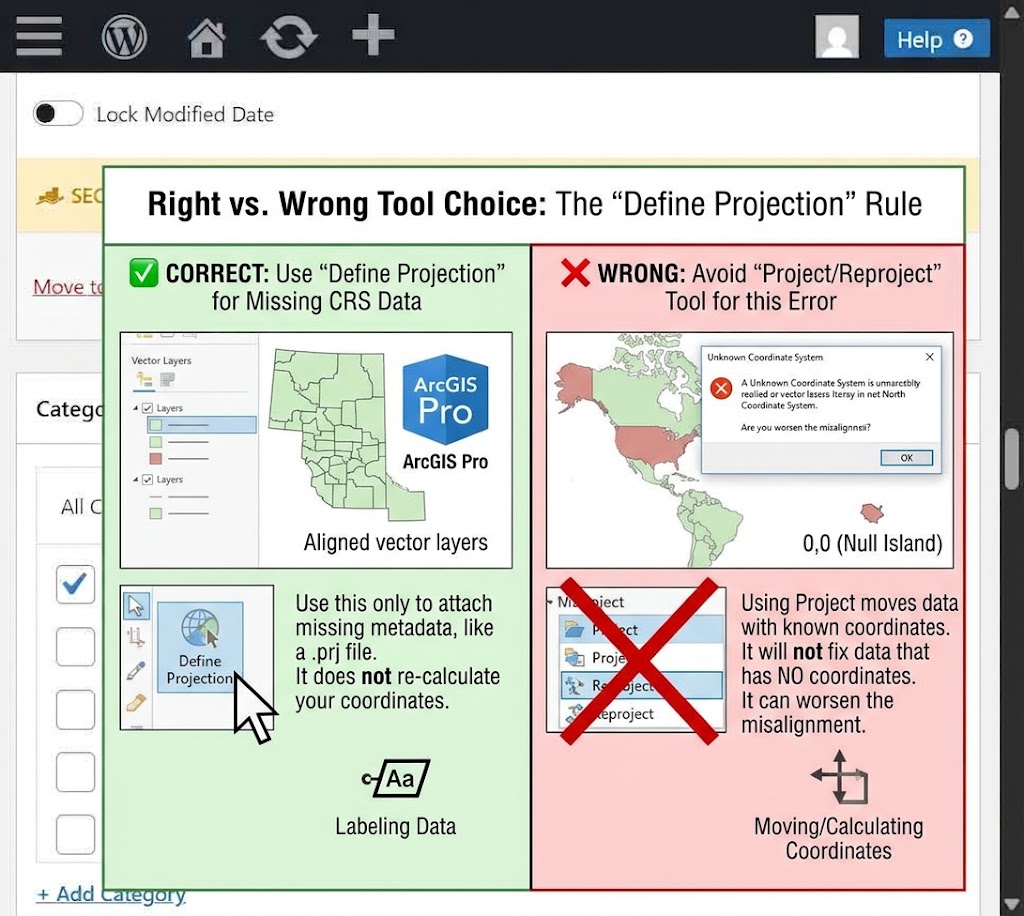
If your layers are scattered across the map instead of stacking correctly, your data is almost certainly missing its coordinate system information — the .prj file or embedded metadata header that tells the software where on Earth the data actually is. The fix depends on your situation: use Define Projection if the layer has no coordinate system assigned at all, or Project/Reproject if the layer has a known but different coordinate system than the rest of your map.
Step 1: ArcGIS Fix (ArcGIS Pro / ArcMap)
Fixing an unknown coordinate system error in ArcGIS Pro requires checking the layer source properties first.
- Open the Catalog Pane, right-click the problem layer, and select Properties to check the Source tab — if Spatial Reference shows “Unknown,” that confirms the missing
.prj. - Open the Define Projection tool (search for it in the Geoprocessing Pane). Select the layer, and manually assign the Coordinate System it should be in (check your assignment brief or data source documentation for this).
- Run the tool, then add the layer back to your map and confirm it now snaps into place with your other layers.
Define Projection vs. Project: Use Define Projection only when the coordinate system is missing — it labels the data without moving a single coordinate. Use the Project tool instead when the layer already has a valid, defined coordinate system but it’s different from your map’s coordinate system — this tool mathematically transforms the coordinates to match.
Step 2: QGIS Fix
If you encounter an unknown coordinate system error in QGIS, assign the CRS manually in Layer Properties.
- Right-click the layer in the Layers Panel and open Layer Properties → Source tab.
- Under Assigned CRS (or the CRS dropdown), manually select the correct Coordinate Reference System for the layer and click OK.
- Confirm the fix by checking that the layer’s bottom-right CRS indicator (or the layer now sitting correctly relative to your other data) matches your project’s CRS.
Set Layer CRS vs. Reproject Layer: Manually setting the Layer CRS in Properties only labels the existing coordinates — use this when the CRS is simply missing or wrong. If the coordinates are correct but in a different system than your project, use the Reproject Layer tool (Vector → Data Management Tools → Reproject Layer) instead — this creates a new, transformed copy of the data rather than just relabeling it.
Quick Verification Checklist
Common Causes of Unknown Coordinate System Error
Spatial data often loses its spatial reference metadata during file transfer or extraction. The most common reasons include:
-
Incomplete Shapefile Downloads: Shapefiles rely on multiple component files. If the
.prjfile is omitted during download or unzipping, the GIS software cannot determine the projection. -
CAD File Conversion: Exporting vector files from AutoCAD or Civil 3D frequently drops georeferencing information unless an accompanying coordinate file is generated.
-
Web Scraping & Open Data Portals: Unprocessed CSV files or raw spatial datasets often contain latitude and longitude coordinates without defining the underlying datum (such as WGS 84 vs. NAD 83).
Always verify the source documentation or metadata provided by your data provider to ensure you assign the correct spatial reference when running the Define Projection tool.
- Zoom to Layer (right-click → Zoom to Layer/Zoom to Layer If the map does not display correctly after executing the **Zoom to Layer** command, it may indicate an unknown coordinate system error. Such discrepancies can lead to misalignment of spatial data, causing features to appear in incorrect geographic locations. It is essential to verify the coordinate system settings of the layers in use to ensure accurate representation. Addressing this issue promptly will help maintain the integrity of the map’s spatial analysis. r(s)) and confirm it lands in the expected geographic location, not off in the ocean or at 0,0.
- Check that shared boundaries (parcels, roads, administrative borders) overlap cleanly with your reference layers instead of sitting offset or rotated.